Logan Township, New Jersey facts for kids
Quick facts for kids
Logan Township, New Jersey
|
|
|---|---|
|
Township
|
|
| Township of Logan | |

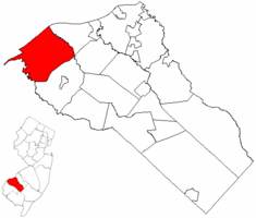
Logan Township highlighted in Gloucester County. Inset map: Gloucester County highlighted in the State of New Jersey.
|
|

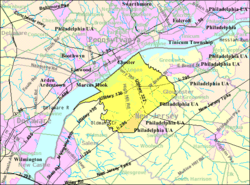
Census Bureau map of Logan Township, New Jersey
|
|
| Country | |
| State | |
| County | |
| Incorporated | March 7, 1877 as West Woolwich Township |
| Renamed | March 6, 1878 as Logan Township |
| Named for | John Alexander "Black Jack" Logan |
| Government | |
| • Type | Faulkner Act (small municipality) |
| • Body | Township Council |
| Area | |
| • Total | 26.60 sq mi (68.89 km2) |
| • Land | 21.93 sq mi (56.79 km2) |
| • Water | 4.67 sq mi (12.09 km2) 17.55% |
| Area rank | 99th of 565 in state 3rd of 24 in county |
| Elevation | 3 ft (0.9 m) |
| Population | |
| • Total | 6,042 |
| • Estimate
(2019)
|
5,874 |
| • Rank | 344th of 566 in state 15th of 24 in county |
| • Density | 275.6/sq mi (106.4/km2) |
| • Density rank | 485th of 566 in state 22nd of 24 in county |
| Time zone | UTC−05:00 (Eastern (EST)) |
| • Summer (DST) | UTC−04:00 (Eastern (EDT)) |
| ZIP Code |
08085, 08014 Swedesboro
|
| Area code(s) | 856 exchanges: 241, 467 |
| FIPS code | 3401541160 |
| GNIS feature ID | 0882143 |
Logan Township is a township in Gloucester County, New Jersey, United States. As of the 2010 United States Census, the township's population was 6,042, reflecting an increase of 10 (+0.2%) from the 6,032 counted in the 2000 Census, which had in turn increased by 885 (+17.2%) from the 5,147 counted in the 1990 Census.
Logan Township was originally formed as West Woolwich Township by an act of the New Jersey Legislature on March 7, 1877, from portions of Woolwich Township. That name lasted just less than a year, as the name was changed to Logan Township as of March 6, 1878.
The community is named for John Alexander "Black Jack" Logan, a Union Army General who was behind the establishment of Memorial Day as a national holiday.
Contents
Geography
According to the United States Census Bureau, the township had a total area of 26.929 square miles (69.747 km2), including 21.925 square miles (56.786 km2) of land and 5.004 square miles (12.961 km2) of water (18.58%).
Beckett (with a 2010 Census population of 4,847) is an unincorporated community and census-designated place (CDP) located within Logan Township.
Other unincorporated communities, localities and place names located partially or completely within the township include Bridgeport, Cadwalader, Center Square, Cooper Wharf, Coopers, Flood Gates, New Bridge, Nortonville, Prospect, Raccoon Island and Repaupo. It is also home to Pureland Industrial Complex, a 3,000-acre (12 km2) industrial park that is one of the largest in the nation.
The township borders Greenwich Township and Woolwich Township. Logan Township also borders the Delaware River, and Oldmans Creek serves as its border with Oldmans Township in Salem County. Raccoon Creek branches off from the Delaware River in Logan Township.
Demographics
| Historical population | |||
|---|---|---|---|
| Census | Pop. | %± | |
| 1880 | 1,765 | — | |
| 1890 | 1,523 | −13.7% | |
| 1900 | 1,444 | −5.2% | |
| 1910 | 1,523 | 5.5% | |
| 1920 | 1,510 | −0.9% | |
| 1930 | 1,860 | 23.2% | |
| 1940 | 1,630 | −12.4% | |
| 1950 | 2,222 | 36.3% | |
| 1960 | 1,924 | −13.4% | |
| 1970 | 1,840 | −4.4% | |
| 1980 | 3,078 | 67.3% | |
| 1990 | 5,147 | 67.2% | |
| 2000 | 6,032 | 17.2% | |
| 2010 | 6,042 | 0.2% | |
| 2019 (est.) | 5,874 | −2.8% | |
| Population sources: 1880-2000 1880-1920 1880-1890 1890-1910 1910-1930 1930-1990 2000 2010 |
|||
Census 2010
As of the census of 2010, there were 6,042 people, 2,087 households, and 1,634 families residing in the township. The population density was 275.6 per square mile (106.4/km2). There were 2,172 housing units at an average density of 99.1 per square mile (38.3/km2)*. The racial makeup of the township was 81.53% (4,926) White, 12.50% (755) Black or African American, 0.15% (9) Native American, 2.55% (154) Asian, 0.02% (1) Pacific Islander, 1.13% (68) from other races, and 2.14% (129) from two or more races. [[Hispanic (U.S. Census)|Hispanic or Latino of any race were 3.97% (240) of the population.
There were 2,087 households out of which 40.2% had children under the age of 18 living with them, 62.6% were married couples living together, 11.5% had a female householder with no husband present, and 21.7% were non-families. 17.4% of all households were made up of individuals, and 4.7% had someone living alone who was 65 years of age or older. The average household size was 2.89 and the average family size was 3.29.
In the township, the population was spread out with 27.1% under the age of 18, 8.3% from 18 to 24, 27.6% from 25 to 44, 30.3% from 45 to 64, and 6.8% who were 65 years of age or older. The median age was 36.8 years. For every 100 females there were 96.7 males. For every 100 females ages 18 and old there were 92.6 males.
The Census Bureau's 2006-2010 American Community Survey showed that (in 2010 inflation-adjusted dollars) median household income was $87,209 (with a margin of error of +/- $6,583) and the median family income was $100,688 (+/- $14,321). Males had a median income of $67,192 (+/- $7,690) versus $49,914 (+/- $4,283) for females. The per capita income for the borough was $35,587 (+/- $2,882). About 1.6% of families and 3.7% of the population were below the poverty line, including 2.4% of those under age 18 and none of those age 65 or over.
Census 2000
As of the 2000 United States Census there were 6,032 people, 2,001 households, and 1,610 families residing in the township. The population density was 266.7 people per square mile (103.0/km2). There were 2,077 housing units at an average density of 91.8 per square mile (35.5/km2). The racial makeup of the township was 82.00% White, 13.51% African American, 0.13% Native American, 1.77% Asian, 0.02% Pacific Islander, 1.21% from other races, and 1.36% from two or more races. Hispanic or Latino of any race were 2.74% of the population.
There were 2,001 households, of which 48.1% had children under the age of 18 living with them, 66.3% were married couples living together, 10.1% had a female householder with no husband present, and 19.5% were non-families. 15.7% of all households were made up of individuals, and 4.3% had someone living alone who was 65 years of age or older. The average household size was 3.00 and the average family size was 3.38.
In the township the population was spread out, with 32.1% under the age of 18, 6.0% from 18 to 24, 35.4% from 25 to 44, 20.3% from 45 to 64, and 6.2% who were 65 years of age or older. The median age was 34 years. For every 100 females, there were 97.3 males. For every 100 females age 18 and over, there were 93.5 males.
The median income for a household in the township was $67,148, and the median income for a family was $70,771. Males had a median income of $48,415 versus $34,864 for females. The per capita income for the township was $26,853. About 3.0% of families and 4.3% of the population were below the poverty line, including 5.3% of those under age 18 and 1.0% of those age 65 or over.
Transportation
Roads and highways
As of May 2010[update], the township had a total of 72.03 miles (115.92 km) of roadways, of which 32.76 miles (52.72 km) were maintained by the municipality, 19.01 miles (30.59 km) by Gloucester County, 18.04 miles (29.03 km) by the New Jersey Department of Transportation and 2.22 miles (3.57 km) by the Delaware River Port Authority.
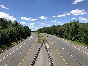
State highways passing through the township include U.S. Route 130, U.S. Route 322/County Route 536, Route 324 (which runs for 1.5 miles (2.4 km), entirely in Logan Township) and Interstate 295.
The Commodore Barry Bridge is a cantilever bridge that spans the Delaware River from Chester, Pennsylvania to the Bridgeport section of Logan Township as part of US 322. Owned and operated by the Delaware River Port Authority, construction of the bridge began in 1969 and the bridge opened to traffic in February 1974. The bridge is named for the American Revolutionary War hero and Philadelphia resident, John Barry.
Public transportation
NJ Transit bus service is available between in the township between Pennsville Township and Philadelphia on the 402 route.
Economy
Pureland Industrial Complex was established in the early 1970s when 45 farms comprising 3,200 acres (1,300 ha) were assembled in Logan Township. Under the ownership of State Mutual Life Assurance Company of America, environmental studies were undertaken by Jack McCormick, the first scientist with a doctorate in environmental science. In 1971, The New York Times described the project as "the nation's first ecologically planned industrial complex".
In 1973, the Pureland Association was formed and Declaration of Environmental Standards were established and recorded in Gloucester County. Approximately 1,200 acres (490 ha) were placed in an environmental reserve in perpetuity and rigid environmental controls were established, prior to the establishment of the United States Environmental Protection Agency or the New Jersey Department of Environmental Protection. These restrictive covenants protect property owners' value and are enforced by the Pureland Association which consist of property owners.
In 1976, the initial infrastructure was established with public water, sewer and rail servicing Pureland.
In 1977, Center Square Real Estate Development Company took over management of Pureland for State Mutual Life Assurance Company of America.
In 2000, Center Square Real Estate Development Company purchased the undeveloped land from State Mutual and continues to manage and develop Pureland today.
Pureland consists of 12,000,000 square feet (1,100,000 m2) of space and houses in excess of 180 companies employing over 8,500 people, mostly in the arena of warehousing and distribution. Pureland is the largest industrial complex in New Jersey.
Logan Township was the proposed location for the Crown Landing LNG Terminal, a liquefied natural gas (LNG) off-loading and processing facility to be sited along the Delaware River. The facility would have included an off-loading pier that would technically enter the waters of the state of Delaware. Delaware opposed the project and filed a lawsuit in federal court to stop the project from going forward on the basis that they control the waters in which part of the pier would be situated; a lawsuit the State of Delaware lost. The Federal Energy Regulatory Commission approved the Crown Landing LNG Terminal on June 15, 2006. In 2009, long after the project should have been completed, Hess Energy acquired the project after BP failed to get plans approved and construction started. On January 6, 2012, Hess Energy surrendered its authorization to construct and operate the terminal. In a letter to the Federal Energy Regulatory Commission (FERC), Hess said it determined that the terminal would not be profitable, saying that "significant increases in natural gas production from North American shale resources" would affect prices and demand for natural gas.
Education
The Logan Township School District serves public school students in kindergarten through eighth grade. As of the 2018–19 school year, the district, comprised of three schools, had an enrollment of 857 students and 88.4 classroom teachers (on an FTE basis), for a student–teacher ratio of 9.7:1. Schools in the district (with 2018–19 enrollment data from the National Center for Education Statistics) are Center Square School on Peachwood Drive with 247 students in grades PreK - 1, Logan Elementary School located on School Lane with 372 students in grades 2-5 and Logan Middle School with 236 students in grades 6–8.
Public school students in ninth through twelfth grades are educated at Kingsway Regional High School under a sending/receiving relationship in which tuition is paid on a per-pupil basis to the Kingsway Regional School District, which serves students in seventh through twelfth grades from East Greenwich Township, South Harrison Township, Swedesboro and Woolwich Township. As of the 2018–19 school year, the district, comprised of two schools, had an enrollment of 2,782 students and 210.5 classroom teachers (on an FTE basis), for a student–teacher ratio of 13.2:1. Schools in the district (with 2018–19 enrollment data from the National Center for Education Statistics) are Kingsway Regional Middle School with 985 students in grades 7-8 and Kingsway Regional High School with 1,752 students in grades 9-12. Under a 2011 proposal, Kingsway would merge with its constituent member's K-6 districts to become a full K-12 district, with various options for including Logan Township as part of the consolidated district.
As of 2020[update] Guardian Angels Regional School (Pre-K-Grade 3 campus in Gibbstown CDP and 4-8 campus in Paulsboro) takes students from Logan Township. It is under the Roman Catholic Diocese of Camden.
Notable people
People who were born in, residents of, or otherwise closely associated with Logan Towsnhip include:
- Edward Durr (born 1963), politician and truck driver who represents the 3rd Legislative district in the New Jersey Senate.
See also
 In Spanish: Municipio de Logan (Nueva Jersey) para niños


