Lopatcong Township, New Jersey facts for kids
Quick facts for kids
Lopatcong Township, New Jersey
|
|
|---|---|
|
Township
|
|
| Township of Lopatcong | |
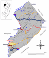
Map of Lopatcong Township in Warren County. Inset: Location of Warren County highlighted in the State of New Jersey.
|
|
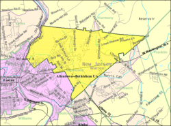
Census Bureau map of Lopatcong Township, New Jersey
|
|
| Country | |
| State | |
| County | |
| Incorporated | March 7, 1851 |
| Government | |
| • Type | Faulkner Act (small municipality) |
| • Body | Township Council |
| Area | |
| • Total | 7.38 sq mi (19.10 km2) |
| • Land | 7.32 sq mi (18.95 km2) |
| • Water | 0.06 sq mi (0.16 km2) 0.81% |
| Area rank | 237th of 565 in state 16th of 22 in county |
| Elevation | 384 ft (117 m) |
| Population | |
| • Total | 8,014 |
| • Estimate
(2019)
|
8,387 |
| • Rank | 287th of 566 in state 3rd of 22 in county |
| • Density | 1,129.0/sq mi (435.9/km2) |
| • Density rank | 365th of 566 in state 6th of 22 in county |
| Time zone | UTC−05:00 (Eastern (EST)) |
| • Summer (DST) | UTC−04:00 (Eastern (EDT)) |
| ZIP Code |
08865
|
| Area code(s) | 908 |
| FIPS code | 3404141490 |
| GNIS feature ID | 0882252 |
| Website | |
Lopatcong Township is a township in Warren County, New Jersey, United States. As of the 2010 United States Census, the township's population was 8,014, reflecting an increase of 2,249 (+39.0%) from the 5,765 counted in the 2000 Census, which had in turn increased by 713 (+14.1%) from the 5,052 counted in the 1990 Census.
Contents
History
What is now Lopatcong Township was created as Phillipsburg Township on March 7, 1851, by an act approved by the New Jersey Legislature from portions of Greenwich Township and Harmony Township. After Phillipsburg was incorporated as an independent municipality on March 8, 1861, the township changed its name to Lopatcong as of March 18, 1863, after a creek in the area.
The name of the creek and township — Lopatcong — came from four words of the Lenni Lenape Native Americans — Lowan peek achtu onk, which meant "winter watering place for deer".
Geography
According to the United States Census Bureau, the township had a total area of 7.159 square miles (18.541 km2), including 7.098 square miles (18.384 km2) of land and 0.061 square miles (0.157 km2) of water (0.85%).
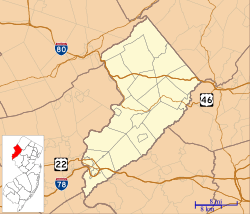
Delaware Park (2010 Census population of 700) and Lopatcong Overlook (population 734 as of 2010) are unincorporated communities and census-designated places (CDPs) located within the township.
Other unincorporated communities, localities and place names located partially or completely within the township include Ingersol Heights and Union Town.
Lopatcong is made up of several neighborhoods, including Morris Park, Delaware Park, Rosehill Heights, Brakeley Park, Lows Hollow, Country Hills, Meadow View, Scott's Mountain and Overlook.
Demographics
| Historical population | |||
|---|---|---|---|
| Census | Pop. | %± | |
| 1860 | 3,741 | — | |
| 1870 | 1,150 | −69.3% | |
| 1880 | 1,591 | 38.3% | |
| 1890 | 1,738 | 9.2% | |
| 1900 | 1,982 | 14.0% | |
| 1910 | 766 | −61.4% | |
| 1920 | 1,050 | 37.1% | |
| 1930 | 1,269 | 20.9% | |
| 1940 | 1,450 | 14.3% | |
| 1950 | 1,737 | 19.8% | |
| 1960 | 2,703 | 55.6% | |
| 1970 | 3,144 | 16.3% | |
| 1980 | 4,998 | 59.0% | |
| 1990 | 5,052 | 1.1% | |
| 2000 | 5,765 | 14.1% | |
| 2010 | 8,014 | 39.0% | |
| 2019 (est.) | 8,387 | 4.7% | |
| Population sources: 1860-1920 1860-1870 1880-1890 1890-1910 1910-1930 1930-1990 2000 2010 * = Lost territory in previous decade |
|||
The Township's economic data (as is all of Warren County) is calculated by the US Census Bureau as part of the Allentown-Bethlehem-Easton, PA-NJ Metropolitan Statistical Area.
Census 2010
As of the census of 2010, there were 8,014 people, 3,136 households, and 2,089 families residing in the township. The population density was 1,129.0 per square mile (435.9/km2). There were 3,420 housing units at an average density of 481.8 per square mile (186.0/km2)*. The racial makeup of the township was 87.22% (6,990) White, 6.03% (483) Black or African American, 0.14% (11) Native American, 4.18% (335) Asian, 0.01% (1) Pacific Islander, 0.81% (65) from other races, and 1.61% (129) from two or more races. [[Hispanic (U.S. Census)|Hispanic or Latino of any race were 5.99% (480) of the population.
There were 3,136 households out of which 30.0% had children under the age of 18 living with them, 55.7% were married couples living together, 7.9% had a female householder with no husband present, and 33.4% were non-families. 29.3% of all households were made up of individuals, and 13.3% had someone living alone who was 65 years of age or older. The average household size was 2.46 and the average family size was 3.09.
In the township, the population was spread out with 23.1% under the age of 18, 5.5% from 18 to 24, 25.5% from 25 to 44, 27.8% from 45 to 64, and 18.1% who were 65 years of age or older. The median age was 42.3 years. For every 100 females there were 88.3 males. For every 100 females ages 18 and old there were 82.6 males.
The Census Bureau's 2006-2010 American Community Survey showed that (in 2010 inflation-adjusted dollars) median household income was $77,320 (with a margin of error of +/- $4,889) and the median family income was $89,317 (+/- $6,056). Males had a median income of $61,771 (+/- $6,980) versus $49,338 (+/- $4,584) for females. The per capita income for the borough was $33,633 (+/- $2,586). About 0.7% of families and 4.3% of the population were below the poverty line, including 2.0% of those under age 18 and 8.4% of those age 65 or over.
Census 2000
As of the 2000 United States Census there were 5,765 people, 2,143 households, and 1,523 families residing in the township. The population density was 814.6 people per square mile (314.4/km2). There were 2,429 housing units at an average density of 343.2 per square mile (132.5/km2). The racial makeup of the township was 96.27% White, 1.13% African American, 0.07% Native American, 1.63% Asian, 0.49% from other races, and 0.42% from two or more races. Hispanic or Latino of any race were 1.99% of the population.
There were 2,143 households, out of which 32.3% had children under the age of 18 living with them, 62.5% were married couples living together, 5.7% had a female householder with no husband present, and 28.9% were non-families. 26.2% of all households were made up of individuals, and 16.6% had someone living alone who was 65 years of age or older. The average household size was 2.55 and the average family size was 3.09.
In the township the population was spread out, with 24.5% under the age of 18, 4.4% from 18 to 24, 26.7% from 25 to 44, 22.2% from 45 to 64, and 22.2% who were 65 years of age or older. The median age was 41 years. For every 100 females, there were 85.4 males. For every 100 females age 18 and over, there were 79.3 males.
The median income for a household in the township was $50,918, and the median income for a family was $65,545. Males had a median income of $52,540 versus $30,967 for females. The per capita income for the township was $24,333. About 4.7% of families and 6.4% of the population were below the poverty line, including 8.2% of those under age 18 and 9.3% of those age 65 or over.
Transportation
Roads and highways
As of May 2010[update], the township had a total of 45.59 miles (73.37 km) of roadways, of which 35.19 miles (56.63 km) were maintained by the municipality, 6.56 miles (10.56 km) by Warren County and 3.84 miles (6.18 km) by the New Jersey Department of Transportation.
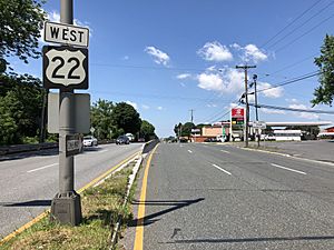
The most prominent highway in Lopatcong Township is US 22, which traverses the southern section of the township. Route 57 traverses towards the center from its western end at US 22. The main county road that passes through is County Route 519 which passes through in the eastern part of the township.
Public transportation
NJ Transit bus service is provided on the 890 and 891 routes.
Film community
Lopatcong Township was the primary location for the independent film Several Ways to Die Trying. The film's writer/director, Glen Tickle, as well as members of the cast and crew are residents of the township.
- Lopatcong Township School District's 2014–15 School Report Card from the New Jersey Department of Education
Education
The Lopatcong Township School District serves public school students in pre-kindergarten through eighth grade. As of the 2018–19 school year, the district, comprised of two schools, had an enrollment of 737 students and 54.4 classroom teachers (on an FTE basis), for a student–teacher ratio of 13.5:1. Schools in the district (with 2018–19 enrollment data from the National Center for Education Statistics) are Lopatcong Elementary School with 378 students in grades PreK-4 and Lopatcong Middle School with 356 students in grades 5–8. Before the Middle School opened in 2003, students would attend the Elementary School through eighth grade; The middle school was constructed in the wake of increasing enrollment, which climbed more than 50% from just over 500 in 1995 to more than 750 by 2001.
Public school students in ninth through twelfth grades attend Phillipsburg High School in Phillipsburg as part of a sending/receiving relationship with the Phillipsburg School District. The high school also serves students from four other sending communities: Alpha, Bloomsbury (in Hunterdon County), Greenwich Township and Pohatcong Township. The site of the new Phillipsburg High School, which began construction in January 2014, is in Lopatcong's borders. The three-story, 330,000-square-foot (31,000 m2) building, with more than double the floor space of the existing high school and a capacity to accommodate more than 2,100 students, was completed for the 2016–17 school year and was dedicated in September 2016 at ceremonies attended by Governor of New Jersey Chris Christie. As of the 2018–19 school year, the high school had an enrollment of 1,650 students and 126.5 classroom teachers (on an FTE basis), for a student–teacher ratio of 13.0:1.
Students from the township and from all of Warren County are eligible to attend Ridge and Valley Charter School in Frelinghuysen Township (for grades K-8) or Warren County Technical School in Washington borough (for 9-12), with special education services provided by local districts supplemented throughout the county by the Warren County Special Services School District in Oxford Township (for PreK-12).
Lopatcong Township was featured in a 2003 The New York Times, which addressed problems of public school financing in suburban communities and various strategies that Lopatcong and other such communities were adopting to deal with the problem.
Notable people
People who were born in, residents of, or otherwise closely associated with Lopatcong Township include:
- Donald J. Albanese (born 1937), politician who served in the New Jersey General Assembly from 1976 to 1982.
- Ned Bolcar (born 1967), linebacker who played three seasons in the NFL, one with the Seattle Seahawks and two with the Miami Dolphins.
- Lou Reda (1925–2017), filmmaker who specialized in television documentaries.
- Harold S. Sloan (1888-1988), economist who wrote extensively and taught in the field of economics, who also served as the executive director of the Alfred P. Sloan Foundation.
- Doug Steinhardt (born 1968), attorney and politician who served as mayor of Lopatcong Township and is Chairman of the New Jersey Republican State Committee.
See also
 In Spanish: Municipio de Lopatcong (Nueva Jersey) para niños


