
Los Banos, California facts for kids
Quick facts for kids
Los Banos, California
Los Baños
|
|
|---|---|
| City of Los Banos | |

The Falasco Arts Center, housed in the historic St. Joseph's Church, Los Banos.
|
|

Location in Merced County and the state of California
|
|

Los Banos, California
Location in the United States
|
|
| Country | |
| State | |
| County | Merced |
| Incorporated | May 8, 1907 |
| Area | |
| • Total | 10.12 sq mi (26.20 km2) |
| • Land | 9.99 sq mi (25.88 km2) |
| • Water | 0.12 sq mi (0.32 km2) 1.22% |
| Elevation | 118 ft (35 m) |
| Population
(2020)
|
|
| • Total | 45,532 |
| • Estimate
(2019)
|
41,036 |
| • Density | 4,106.47/sq mi (1,585.47/km2) |
| Time zone | UTC−8 (Pacific) |
| • Summer (DST) | UTC−7 (PDT) |
| ZIP Code |
93635
|
| Area code | 209 |
| FIPS code | 06-44028 |
| GNIS feature IDs | 277547, 2410878 |
Los Banos ( LOHSS-_-BAN-ohss), alternatively Los Baños ( LOHSS-_-BAN-yohss), is a city in Merced County, central California. It is located in the San Joaquin Valley, near the junction of State Route 152 and Interstate 5.
The population was 45,532 at the 2020 census, up from 35,972 at the 2010 census. The city is served by Los Banos Municipal Airport for air transport access.
Contents
Etymology
The name Los Banos is from Spanish los baños "the baths". It is named after a spring that feeds natural wetlands in the western San Joaquín Valley. Its official spelling, reflected in the name of its post office, omits the tilde of the ñ.
Geography
Los Banos is located on the west side of the San Joaquin Valley, 26 miles (42 km) southwest of Merced, at approximately 118 ft (36 m) elevation. Its coordinates are 37°03′30″N 120°51′00″W / 37.05833°N 120.85000°W. The city is at the intersection of California State Route 152 and California State Route 165. To the west is Interstate 5, which runs north-to-south between the Bay Area and Los Angeles, the San Luis Reservoir, and the Diablo Range.
According to the United States Census Bureau, the city has a total area of 10.1 square miles (26 km2), of which 10.0 square miles (26 km2) is land and 0.1 square miles (0.26 km2) (1.22%) is water.

Los Banos sits on the southwestern edge of extensive national and state game refuges; wetlands that support waterfowl and other wildlife habitat along a stretch of the San Joaquin river that still carries water and the Grasslands Ecological Area, home to rare California Grasslands habitat. The San Luis National Wildlife Refuge Complex includes San Luis National Wildlife Refuge which includes the Kesterson Unit, East Bear Creek, West Bear Creek and the Blue Goose Unit. Nearby are the Merced National Wildlife Refuge and the San Joaquin River National Wildlife Refuge. Fishers, hunters, birdwatchers and other recreational users flock to Los Banos year round.
Climate
Los Banos has a Mediterranean climate with cool winters and hot summers. Most of the precipitation falls in the winter months. Gusty winds are common in the late afternoon, especially in the vicinity of nearby Pacheco Pass.
There is an average of 96.9 days with highs of 90 °F (32 °C) or higher, and an average of 29.4 days with lows of 32 °F (0 °C) or lower. The record high temperature of 116 °F (47 °C) was on July 25, 1931. A record low temperature of 14 °F (−10 °C) was on January 11, 1949, and again on December 22, 1990.
The average annual rainfall is 9.95 inches (25.3 cm). There is an average of 46 days with measurable precipitation. The wettest year recorded was 1998 with 21.08 inches (53.5 cm) and the driest year was 1947 with 4.61 inches (11.7 cm). The most rainfall in one month was 8.08 inches (20.5 cm) in March 1998. The most rainfall in 24 hours was 2.40 inches (6.1 cm) on January 18, 1914. Although snow is rare, 3 in (7.6 cm) fell in January 1916 and 1.5 inches (3.8 cm) fell in January 1962.
| Weather chart for Los Banos | |||||||||||||||||||||||||||||||||||||||||||||||
|---|---|---|---|---|---|---|---|---|---|---|---|---|---|---|---|---|---|---|---|---|---|---|---|---|---|---|---|---|---|---|---|---|---|---|---|---|---|---|---|---|---|---|---|---|---|---|---|
| J | F | M | A | M | J | J | A | S | O | N | D | ||||||||||||||||||||||||||||||||||||
|
2
56
39
|
1.9
63
42
|
1.5
69
46
|
0.7
74
49
|
0.5
83
55
|
0.1
90
60
|
0
95
63
|
0
94
62
|
0.2
90
59
|
0.5
80
52
|
1
66
44
|
1.6
56
38
|
||||||||||||||||||||||||||||||||||||
| temperatures in °F precipitation totals in inches source: WRCC—NCDC 1981–2010 monthly normals |
|||||||||||||||||||||||||||||||||||||||||||||||
|
Metric conversion
|
|||||||||||||||||||||||||||||||||||||||||||||||
Demographics
| Historical population | |||
|---|---|---|---|
| Census | Pop. | %± | |
| 1910 | 745 | — | |
| 1920 | 1,276 | 71.3% | |
| 1930 | 1,875 | 46.9% | |
| 1940 | 2,214 | 18.1% | |
| 1950 | 3,868 | 74.7% | |
| 1960 | 5,272 | 36.3% | |
| 1970 | 9,188 | 74.3% | |
| 1980 | 10,341 | 12.5% | |
| 1990 | 14,519 | 40.4% | |
| 2000 | 25,869 | 78.2% | |
| 2010 | 35,972 | 39.1% | |
| 2020 | 45,532 | 26.6% | |
| 2019 (est.) | 41,036 | 14.1% | |
| U.S. Decennial Census | |||
2010
At the 2010 census Los Banos had a population of 35,972. The population density was 3,555.6 people per square mile (1,372.8/km2). The racial makeup of Los Banos was 20,846 (58.0%) White, 1,354 (3.8%) African American, 512 (1.4%) Native American, 1,162 (3.2%) Asian, 134 (0.4%) Pacific Islander, 10,123 (28.1%) from other races, and 1,841 (5.1%) from two or more races. Hispanic or Latino of any race were 23,346 persons (64.9%).
The census reported that 35,791 people (99.5% of the population) lived in households, 103 (0.3%) lived in non-institutionalized group quarters, and 78 (0.2%) were institutionalized.
There were 10,259 households, 5,451 (53.1%) had children under the age of 18 living in them, 6,018 (58.7%) were opposite-sex married couples living together, 1,474 (14.4%) had a female householder with no husband present, 838 (8.2%) had a male householder with no wife present. There were 791 (7.7%) unmarried opposite-sex partnerships, 78 (0.8%) same-sex married couples or partnerships, and 1,551 households (15.1%) were one person and 653 (6.4%) had someone living alone who was 65 or older. The average household size was 3.49. There were 8,330 families (81.2% of households); the average family size was 3.84.
The age distribution was 12,102 people (33.6%) under the age of 18, 3,703 people (10.3%) aged 18 to 24, 9,596 people (26.7%) aged 25 to 44, 7,494 people (20.8%) aged 45 to 64, and 3,077 people (8.6%) who were 65 or older. The median age was 29.8 years. For every 100 females, there were 99.2 males. For every 100 females age 18 and over, there were 96.0 males.
There were 11,375 housing units at an average density of 1,124.4 per square mile, of the occupied units 6,197 (60.4%) were owner-occupied and 4,062 (39.6%) were rented. The homeowner vacancy rate was 4.1%; the rental vacancy rate was 8.4%. 20,687 people (57.5% of the population) lived in owner-occupied housing units and 15,104 people (42.0%) lived in rental housing units.
2000

At the 2000 census there were 25,869 people in 7,721 households, including 6,223 families, in the city. The population density was 3,218.7 people per square mile (1,242.3/km2). There were 8,049 housing units at an average density of 1,001.5 per square mile (386.5/km2). The racial makeup of the city was 58.61% White, 4.25% African American, 1.35% Native American, 2.34% Asian, 0.33% Pacific Islander, 26.90% from other races, and 6.21% from two or more races. Hispanic or Latino of any race were 50.44%.
Of the 7,721 households, 48.9% had children under the age of 18 living with them, 62.5% were married couples living together, 12.4% had a female householder with no husband present, and 19.4% were non-families. Of all households, 15.8% were one person and 7.0% were one person aged 65 or older. The average household size was 3.33 and the average family size was 3.69.
The age distribution was 35.1% under the age of 18, 8.9% from 18 to 24, 29.9% from 25 to 44, 16.8% from 45 to 64, and 9.3% 65 or older. The median age was 30 years. For every 100 females, there were 99.0 males. For every 100 females age 18 and over, there were 96.0 males.
The median household income was $43,690 and the median family income was $45,304. Males had a median income of $38,294 versus $27,994 for females. The per capita income for the city was $15,582. About 9.8% of families and 12.1% of the population were below the poverty line, including 13.9% of those under age 18 and 9.8% of those age 65 or over.
History and culture
The Los Banos area was initially settled, according to Mexican land grant records, back in the 1840s. The first white settler in the area was Uriah Wood, who built his two-room cabin in 1859. The original site of Los Banos was located several miles from the current town center, about a mile and half west of the railroad near present-day Volta. The town was essentially a trading post and received its name when the Post Office was established and the Post Office Department designated the office "Los Banos" after the nearby creek. When the railroad arrived, Los Banos relocated to its present-day site. The first post office opened in 1873.
Land and water rights were important to early Los Banos residents, but those rights were recognized only when the land and deed were registered. Sometimes those rights depended on fleet footedness, as it did in the "race" between Los Banos residents Uriah Wood and Henry Miller. Wood, whose homestead was located off of Badger Flat Road, raced Miller to the land office in Stockton to insure his claim to the land would be recognized. After crossing the San Joaquin River, Wood paid the ferryman $5 to hold the boat on the east side of the river to insure he would gain sufficient distance from Miller to insure he would reach the land office first. Wood succeeded and the seven sections that he registered cost him only 45¢ an acre.
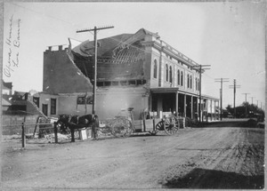
The centerpiece of downtown Los Banos is the newly created Miller Plaza, honoring early California rancher, Henry Miller. The 10-acre (4.0 ha) half-oval public plaza features a monumental scale bronze arrangement of Miller with cattle. At one time in the late nineteenth century, Miller was the largest land owner in the United States. The success of his business monopolized the California agricultural industry, funneling resources and supplies to create his prosperous company. Centered around cattle farming, the Miller and Lux Corporation ultimately transformed the San Joaquin Valley into what can be considered as a precursor to corporate farming and turning independent farmers into wageworkers. His company, the Miller & Lux Corporation, was headquartered in Los Banos on a site currently housing the Mexican restaurant España's and the Canal Farm Inn.
Los Banos has a long history of Portuguese and Spanish immigrants, as do many of the nearby towns on the west side of the San Joaquin Valley. This is reflected both in local restaurants and in several festivals and parades that take place during the year. There is also a significant community of Basques. Los Banos is locally known for its annual May Day Fair during the first week of May.
Los Banos is home to The Randall Fawcett House which is a Frank Lloyd Wright designed Usonian home.
A member of the Manson family, Susan Atkins attended Los Banos High School, before joining the family.
Since the 1980s, the city's population has changed with a continuing influx of people who work in the San Jose/Silicon Valley area but seek more affordable housing and slower pace of semi-rural life, a pattern seen in many other small towns within commuting distance of Silicon Valley.
Economy
Top employers
According to the city's 2018 Comprehensive Annual Financial Report, the top employers in the city are:
| # | Employer | # of Employees |
|---|---|---|
| 1 | Los Banos Unified School District | 1,082 |
| 2 | Walmart | 340 |
| 3 | Memorial Hospital Los Banos | 286 |
| 4 | Kagome | 206 |
| 5 | City of Los Banos | 178 |
| 6 | Target | 153 |
| 7 | APEX | 126 |
| 8 | The Home Depot | 125 |
| 9 | Save Mart | 90 |
| 10 | Central California Irrigation District | 75 |
Education
K–12 education is provided by the Los Banos Unified School District. In addition, the Los Banos Campus of Merced College has served community college students since 2007.
Notable people
- Maude Apatow, (b. 1997) is an American actress. She stars as Lexi Howard in the HBO drama series Euphoria.
- Mack Wheat, (1893–1979), was a Major League Baseball catcher from 1915 to 1921 for Brooklyn and the Philadelphia Phillies.
Images for kids
-
Canal Farm Inn, a California Historical Landmark

See also
 In Spanish: Los Baños (California) para niños
