Loxahatchee Groves, Florida facts for kids
Quick facts for kids
Loxahatchee Groves, Florida
|
||
|---|---|---|
|
||
| Motto(s):
Florida's Last Frontier
|
||

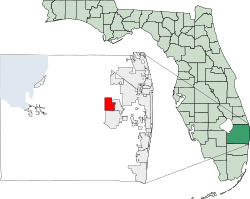
Location in Palm Beach County and the state of Florida
|
||
| Country | ||
| State | ||
| County | Palm Beach | |
| Settled | 1917 | |
| Incorporated | November 1, 2006 | |
| Area | ||
| • Total | 12.53 sq mi (32.45 km2) | |
| • Land | 12.51 sq mi (32.40 km2) | |
| • Water | 0.02 sq mi (0.04 km2) | |
| Elevation | 5 ft (16 m) | |
| Population
(2020)
|
||
| • Total | 3,355 | |
| • Density | 268.16/sq mi (103.54/km2) | |
| Time zone | UTC-5 (Eastern (EST)) | |
| • Summer (DST) | UTC-4 (EDT) | |
| ZIP codes |
33470
|
|
| Area code(s) | 561 | |
| FIPS code | 12-41577 | |
| GNIS feature ID | 286185 | |
Loxahatchee Groves is a town in Palm Beach County, Florida, United States. As of the 2010 census, the town had a population of 3,180. Loxahatchee Groves was incorporated November 1, 2006, as the 38th municipality in Palm Beach County. The first election for town council members was held on March 13, 2007. Although Loxahatchee Groves did not become a municipality until 2006, the area had been settled since 1917. Billing itself as "Florida's Last Frontier", Loxahatchee Groves was primarily incorporated to better protect the area from encroaching urbanization as nearby cities continued to develop and to preserve the area's rural character.
The town derives its name from the Loxahatchee River; "Loxahatchee" is from the Seminole words lowchow (turtle) and hatchee (river), thus translating to "river of turtles". Loxahatchee Groves is bounded on the east by Royal Palm Beach, on the south by Wellington, and on the west and north by The Acreage and Loxahatchee. It has an area of approximately 12.5 square miles (32.4 km2).
Contents
Demographics
| Historical population | |||
|---|---|---|---|
| Census | Pop. | %± | |
| 2010 | 3,180 | — | |
| 2020 | 3,355 | 5.5% | |
| U.S. Decennial Census | |||
2020 census
| Race | Number | Percentage |
|---|---|---|
| White (NH) | 2,330 | 69.45% |
| Black or African American (NH) | 96 | 2.86% |
| Native American or Alaska Native (NH) | 1 | 0.03% |
| Asian (NH) | 76 | 2.27% |
| Some Other Race (NH) | 19 | 0.57% |
| Mixed/Multi-Racial (NH) | 145 | 4.32% |
| Hispanic or Latino | 688 | 20.51% |
| Total | 3,355 |
As of the 2020 United States census, there were 3,355 people, 1,189 households, and 858 families residing in the town.
2010 census
As of the census of 2010, there were 1,105 households, out of which 9.6% were vacant. The 2010 census also indicated that 24.4% had children under the age of 18 living with them, 55.0% were married couples living together, 8.4% had a female householder with no husband present, and 29.7% were non-families. Approximately 26.1% of households had an individual who was 65 years of age or older. The average household size was 2.26 and the average family size was 3.02. As of the census of 2010, there were 3,180 people living in the town. The population density was 276.85 per square mile (106.89/km2). The racial makeup of the town was 81.3% White (74.2% were non-Hispanic White), 3.1% African American, 0.3% Native American, 1.6% Asian, 0.0% Pacific Islander, 0.1% from other races, and 1.9% from two or more races. Hispanic or Latino of any race were 18.7% of the population.
Education
Primary and secondary schools
The School District of Palm Beach County serves Loxahatchee Groves. Public schools in Loxahatchee Groves and schools serving Loxahatchee Groves include:
- Loxahatchee Groves Elementary School
- Western Pines Middle School
- Seminole Ridge Community High School
Colleges
Palm Beach State College (PBSC) opened a campus in Loxahatchee Groves in February 2017 to serve college students in The Acreage, Loxahatchee, Loxahatchee Groves, Royal Palm Beach, and Wellington. Named after former school president Dennis P. Gallon, the campus covers 50,000 sq ft (4,600 m2) of space and features 20 classrooms and computer labs, a large multi-propose room, and a doctor's office simulation room. Although the campus does not include a cafe, library, or bookstore, those may be included in the construction of two additional buildings planned, depending on enrollment numbers.
Transportation
U.S. routes 98 and 441 and State Road 80 all jointly move east-to-west along the southern end of the town, a road which is locally known as Southern Boulevard. Okeechobee Boulevard, designated as State Road 704 to the east of Royal Palm Beach, also runs east-to-west through the town. Palm Tran Route 40, which runs from downtown West Palm Beach to Belle Glade, has a few stops along Southern Boulevard in Loxahatchee Groves and just outside the town limits.
See also
 In Spanish: Loxahatchee Groves para niños


