
Lynn Haven, Florida facts for kids
Quick facts for kids
Lynn Haven, Florida
|
|
|---|---|

City Hall as seen from Florida State Road 77
|
|

Location in Bay County and the state of Florida
|
|
| Country | |
| State | |
| County | |
| Incorporated (town) | July 1, 1914 |
| Incorporated (city) | 1927 |
| Area | |
| • Total | 10.53 sq mi (27.27 km2) |
| • Land | 10.45 sq mi (27.07 km2) |
| • Water | 0.07 sq mi (0.19 km2) |
| Elevation | 13 ft (4 m) |
| Population
(2020)
|
|
| • Total | 18,695 |
| • Density | 1,788.48/sq mi (690.57/km2) |
| Time zone | UTC-6 (Central (CST)) |
| • Summer (DST) | UTC-5 (CDT) |
| ZIP code |
32444
|
| Area code(s) | 850 |
| FIPS code | 12-41825 |
| GNIS feature ID | 0286227 |
Lynn Haven is a city in Bay County, Florida, United States, north of Panama City. The population was 18,493 at the 2010 census. Like many communities in Bay County, the city was severely damaged by Category 5 Hurricane Michael on October 10, 2018.
Geography
Lynn Haven is located at 30°14′23″N 85°38′53″W / 30.239849°N 85.648126°W.
According to the United States Census Bureau, the city has a total area of 11.8 square miles (30.5 km2), of which 10.4 square miles (26.9 km2) is land, and 1.4 square miles (3.6 km2) (11.90%) is water.
Demographics
| Historical population | |||
|---|---|---|---|
| Census | Pop. | %± | |
| 1920 | 874 | — | |
| 1930 | 928 | 6.2% | |
| 1940 | 1,246 | 34.3% | |
| 1950 | 1,787 | 43.4% | |
| 1960 | 3,078 | 72.2% | |
| 1970 | 4,044 | 31.4% | |
| 1980 | 6,239 | 54.3% | |
| 1990 | 9,298 | 49.0% | |
| 2000 | 12,451 | 33.9% | |
| 2010 | 18,493 | 48.5% | |
| 2020 | 18,695 | 1.1% | |
| U.S. Decennial Census | |||
As of the census of 2010, there were 18,493 people, 4,898 households, and 3,649 families residing in the city. The population density was 1,783.4 inhabitants per square mile (589.9/km2). There were 8,266 housing units at an average density of 643.3 per square mile (248.4/km2). The racial makeup of the city was 83.2% White, 10.0% African American, 0.6% Native American, 2.4% Asian, 0.1% Native Hawaiian and 2.9% from two or more races. Hispanic or Latino of any race were 4.1% of the population.
There were 4,898 households, out of which 35.9% had children under the age of 18 living with them, 58.8% were married couples living together, 12.5% had a female householder with no husband present, and 25.5% were non-families. 21.8% of all households were made up of individuals, and 7.6% had someone living alone who was 65 years of age or older. The average household size was 2.54 and the average family size was 2.95.
In the city, the population was spread out, with 26.1% under the age of 18, 7.2% from 18 to 24, 30.4% from 25 to 44, 24.3% from 45 to 64, and 12.0% who were 65 years of age or older. The median age was 37 years. For every 100 females, there were 93.2 males. For every 100 females age 18 and over, there were 90.1 males.
The median income for a household in the city was $42,105, and the median income for a family was $48,904. Males had a median income of $33,698 versus $24,707 for females. The per capita income for the city was $20,330. About 6.2% of families and 7.2% of the population were below the poverty line, including 8.1% of those under age 18 and 12.9% of those age 65 or over.
Hurricane Michael On October 10, 2018, Hurricane Michael made landfall near Lynn Haven. The 3rd strongest hurricane to ever make landfall in the contiguous United States was the first category 5 hurricane to strike the United States since Hurricane Andrew in 1992. Hurricane Michael displaced thousands of Lynn Haven residents.
Historic buildings
Historic buildings in Lynn Haven include:
- First Presbyterian Church, built in 1911
- Panama Country Club Golf Course developed in 1927
Education
There are six public schools:
- Lynn Haven Elementary School
- Mowat Middle School
- A. Crawford Mosley High School
- Deer Point Elementary School
- New Horizon School
- Haney Vo Tech School
There are two charter schools:
- Bay Haven [1]
- North Bay Haven [2]
Images for kids
-
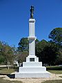
Union soldier monument

See also
 In Spanish: Lynn Haven para niños
