
M69 motorway facts for kids
Quick facts for kids
|
||||
|---|---|---|---|---|
_map.svg) |
||||
| Route information | ||||
| Length | 15.7 mi (25.3 km) | |||
| Existed | 1976–present | |||
| History | Constructed 1976–77 | |||
| Major junctions | ||||
| North end | Leicester | |||
M6 motorway M1 motorway |
||||
| South end | Coventry | |||
| Location | ||||
| Primary destinations: |
Nuneaton, Hinckley | |||
| Road network | ||||
|
||||

The M69 is a controlled-access highway in the Midlands of England. It goes between the M6, near Coventry, and the M1, near Leicester. The motorway is about 16 miles (26 km) long and first opened in 1977.
Junctions
| M69 motorway junctions | |||
| Southwestbound exits (B carriageway) | Junction | Northeastbound exits (A carriageway) | Coordinates |
| Road continues to Coventry (South) and Leamington Spa via A46' | M6, J2 | Coventry (North), Birmingham, The South, Rugby, Kettering M6(A14) Coventry (Central) A4600 Ansty B4065 Non-motorway traffic |
52°26′14″N 1°25′24″W / 52.43724°N 1.42341°W |
| Birmingham M6 Coventry (Central) A4600 Ansty B4065 |
Start of motorway | ||
| Nuneaton A5 Hinckley B4109 |
J1 | Nuneaton A5 Hinckley B4109 |
52°30′55″N 1°21′40″W / 52.51516°N 1.36123°W |
| Hinckley B4669 | J2 | No access (on-ramp only) | 52°32′25″N 1°19′01″W / 52.54017°N 1.31698°W |
| Start of motorway | J3 Terminus |
Cntl Leicester (S)'Freemens|Liberty Circus' Leicester SW, Fosse Park A5460 City Centre (West End), Highcross) Braunstone, Thorpe Astley A563/N Cntl Leicester(SE,E) Southfields:St-George Leicester S, SE, Whetstone Wigston, Oadby A563/E Narborough-Enderby (B4114) Leicester NW, N, NE, Newark M1(A46) The North - Nottingham M1/N The South - Northampton (M1/S) |
52°36′04″N 1°11′46″W / 52.6011°N 1.19604°W |
Images for kids
-
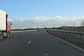
Heading east along the road


All content from Kiddle encyclopedia articles (including the article images and facts) can be freely used under Attribution-ShareAlike license, unless stated otherwise. Cite this article:
M69 motorway Facts for Kids. Kiddle Encyclopedia.