
Maclagan, Queensland facts for kids
Quick facts for kids MaclaganQueensland |
|||||||||||||||
|---|---|---|---|---|---|---|---|---|---|---|---|---|---|---|---|

General store, 2017
|
|||||||||||||||

Maclagan
Location in Queensland
|
|||||||||||||||
| Population | 195 (2016 census locality) | ||||||||||||||
| • Density | 2.552/km2 (6.61/sq mi) | ||||||||||||||
| Established | circa 1890 | ||||||||||||||
| Postcode(s) | 4352 | ||||||||||||||
| Area | 76.4 km2 (29.5 sq mi) | ||||||||||||||
| Time zone | AEST (UTC+10:00) | ||||||||||||||
| Location | |||||||||||||||
| LGA(s) | Toowoomba Region | ||||||||||||||
| State electorate(s) | Nanango | ||||||||||||||
| Federal Division(s) | Groom | ||||||||||||||
|
|||||||||||||||
Maclagan is a rural town and locality in the Toowoomba Region, Queensland, Australia. In the 2016 census the locality of Maclagan had a population of 195 people.
History


The township of Maclagan was surveyed in 17 May 1889. The town was originally named Bismark after Otto von Bismarck until 1916 when it was renamed Maclagan due to the anti German sentiment during World War I. The township was then renamed Maclagan in honour of Brigadier Ewen George Sinclair-Maclagan (1868-1948). Bismark Street is still a street in the town.
Economy
Maclagan Meats Processing is at 4282 Dalby Cooyar Road (27°05′17″S 151°37′59″E / 27.0881°S 151.6331°E).
Education
There are no schools in Maclagan. The nearest primary school and secondary school to Year 10 is Quinalow State School in neighbouring Quinalow to the south-west. For secondary education to Year 12 the nearest schools are Oakey State High School in Oakey to the south and Dalby State High School in Dalby to the south-west.
Road infrastructure
The Dalby–Cooyar Road runs through from south to east. Bunya Mountains-Maclagan Road exits to the north. The Pechey-Maclagan Road ends at the southern boundary where it meets Dalby-Cooyar Road.
Images for kids
-
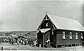
Lutheran church, 1936

