
Manchester, Missouri facts for kids
Quick facts for kids
Manchester, Missouri
|
|
|---|---|

Manchester City Hall, located in the Lyceum Building, which is listed on the National Register of Historic Places.
|
|

Location of Manchester, Missouri
|
|
| Country | United States |
| State | Missouri |
| County | St. Louis |
| Area | |
| • Total | 5.03 sq mi (13.03 km2) |
| • Land | 5.03 sq mi (13.03 km2) |
| • Water | 0.00 sq mi (0.00 km2) |
| Elevation | 577 ft (176 m) |
| Population
(2020)
|
|
| • Total | 18,333 |
| • Density | 3,645/sq mi (1,407.0/km2) |
| Time zone | UTC-6 (Central (CST)) |
| • Summer (DST) | UTC-5 (CDT) |
| FIPS code | 29-45668 |
| GNIS feature ID | 0756342 |
Manchester is a city in St. Louis County, Missouri, United States. It is a western suburb of St. Louis. The population was 18,333 at the 2020 census.
History
Manchester was named by an English settler after Manchester, England.
Geography
Manchester is located at 38°35′3″N 90°30′27″W / 38.58417°N 90.50750°W (38.584244, -90.507449).
According to the United States Census Bureau, the city has a total area of 5.08 square miles (13.16 km2), all of it land.
Demographics
| Historical population | |||
|---|---|---|---|
| Census | Pop. | %± | |
| 1960 | 2,021 | — | |
| 1970 | 5,031 | 148.9% | |
| 1980 | 6,351 | 26.2% | |
| 1990 | 6,542 | 3.0% | |
| 2000 | 19,161 | 192.9% | |
| 2010 | 18,094 | −5.6% | |
| 2020 | 18,333 | 1.3% | |
| U.S. Decennial Census | |||
2020 census
As of the 2020 census, 18,333 people and 7,466 households were living in the city. The racial makeup of the city was 81.3% White (80.3% non-Hispanic White), 3.6% African American, 0.1% Native American, 6.8% Asian, 1.3% from other races, and 6.9% from two or more races. Hispanic or Latino of any race were 4.0% of the population.
2010 census
As of the census of 2010, there were 18,094 people, 7,239 households, and 5,048 families living in the city. The population density was 3,561.8 inhabitants per square mile (1,375.2/km2). There were 7,553 housing units at an average density of 1,486.8 per square mile (574.1/km2). The racial makeup of the city was 87.6% White, 3.1% African American, 0.2% Native American, 6.0% Asian, 1.1% from other races, and 2.1% from two or more races. Hispanic or Latino of any race were 2.9% of the population.
There were 7,239 households, of which 32.4% had children under the age of 18 living with them, 57.7% were married couples living together, 8.7% had a female householder with no husband present, 3.3% had a male householder with no wife present, and 30.3% were non-families. 24.3% of all households were made up of individuals, and 7.7% had someone living alone who was 65 years of age or older. The average household size was 2.50 and the average family size was 3.00.
The median age in the city was 38.9 years. 23.5% of residents were under the age of 18; 8% were between the ages of 18 and 24; 26.2% were from 25 to 44; 29.5% were from 45 to 64; and 12.9% were 65 years of age or older. The gender makeup of the city was 48.7% male and 51.3% female.
Education
The Parkway School District has one high school located within the Manchester city limits: Parkway South High School. Two middle schools (South Middle and Southwest Middle) serve this high school area, and several elementary schools bring education to the neighborhood level. Hanna Woods, Carman Trails, and Wren Hollow are some of the elementary schools that serve Manchester.
The Grand Glaize Branch of St. Louis County Library is in Manchester.
Images for kids
-
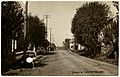
Manchester in 1911.

See also
 In Spanish: Manchester (Misuri) para niños
