
Maranhão facts for kids
Quick facts for kids
State of Maranhão
|
|||
|---|---|---|---|
|
|||

Location of State of Maranhão in Brazil
|
|||
| Country | |||
| Capital and Largest City | São Luís | ||
| Area | |||
| • Total | 331,983.293 km2 (128,179.466 sq mi) | ||
| Area rank | 8th | ||
| Population
(2012)
|
|||
| • Total | 6,714,314 | ||
| • Rank | 10th | ||
| • Density | 20.2248551/km2 (52.382134/sq mi) | ||
| • Density rank | 16th | ||
| Demonym(s) | Maranhense | ||
| GDP | |||
| • Year | 2006 estimate | ||
| • Total | R$ 28,621,000,000 (16th) | ||
| • Per capita | R$ 4,628 (26th) | ||
| HDI | |||
| • Year | 2005 | ||
| • Category | 0.683 – medium (26th) | ||
| Time zone | UTC-3 (BRT) | ||
| • Summer (DST) | UTC-2 (BRST) | ||
| Postal Code |
65000-000 to 65990-000
|
||
| ISO 3166 code | BR-MA | ||
| Website | ma.gov.br | ||


Maranhão is one of the states of Brazil. It is in the northeastern region of the country. To the north is the coast of the Atlantic Ocean. Maranhão shares borders with Piauí, Tocantins and Pará.
Major cities in the state besides the state capital São Luís are Imperatriz, Timon, and Caxias. The Alcantara spaceport is in the north of the state, not far from São Luís.
| States of Brazil | |
|---|---|
| Acre | Alagoas | Amapá | Amazonas | Bahia | Ceará | Espírito Santo | Goiás | Maranhão | Mato Grosso | Mato Grosso do Sul | Minas Gerais | Pará | Paraíba | Paraná | Pernambuco | Piauí | Rio de Janeiro | Rio Grande do Norte | Rio Grande do Sul | Rondônia | Roraima | Santa Catarina | São Paulo | Sergipe | Tocantins | |
| Federal District: Brazilian Federal District | |
Images for kids
-
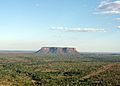
Morro do Chapéu Peak
-
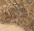
A 1629 map of São Luís
-
Old São Luís.
-
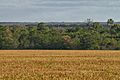
Soybean production in Balsas
-
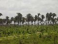
Banana plantation in Baixada Maranhense
-
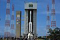
The Alcântara Launch Center in Maranhão
-
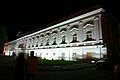
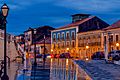
Palace of Lions at night, in São Luís
-
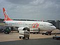
São Luís Airport
-
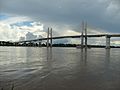
Imperatriz Bridge over Imperatriz River in Maranhão
-
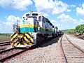
The Carajás Railway
.jpg)
.jpg)


.jpg)


.jpg)


See also
 In Spanish: Maranhão para niños

All content from Kiddle encyclopedia articles (including the article images and facts) can be freely used under Attribution-ShareAlike license, unless stated otherwise. Cite this article:
Maranhão Facts for Kids. Kiddle Encyclopedia.