
Marietta, Pennsylvania facts for kids
Quick facts for kids
Marietta, Pennsylvania
|
|
|---|---|
|
Borough
|
|

Old Town Hall
|
|

Location in Lancaster County, Pennsylvania
|
|

Marietta, Pennsylvania
Location in Pennsylvania

Marietta, Pennsylvania
Location in the United States
|
|
| Country | United States |
| State | Pennsylvania |
| County | Lancaster |
| Area | |
| • Total | 0.75 sq mi (1.95 km2) |
| • Land | 0.75 sq mi (1.93 km2) |
| • Water | 0.01 sq mi (0.02 km2) |
| Elevation | 279 ft (85 m) |
| Population
(2010)
|
|
| • Total | 2,588 |
| • Estimate
(2019)
|
2,604 |
| • Density | 3,485.94/sq mi (1,345.93/km2) |
| Time zone | UTC-5 (EST) |
| • Summer (DST) | UTC-4 (EDT) |
| ZIP code |
17547
|
| Area codes | 717 and 223 |
| School district | Donegal School District |
Marietta is a borough in Lancaster County, Pennsylvania, United States. The population was 2,588 at the 2010 census. It is located on the east bank of the Susquehanna River northwest of Columbia.
Geography
Marietta is located at 40°3′26″N 76°33′21″W / 40.05722°N 76.55583°W (40.057169, -76.555955).
According to the United States Census Bureau, the borough has a total area of 0.8 square miles (2.1 km2), all of it land.
Market Street runs the whole length of the town. The east/west divider is Waterford Avenue.
History
In 1727, James Anderson made a lottery that laid out part of present-day Marietta. Later David Cook laid another portion of present-day Marietta. Further development by Jacob Grosh, John Myers, John Peadan, James Mehaffey, Benjamin Long, and James Huffy laid out the rest of present-day Marietta. In 1812, the borough was incorporated, merging all the areas of town except for the western portion of the borough which was extended into Marietta at a later date.
For the first couple years of existence, the growth of the borough was meager. Then an economic crisis struck the town, not relenting until around 1830. Then throughout the years, industries such as timber and iron smelting provide many economic opportunities in the borough.
The borough was named for the wives of two settlers.
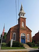
The Ashley and Bailey Silk Mill, Joseph Bucher House, Chickies Historic District, Linden House, and Marietta Historic District are listed on the National Register of Historic Places.
Demographics
| Historical population | |||
|---|---|---|---|
| Census | Pop. | %± | |
| 1840 | 1,428 | — | |
| 1850 | 2,099 | 47.0% | |
| 1860 | 2,186 | 4.1% | |
| 1870 | 2,397 | 9.7% | |
| 1880 | 2,503 | 4.4% | |
| 1890 | 2,402 | −4.0% | |
| 1900 | 2,469 | 2.8% | |
| 1910 | 2,079 | −15.8% | |
| 1920 | 1,735 | −16.5% | |
| 1930 | 1,969 | 13.5% | |
| 1940 | 2,128 | 8.1% | |
| 1950 | 2,442 | 14.8% | |
| 1960 | 2,385 | −2.3% | |
| 1970 | 2,838 | 19.0% | |
| 1980 | 2,740 | −3.5% | |
| 1990 | 2,778 | 1.4% | |
| 2000 | 2,689 | −3.2% | |
| 2010 | 2,588 | −3.8% | |
| 2019 (est.) | 2,604 | 0.6% | |
| Sources: | |||
As of the census of 2000, there were 2,689 people, 1,092 households, and 723 families residing in the borough. The population density was 3,587.0 people per square mile (1,384.3/km2). There were 1,168 housing units at an average density of 1,558.1 per square mile (601.3/km2). The racial makeup of the borough was 95.83% White, 2.49% African American, 0.15% Native American, 0.15% Asian, 0.04% Pacific Islander, 0.52% from other races, and 0.82% from two or more races. Hispanic or Latino of any race were 1.90% of the population.
There were 1,092 households, out of which 32.2% had children under the age of 18 living with them, 51.3% were married couples living together, 10.7% had a female householder with no husband present, and 33.7% were non-families. 25.8% of all households were made up of individuals, and 7.7% had someone living alone who was 65 years of age or older. The average household size was 2.46 and the average family size was 2.99.
In the borough the population was spread out, with 24.8% under the age of 18, 8.1% from 18 to 24, 34.3% from 25 to 44, 22.0% from 45 to 64, and 10.8% who were 65 years of age or older. The median age was 36 years. For every 100 females, there were 99.9 males. For every 100 females age 18 and over, there were 97.7 males.
The median income for a household in the borough was $40,563, and the median income for a family was $46,905. Males had a median income of $33,783 versus $21,863 for females. The per capita income for the borough was $19,265. About 6.7% of families and 9.2% of the population were below the poverty line, including 11.8% of those under age 18 and 11.0% of those age 65 or over.
Gallery
-
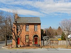
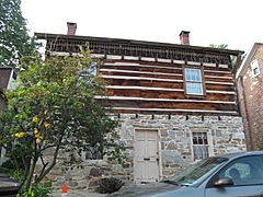
Joseph Bucher House
-
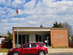
Post office
-
-
-
-
-
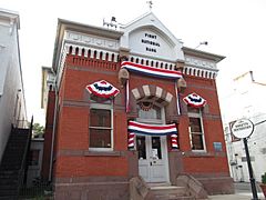
First National Bank Building
-


.jpg)
.jpg)
.jpg)
.jpg)
.jpg)
.jpg)
Education
Primary and secondary education in the borough of Marietta is provided by the Donegal School District. Students kindergarten through second grade attend the Donegal Primary School in Mount Joy. Students third grade through sixth grade attend the Donegal Intermediate School located on PA 441 just outside the borough. Students seventh grade through eighth grade attend the Donegal Junior High School in Mount Joy. Students ninth grade through twelfth grade attend the Donegal Senior High School in Mount Joy.
Notable people
- Henry B. Cassel, Republican member of the U.S. House of Representatives
- Alan Dawson (1929-1996), jazz drummer and percussion teacher based in Boston; born in Marietta.
- David Hickernell, Republican member of the Pennsylvania House of Representatives
See also
 In Spanish: Marietta (Pensilvania) para niños
