
Markleeville, California facts for kids
Quick facts for kids
Markleeville
|
|
|---|---|

General Store
|
|

Location in Alpine County and the state of California
|
|

Markleeville, California
Location in California

Markleeville, California
Location in the United States
|
|
| Country | |
| State | |
| County | Alpine |
| Area | |
| • Total | 6.531 sq mi (16.915 km2) |
| • Land | 6.531 sq mi (16.915 km2) |
| • Water | 0 sq mi (0 km2) 0% |
| Elevation | 5,531 ft (1,686 m) |
| Population
(2010)
|
|
| • Total | 210 |
| • Density | 32.2/sq mi (12.42/km2) |
| Time zone | UTC-8 (Pacific (PST)) |
| • Summer (DST) | UTC-7 (PDT) |
| ZIP code |
96120
|
| Area code(s) | 530 |
| FIPS code | 06-45988 |
| GNIS feature IDs | 1659065, 2408184 |
Markleeville (formerly, Markleville) is a census-designated place (CDP) and the county seat of Alpine County, California, United States. The population was 210 at the 2010 census, up from 197 at the 2000 census.
Contents
History
| Marklee's Cabin | |
|---|---|
| Location | Alpine County Courthouse |
| Built | 1861 |
| Architect | Jacob J. Marklee |
| Reference no. | 240 |
Jacob J. Marklee founded a toll bridge crossing the Carson River in 1861. He aimed to tap into the traffic from the silver mining boom at Silver Mountain City. On June 23, 1862, he recorded a land claim of 160 acres in Douglas County, Nevada. A boundary survey took place, and the property ended up being in California. In 1863, Marklee died after being involved in a gunfight. When the Comstock Lode discovery took place, the town of Markleeville was founded on the Marklee property. Today, the Alpine County Courthouse sits on the former property, which is listed as a California Historical Landmark.
A post office opened in Markleeville in 1863.
Geography
According to the United States Census Bureau, the CDP has a total area of 6.5 square miles (17 km2), all land. The region comprising Markleeville is Alpine in appearance, with lush grassy valley areas. There is a hot spring, and a state park with a campground. Excellent hiking trails abound.
Climate
According to the Köppen Climate Classification system, Markleeville has a warm-summer Mediterranean climate, abbreviated Csb on climate maps, though it approaches a continental Mediterranean climate (Dsb).
Markleeville has warm summers with only occasional rainfall, mostly from afternoon and evening thunderstorms; nights are usually well below 50 °F (10 °C). Winters are somewhat cold and often snowy. The average January temperatures are a maximum of 45.7 °F or 7.6 °C and a minimum of 17.4 °F or −8.1 °C. The average July temperatures are a maximum of 84.5 °F (29.2 °C) and a minimum of 43.1 °F or 6.2 °C. There are an average of 15.7 afternoons with highs of 90 °F or 32.2 °C or higher and an average of 221.7 mornings with lows of 32 °F or 0 °C or lower, including 5.4 mornings falling to or below 0 °F or −17.8 °C, and 8.1 afternoons that do not top freezing. The record high temperature was 102 °F (38.9 °C) on July 11, 1931. The record low temperature was −25 °F (−31.7 °C) on December 22, 1990.
Average annual precipitation is 19.18 inches or 487.2 millimetres. There are an average of 59 days with measurable precipitation. The wettest calendar year was 1996 with 38.35 inches (974.1 mm) and the driest year was 1917 with 11.74 inches (298.2 mm). The most precipitation in one month occurred in January 1914 with 16.13 inches (409.7 mm). The most precipitation in 24 hours was 4.72 inches (119.9 mm) on December 3, 1950. Average annual snowfall is 82.9 inches or 2.11 metres, and snow depths of over 60 inches or 1.52 metres were recorded during the very cold months of January 1916 and February 1922 – the average depth of snow on the ground in January being 8 inches or 0.20 metres. The snowiest year was 1916 with 144.0 inches (3.66 m), including 99.0 inches (2.51 m) in January 1916.
| Climate data for Markleeville, California (045356) | |||||||||||||
|---|---|---|---|---|---|---|---|---|---|---|---|---|---|
| Month | Jan | Feb | Mar | Apr | May | Jun | Jul | Aug | Sep | Oct | Nov | Dec | Year |
| Record high °F (°C) | 66 (19) |
69 (21) |
80 (27) |
82 (28) |
90 (32) |
94 (34) |
102 (39) |
101 (38) |
98 (37) |
87 (31) |
75 (24) |
67 (19) |
102 (39) |
| Average high °F (°C) | 45.3 (7.4) |
46.9 (8.3) |
53.8 (12.1) |
58.9 (14.9) |
66.4 (19.1) |
75.6 (24.2) |
84.5 (29.2) |
84.7 (29.3) |
77.8 (25.4) |
67.0 (19.4) |
53.4 (11.9) |
44.6 (7.0) |
63.3 (17.4) |
| Average low °F (°C) | 17.4 (−8.1) |
19.0 (−7.2) |
23.5 (−4.7) |
27.1 (−2.7) |
33.1 (0.6) |
38.1 (3.4) |
43.1 (6.2) |
42.1 (5.6) |
35.5 (1.9) |
28.1 (−2.2) |
21.8 (−5.7) |
16.3 (−8.7) |
28.8 (−1.8) |
| Record low °F (°C) | −20 (−29) |
−21 (−29) |
−15 (−26) |
16 (−9) |
10 (−12) |
24 (−4) |
26 (−3) |
25 (−4) |
18 (−8) |
6 (−14) |
−7 (−22) |
−25 (−32) |
−25 (−32) |
| Average precipitation inches (mm) | 3.72 (94) |
3.14 (80) |
2.10 (53) |
1.26 (32) |
0.99 (25) |
0.60 (15) |
0.39 (9.9) |
0.46 (12) |
0.47 (12) |
0.93 (24) |
2.11 (54) |
3.01 (76) |
19.18 (486.9) |
| Average snowfall inches (cm) | 21.8 (55) |
19.2 (49) |
13.1 (33) |
4.8 (12) |
1.4 (3.6) |
0.2 (0.51) |
0.0 (0.0) |
0.0 (0.0) |
0.1 (0.25) |
0.6 (1.5) |
5.6 (14) |
16.1 (41) |
82.9 (209.86) |
| Average precipitation days (≥ 0.01 inch) | 8 | 8 | 6 | 5 | 5 | 3 | 3 | 2 | 3 | 4 | 5 | 7 | 59 |
| Source: Western Regional Climate Center | |||||||||||||
Demographics
2010
At the 2010 census Markleeville had a population of 210. The population density was 32.2 people per square mile (12.4/km2). The racial makeup of Markleeville was 192 (91%) White, 0 (0%) African American, 4 (2%) Native American, 2 (1%) Asian, 0 (0%) Pacific Islander, 6 (3%) from other races, and 6 (3%) from two or more races. Hispanic or Latino of any race were 11 people (5%).
The whole population lived in households; no one lived in non-institutionalized group quarters and no one was institutionalized.
There were 100 households, 19 (19%) had children under the age of 18 living in them, 47 (47%) were opposite-sex married couples living together, 5 (5%) had a female householder with no husband present, 5 (5%) had a male householder with no wife present. There were 9 (9%) unmarried opposite-sex partnerships, and 1 (1%) same-sex married couples or partnerships. 32 households (32%) were one person and 8 (8%) had someone living alone who was 65 or older. The average household size was 2.1. There were 57 families (57% of households); the average family size was 2.7.
The population was spread out, with 39 people (19%) under the age of 18, 3 people (1%) aged 18 to 24, 42 people (20%) aged 25 to 44, 92 people (44%) aged 45 to 64, and 34 people (16%) who were 65 or older. The median age was 50.8 years. For every 100 females, there were 101.9 males. For every 100 females age 18 and over, there were 101.2 males.
There were 194 housing units at an average density of 29.7 per square mile (11.5/km2), of which 100 were occupied, of which 63 (63%) were owner-occupied, and 37 (37%) were occupied by renters. The homeowner vacancy rate was 2%; the rental vacancy rate was 10%. 133 people (63% of the population) lived in owner-occupied housing units and 77 people (37%) lived in rental housing units.
2000
At the 2000 census there were 197 people, 92 households, and 57 families in the CDP. The population density was 10.3 people per square mile (4.0/km2). There were 173 housing units at an average density of 9.1 per square mile (3.5/km2). The racial makeup of the CDP was 98% White, 2% Native American, 1% from other races. 2% were Hispanic or Latino of any race.
Of the 92 households, 21% had children under the age of 18 living with them, 51% were married couples living together, 8% had a female householder with no husband present, and 38% were non-families. 30% of households were one person, and 9% were one person aged 65 or older. The average household size was 2.1 and the average family size was 2.6.
The age distribution was 17% under the age of 18, 4% from 18 to 24, 31% from 25 to 44, 34% from 45 to 64, and 15% 65 or older. The median age was 45 years. For every 100 females, there were 95.0 males. For every 100 females age 18 and over, there were 101.2 males.
The median household income was $46,563 and the median family income was $63,750. Males had a median income of $49,375 versus $25,972 for females. The per capita income for the CDP was $40,774. About 7% of families and 15% of the population were below the poverty line, including 25% of those under the age of eighteen and 13% of those 65 or over.
Markleeville Death Ride
Markleeville hosts an annual bicycle ride called the Death Ride - Tour of the California Alps. The route goes over five passes for a total distance of 129 miles and over 15,000 feet of elevation gain. In 2010 3,500 riders participated and 2,417 completed the full course of 5 mountain passes.
Images for kids
-
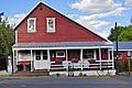
The general store.
See also
 In Spanish: Markleeville para niños
