
Mason County, Michigan facts for kids
Quick facts for kids
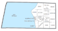
Mason County
|
|
|---|---|

|
|

Location within the U.S. state of Michigan
|
|
 Michigan's location within the U.S. |
|
| Country | |
| State | |
| Founded | 1840 (founded as Notipekago) 1855 (organized) |
| Named for | Stevens T. Mason |
| Seat | Ludington |
| Largest city | Ludington |
| Area | |
| • Total | 1,242 sq mi (3,220 km2) |
| • Land | 495 sq mi (1,280 km2) |
| • Water | 747 sq mi (1,930 km2) 60%% |
| Population
(2020)
|
|
| • Total | 29,052 |
| • Density | 58/sq mi (22/km2) |
| Time zone | UTC−5 (Eastern) |
| • Summer (DST) | UTC−4 (EDT) |
| Congressional districts | 1st, 2nd |
Mason County is a county located in the U.S. state of Michigan. As of the 2020 Census, the population was 29,052. The county seat is Ludington.
Mason County comprises the Ludington, MI Micropolitan Statistical Area.
Contents
History

The county is named for Stevens T. Mason, Governor of Michigan. It was created by the Michigan Legislature in 1840 as Notipekago County, then renamed Mason County in 1843. The county was administered by Ottawa County prior to the organization of county government in 1855.
Geography
According to the U.S. Census Bureau, the county has a total area of 1,242 square miles (3,220 km2), of which 495 square miles (1,280 km2) is land and 747 square miles (1,930 km2) (60%) is water.
Major highways
 US 10
US 10 US 31
US 31
Bus. US 31- M-116
Adjacent counties
- Manistee (north)
- Lake (east)
- Oceana (south)
- Sheboygan County, Wisconsin (southwest)
- Manitowoc County, Wisconsin (west)
National protected area
- Manistee National Forest (part)
Demographics
| Historical population | |||
|---|---|---|---|
| Census | Pop. | %± | |
| 1850 | 93 | — | |
| 1860 | 831 | 793.5% | |
| 1870 | 3,263 | 292.7% | |
| 1880 | 10,065 | 208.5% | |
| 1890 | 16,385 | 62.8% | |
| 1900 | 18,885 | 15.3% | |
| 1910 | 21,832 | 15.6% | |
| 1920 | 19,831 | −9.2% | |
| 1930 | 18,756 | −5.4% | |
| 1940 | 19,378 | 3.3% | |
| 1950 | 20,474 | 5.7% | |
| 1960 | 21,929 | 7.1% | |
| 1970 | 22,612 | 3.1% | |
| 1980 | 26,365 | 16.6% | |
| 1990 | 25,537 | −3.1% | |
| 2000 | 28,274 | 10.7% | |
| 2010 | 28,705 | 1.5% | |
| 2020 | 29,052 | 1.2% | |
| US Decennial Census 1790-1960 1900-1990 1990-2000 2010-2018 |
|||
As of the 2000 United States Census, of 2000, there were 28,274 people, 11,406 households, and 7,881 families in the county. The population density was 57 people per square mile (22/km2). There were 16,063 housing units at an average density of 32 per square mile (13/km2). The racial makeup of the county was 95.84% White, 0.73% Black or African American, 0.78% Native American, 0.28% Asian, 0.02% Pacific Islander, 0.82% from other races, and 1.53% from two or more races. 3.01% of the population were Hispanic or Latino of any race. 24.5% were of German, 10.4% Polish, 8.8% English, 8.5% Irish, 7.7% American and 5.0% Swedish ancestry. 96.0% spoke English and 2.2% Spanish as their first language.
There were 11,406 households, out of which 29.70% had children under the age of 18 living with them, 56.40% were married couples living together, 9.20% had a female householder with no husband present, and 30.90% were non-families. 26.50% of all households were made up of individuals, and 11.70% had someone living alone who was 65 years of age or older. The average household size was 2.43 and the average family size was 2.92.
The county population contained 24.20% under the age of 18, 7.10% from 18 to 24, 26.20% from 25 to 44, 25.80% from 45 to 64, and 16.80% who were 65 years of age or older. The median age was 40 years. For every 100 females there were 97.50 males. For every 100 females age 18 and over, there were 94.40 males.
The median income for a household in the county was $34,704, and the median income for a family was $41,654. Males had a median income of $33,873 versus $22,616 for females. The per capita income for the county was $17,713. About 8.20% of families and 11.00% of the population were below the poverty line, including 16.50% of those under age 18 and 7.00% of those age 65 or over.
Communities
Cities
- Ludington (county seat)
- Scottville
Villages
Townships
- Amber Township
- Branch Township
- Custer Township
- Eden Township
- Free Soil Township
- Grant Township
- Hamlin Township
- Logan Township
- Meade Township
- Pere Marquette Charter Township
- Riverton Township
- Sheridan Township
- Sherman Township
- Summit Township
- Victory Township
Images for kids
-
U.S. Census data map showing local municipal boundaries within Mason County. Shaded areas represent incorporated cities.

See also
 In Spanish: Condado de Mason (Míchigan) para niños
