
Maumee River facts for kids
Quick facts for kids Maumee River |
|
|---|---|

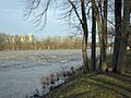
The Maumee River at Grand Rapids, Ohio
|
|

Map of the Maumee River watershed
|
|
| Country | United States |
| States | Indiana, Ohio |
| Cities and towns | Fort Wayne, Indiana; New Haven, Indiana; Antwerp, Ohio; Cecil, Ohio; Defiance, Ohio; Florida, Ohio; Napoleon, Ohio; Grand Rapids, Ohio; Waterville, Ohio; Maumee, Ohio; Perrysburg, Ohio; Rossford, Ohio; Toledo, Ohio; Oregon, Ohio |
| Physical characteristics | |
| Main source | Fort Wayne by the confluence of the St. Joseph and St. Marys 750 ft (230 m) 41°04′58″N 85°07′56″W / 41.0827778°N 85.1322222°W |
| River mouth | Lake Erie at Toledo 571 ft (174 m) 41°41′58″N 83°27′36″W / 41.6994444°N 83.46°W |
| Length | 137 miles (220 km) |
| Basin features | |
| Progression | Northeast |
| Basin size | 6,354 sq mi (16,460 km2) |
The Maumee River (pronounced) (Shawnee: Hotaawathiipi; Miami-Illinois: Taawaawa siipiiwi) is a river running from northeastern Indiana into northwestern Ohio and Lake Erie in the United States. The city of Toledo is located at the mouth of the Maumee.
It is the largest watershed of any of the rivers feeding the Great Lakes, and supplies five percent of Lake Erie’s water.
Images for kids
-
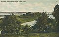
An Island in the Maumee River, Toledo, Ohio, 1909
-
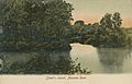
Sheet's Island, Maumee River, Maumee, Ohio, 1900s
-
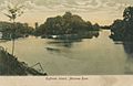
Huffman Island, Maumee River, Toledo, Ohio, 1907
-
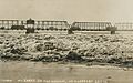
Ice Buildup on Maumee River at Cherry Street Bridge in Toledo, Ohio, 1924
-
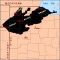
The general extent of the Great Black Swamp prior to the 19th century
-
The St. Marys River (left) and St. Joseph River (right) converge to form the Maumee River (foreground) in Fort Wayne, Indiana.
-
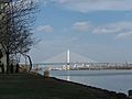
The Veterans' Glass City Skyway in Toledo, Ohio
-

Toledo, Ohio
-
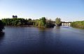
The river in Grand Rapids, Ohio
.jpg)
.jpg)
.jpg)
.jpg)


See also
 In Spanish: Río Maumee para niños
