
Merrimack, New Hampshire facts for kids
Quick facts for kids
Merrimack, New Hampshire
|
||
|---|---|---|
|
Town
|
||

First Church of Merrimack
|
||
|
||
| Motto(s):
One Town...Four Villages
|
||

Location in Hillsborough County, New Hampshire
|
||
| Country | United States | |
| State | New Hampshire | |
| County | Hillsborough | |
| Settled | 1673 | |
| Incorporated | April 2, 1746 | |
| Villages | Merrimack Reeds Ferry South Merrimack Thorntons Ferry |
|
| Area | ||
| • Total | 33.4 sq mi (86.6 km2) | |
| • Land | 32.6 sq mi (84.4 km2) | |
| • Water | 0.8 sq mi (2.2 km2) 2.55% | |
| Elevation | 180 ft (50 m) | |
| Population
(2020)
|
||
| • Total | 26,632 | |
| • Density | 817/sq mi (315.6/km2) | |
| Time zone | UTC−5 (Eastern) | |
| • Summer (DST) | UTC−4 (Eastern) | |
| ZIP code |
03054
|
|
| Area code(s) | 603 | |
| FIPS code | 33-47540 | |
| GNIS feature ID | 0873663 | |

Merrimack is a town in Hillsborough County, New Hampshire, United States. The population was 26,632 as of the 2020 census.
There are four villages in the town: Merrimack Village (formerly known as Souhegan Village), Thorntons Ferry, Reeds Ferry, and South Merrimack.
Contents
History
The first known settlers of the area currently known as Merrimack appeared sometime after the last ice age. European settlers first came to the area in the late 17th century when the area was still in dispute between the Province of New Hampshire and Massachusetts Bay Colony.
Merrimack is a Native American term meaning sturgeon, a type of fish. The Pennacook Indians named the Merrimack River after this fish because of the vast population that once existed there. The Penacooks spelled it Monnomoke or Merramake. "When the town was incorporated, it took the name of the river and spelled it Merrymac.", according to the Merrimack Historical Society.
Merrimack was officially incorporated in 1746, a year largely regarded as Merrimack's birthday, although only the southern portion (primarily what is known as Thornton's Ferry) of the current boundaries of town was included in the original town, with the northern portion of what is now Merrimack (primarily what is known as Reeds Ferry) being added a few years later.
Matthew Thornton, a signer of the Declaration of Independence, lived and was buried in Merrimack. The Signer's House and Matthew Thornton Cemetery are still located in the town.
The Boston and Maine Railroad laid tracks through the town in the 19th century, with several stations operating until the mid-20th century when the advent of the automobile transformed Merrimack from a largely agricultural community to a bedroom community of Boston and nearby cities in New Hampshire. Since 1970 it has been the home of an Anheuser-Busch brewery, their easternmost, and one of their smallest plants in the United States. It is home to a brewery tour and one of the five stables for the Budweiser Clydesdales.
The Merrimack School Board attracted national attention in 1995 when it passed a "prohibition of alternative lifestyle instruction" act, which resulted in the removal of a work by William Shakespeare from the school curriculum. The board members who supported the act were voted out in the subsequent board election.
Geography
According to the United States Census Bureau, the town has a total area of 33.4 square miles (87 km2), of which 32.6 sq mi (84 km2) is land and 0.8 sq mi (2.1 km2) (2.48%) is water. The highest point in Merrimack is an unnamed hill in the northwestern part of town that reaches 512 feet (156 m) above sea level.
Areas of Merrimack
Shadows of the former villages that now make Merrimack still exist. However, the boundaries and exact definitions are unclear due to the expansion of suburban development in the town during the latter half of the 20th century.
Thorntons Ferry
The area of town near Naticook Lake and Continental Boulevard, the name of this area comes from Matthew Thornton, one of the signers of the Declaration of Independence who lived in Merrimack and is now buried in a cemetery near the intersection of Daniel Webster Highway (U.S. Route 3) and Greeley Street. Thorntons Ferry Elementary School is located on Camp Sargent Road.
Reeds Ferry
The northern portion of the town, Reeds Ferry is centered on the current intersection of Bedford Road and Daniel Webster Highway. The boundaries of the area are unclear, as the northwestern part of town near Baboosic Lake is not traditionally considered a portion of Reeds Ferry. While as a defined village it was located mostly near the Merrimack River, the area near Baboosic Lake may now possibly be seen as part of Reeds Ferry. Reeds Ferry Elementary School is located on Lyons Road.
South Merrimack

Centered on Pennichuck Square on Rte. 101A and Continental Boulevard, South Merrimack is usually considered to be the southwestern part of town near Rte. 101A and Boston Post Road. However, the southeastern portion of town near Harris Pond might also be considered part of South Merrimack or Thornton's Ferry.
Merrimack Village
The center of town is not known as "Merrimack Village" per se, but constitutes the area between the more defined Reeds Ferry and Thorntons Ferry areas. Largely considered to be located at the Public Library on the corner of Baboosic Lake Road and Daniel Webster Highway, Merrimack Village was built along the Souhegan River that roughly cuts the current town in half. The elementary school in this part of town is named after James Mastricola, who deeded the land to the town upon his death. The lower and upper elementary schools, the middle school, Merrimack High School, the library, and the current town hall, among other buildings, are all located on the land formerly owned by Mastricola.
The "village" is considered to extend westward to the Amherst border. This is due in large part to the former Town Meetinghouse, which was located on the corner of Turkey Hill Road and Meetinghouse Road.
Demographics
| Historical population | |||
|---|---|---|---|
| Census | Pop. | %± | |
| 1790 | 819 | — | |
| 1800 | 926 | 13.1% | |
| 1810 | 1,048 | 13.2% | |
| 1820 | 1,162 | 10.9% | |
| 1830 | 1,191 | 2.5% | |
| 1840 | 1,113 | −6.5% | |
| 1850 | 1,250 | 12.3% | |
| 1860 | 1,119 | −10.5% | |
| 1870 | 1,066 | −4.7% | |
| 1880 | 1,042 | −2.3% | |
| 1890 | 951 | −8.7% | |
| 1900 | 1,234 | 29.8% | |
| 1910 | 1,039 | −15.8% | |
| 1920 | 1,022 | −1.6% | |
| 1930 | 1,084 | 6.1% | |
| 1940 | 1,253 | 15.6% | |
| 1950 | 1,908 | 52.3% | |
| 1960 | 2,989 | 56.7% | |
| 1970 | 8,595 | 187.6% | |
| 1980 | 15,406 | 79.2% | |
| 1990 | 22,156 | 43.8% | |
| 2000 | 25,119 | 13.4% | |
| 2010 | 25,494 | 1.5% | |
| 2020 | 26,632 | 4.5% | |
| U.S. Decennial Census | |||
As of the census of 2010, there were 25,494 people, 9,503 households, and 7,150 families residing in the town. There were 9,818 housing units, of which 315, or 3.2%, were vacant. The racial makeup of the town was 95.0% white, 0.8% African American, 0.2% Native American, 2.0% Asian, <0.1% Native Hawaiian or Pacific Islander, 0.5% some other race, and 1.6% from two or more races. 2.1% of the population were Hispanic or Latino of any race.
Of the 9,503 households, 36.7% had children under the age of 18 living with them, 62.6% were headed by married couples living together, 8.5% had a female householder with no husband present, and 24.8% were non-families. 18.8% of all households were made up of individuals, and 5.7% were someone living alone who was 65 years of age or older. The average household size was 2.67, and the average family size was 3.06.
In the town, 24.5% of the population were under the age of 18, 6.7% were from 18 to 24, 25.7% from 25 to 44, 32.7% from 45 to 64, and 10.3% were 65 years of age or older. The median age was 40.7 years. For every 100 females, there were 99.0 males. For every 100 females age 18 and over, there were 96.4 males.
For the period 2011–2015, the estimated median annual income for a household was $90,708, and the median income for a family was $101,786. Male full-time workers had a median income of $69,937 versus $50,184 for females. The per capita income for the town was $39,695. 4.0% of the population and 2.3% of families were below the poverty line. 4.7% of the population under the age of 18 and 4.4% of those 65 or older were living in poverty.
Annual events
The Rotary Nashua West club has organized the Rock'N Ribfest every year since 2003. The Ribfest has been held on the Anheuser-Busch grounds of Merrimack for the last eight years and was held there once again on June 15–17, 2012. The Ribfest is the official site for the New Hampshire state barbecue championship, where judges taste test the Northeast's best BBQ from more than 30 competitors.
Economy
PC Connection and Brookstone are based in Merrimack. Merrimack Canoe Company was started in Merrimack before being relocated to Tennessee. Other notable employers include Fidelity Investments, Anheuser-Busch, Campers Inn, and BAE Systems.
| Merrimack's Largest Employers (2019) | |||
|---|---|---|---|
| Business | Product/Service | Employees | Established |
| Fidelity Investments | Financial services | 6,000 | 1996 |
| Connections, Inc. | Computer resale | 1,077 | 1998 |
| Merrimack Premium Outlets | Retail stores | 900 | 2012 |
| BAE Systems | Defense systems | 816 | 1988 |
| Merrimack School District | Education | 800 | – |
| Atrium Maquet Getinge Group | Sterile medical manufacturing | 700 | 2013 |
| Anheuser-Busch, Inc. | Brewery, distribution | 531 | 1991 |
| Kollsman/Elbit Systems of America | Electro-optics | 500 | 1991 |
| Brookstone, Inc | Mail order marketer/retailer | 256 | |
| St. Gobain | PTFE coated fabrics | 253 | 1984 |
Opened in 2012, the Merrimack Premium Outlets are a 560,000-square-foot (52,000 m2) retail mall area with 12 buildings, parking lots, and other site improvements located off exit 10 of the Everett Turnpike.
Education
The six public schools in Merrimack are managed by the Merrimack School District and include Thorntons Ferry Elementary School, Reeds Ferry Elementary School, James Mastricola Elementary School, James Mastricola Upper Elementary School, Merrimack Middle School and Merrimack High School.
Merrimack High School has won one state championship in baseball (2007), three in softball (1980, 1988, 2001), one in football (1987), two in soccer (1998 girls, 2007 boys), three in indoor track (1999, 2007, 2008), four in outdoor track (2003, 2004, 2006, 2007), one in cross-country (2006), one in girls lacrosse (2012), one in skiing (1979), two in volleyball (2001, 2014), and four in basketball (1967, 2003, 2004, 2012).
The Academy for Science and Design was a charter school established for the 2007–2008 academic year; it was New Hampshire's first charter school to concentrate on science, math, engineering, and design and is free of tuition fees. The school has since moved to Nashua. In 2014, the Gate City Charter School for the Arts opened its doors to students.
Also within the town lies the Thomas More College of Liberal Arts.
Notable people
- Walter Kittredge (1834–1905), Civil War-era musician
- David Lozeau, artist, children's book writer
- Tim Schaller (born 1990), NHL player for the Los Angeles Kings
- Forrest Sherman (1896–1951), admiral in the United States Navy who served as Chief of Naval Operations
- Matthew Thornton (1714–1803), Founding Father, signer of the United States Declaration of Independence
Images for kids
-
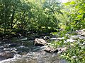
The Souhegan River in Wildcat Conservation Area

See also
 In Spanish: Merrimack (Nuevo Hampshire) para niños
