
Mesquite, Texas facts for kids
Quick facts for kids
Mesquite, Texas
|
|
|---|---|
| City of Mesquite | |

Top to bottom, left to right: AMC 30 Mesquite, Stephen Decatur Lawrence Farmstead, Mesquite Memorial Stadium, Mesquite Metro Airport hangar, Mesquite High School, and Mesquite Tower
|
|
| Nickname(s):
Rodeo Capital of Texas
|
|
| Motto(s):
Real. Texas. Flavor.
|
|

Location within and around Dallas County
|
|

Mesquite, Texas
Location in Texas

Mesquite, Texas
Location in the United States
|
|
| Country | United States |
| State | Texas |
| Counties | Dallas, Kaufman |
| Government | |
| • Type | Council-Manager |
| Area | |
| • Total | 47.22 sq mi (122.30 km2) |
| • Land | 47.06 sq mi (121.89 km2) |
| • Water | 0.16 sq mi (0.41 km2) |
| Elevation | 495 ft (151 m) |
| Population
(2010)
|
|
| • Total | 139,824 |
| • Estimate
(2019)
|
140,937 |
| • Density | 2,994.77/sq mi (1,156.28/km2) |
| Time zone | UTC−6 (CST) |
| • Summer (DST) | UTC−5 (CDT) |
| ZIP codes |
75149, 75150, 75181
|
| Area code(s) | 214, 469, 945, 972 |
| FIPS code | 48-47892 |
| GNIS feature ID | 1341400 |
Mesquite is a suburban city located east of the city of Dallas, Texas, in the United States. Most of the city is located in Dallas County, though a small portion extends into Kaufman County. As of 2019 census estimates, the population was 140,937, making it the 22nd-most populous city in the U.S. state of Texas. Mesquite is positioned at the crossroads of four major highways (Interstates 30, 635, 20, and U.S. Route 80), making locations such as downtown Dallas, Lake Ray Hubbard, Dallas Love Field, and DFW International Airport accessible.
According to legislative action, the city is the "Rodeo Capital of Texas". In 2016, Mesquite received a Playful City USA designation for the fourth year in a row. The city has been named a Tree City USA by the National Arbor Day Foundation for over 25 years. The city of Mesquite holds the 10th-longest reign in all of Texas.
Unique to suburbs of Dallas and Fort Worth, the city of Mesquite is served by its own local airport, Mesquite Metro Airport. Companies and institutions with a major presence in the city are the United Parcel Service, Sears, AT&T, Charter Spectrum, Eastfield College, Ashley Furniture, and FedEx.
Contents
History
The city was founded on March 14, 1878, on land along the Texas & Pacific Railroad, which ran from Dallas to Shreveport, Louisiana. The locals then named the town after Mesquite Creek. The city was officially incorporated on December 3, 1887, after electing Mayor J.E. Russell.
Mesquite prospered through the late 19th century and early 20th century as a farming community growing cotton, hay, corn and sugar and using the railroad to ship raw goods. The town remained predominantly agrarian until after World War II when the suburban boom also took root in Mesquite. The city's population rapidly grew:
Years before the settlers moved into the area, Mesquite was an open prairie land and a key trading ground for Indigenous peoples. The Ionies, were the western tribe located close to present day Fort Worth. The Tawakonies, were in present day Dallas. Finally, the Caddo, were the native farmers of the Mesquite land. From 1680 to 1790, after harvest was over, these three tribes held an annual tournament and trading fair.
Many outlaws resided in the area, but Sam Bass is historically known for his train robberies in Texas. In 1878 he robbed a train in downtown Mesquite, escaping with $30,000.
The Mesquiter, was established in 1882 by R.S. Kimbrough, and was Dallas County's longest running newspaper.
In 1958, the Mesquite ProRodeo was founded by Neal Gay, and was one of the only rodeos that had a permanent location. By the mid 80s, the events were being broadcast by ESPN.
In 1959, Big Town Mall opened as the first air conditioned shopping mall in the United States. The mall was demolished in the summer of 2006.
By 1970, LBJ Freeway (I-635) was constructed, connecting Mesquite to its neighbors, Garland to the north and Balch Springs to the south. Also in 1971, Town East Mall was constructed. The mall was used by director Ron Howard to film portions of the movie Cotton Candy in 1978. The mall's associated traffic and shops would continue to grow the town. By the 1990 census, the city had grown to 101,484 people, nearly twice the population twenty years earlier.
In 1986, the Mesquite Arena opened its doors as the new home for the Mesquite ProRodeo. By 1998, the facility was expanded to include a Convention Center, Exhibition Hall and a Hampton Inn & Suites.
2011 saw Mesquite pass a law that allows beer and wine sales in the city. The measure had been considered several times for many years, but was always blocked by strong protest against the proposed sales. It was one of the few cities without beer and wine sales in eastern Dallas County before the law came into effect.
In June of 2015, the Mesquite Arts Center added on a Freedom Park exhibit, in memorial of September 11. The park displays a 15 foot beam that was recovered from the remains of Ground Zero. Mesquite Fire Department received the beam in 2011.
Geography
Mesquite is located at 32°46′58″N 96°36′36″W / 32.782878°N 96.609862°W (32.782878, -96.609862).
According to the United States Census Bureau, the city has a total area of 46.2 square miles (119.6 km2), of which 46.0 square miles (119.2 km2) is land and 0.15 square miles (0.4 km2), or 0.33%, is water.
| Weather chart for Mesquite, Texas | |||||||||||||||||||||||||||||||||||||||||||||||
|---|---|---|---|---|---|---|---|---|---|---|---|---|---|---|---|---|---|---|---|---|---|---|---|---|---|---|---|---|---|---|---|---|---|---|---|---|---|---|---|---|---|---|---|---|---|---|---|
| J | F | M | A | M | J | J | A | S | O | N | D | ||||||||||||||||||||||||||||||||||||
|
1.9
55
36
|
2.3
61
41
|
3.1
69
49
|
3.5
77
56
|
5.3
84
65
|
3.9
92
73
|
2.4
96
77
|
2.2
96
76
|
2.7
89
69
|
4.7
79
58
|
2.6
66
47
|
2.5
57
39
|
||||||||||||||||||||||||||||||||||||
| temperatures in °F precipitation totals in inches source: Weather.com / NWS |
|||||||||||||||||||||||||||||||||||||||||||||||
|
Metric conversion
|
|||||||||||||||||||||||||||||||||||||||||||||||
Climate
On average, the warmest month is July. The highest recorded temperature was 112 °F in 1980. The average coolest month is January. The lowest recorded temperature was 1 °F in 1989.
May is the average wettest month. Mesquite is part of the humid subtropical region.
Transportation
Mesquite is served by a publicly owned and operated airport, Mesquite Metro Airport. The airport includes a 6,000-foot (1,800 m) lighted runway with ILS. General aviation accounts for about 75% of daily operations, while commercial aviation accounts for the rest. Mesquite Metro Airport is popular among transient aircraft due to its location near Dallas and favorable fuel prices.
Two other nearby airports, Dallas/Fort Worth International Airport and Dallas Love Field, provide regular commercial passenger service to the region. Dallas Love Field is around 15 miles (24 km) from Mesquite; DFW Airport is roughly 30 miles (48 km) from Mesquite.
Mesquite is not a member of Dallas Area Rapid Transit, but on April 12, 2011, the DART Board changed its policy to permit DART to contract with nonmember cities for services, such as passenger rail and express service. The city and DART staffs have developed a coordinated plan to have a weekday commuter service in operation between the Hanby Stadium visitor parking lot and the DART's Green Line Lawnview Station. This route opened March 12, 2012. The city also has an optional public transportation service where citizens can schedule specific pickup and drop off times and locations within Mesquite through the STAR Transit service.
Union Pacific Railroad operates an intermodal facility for its freight rail service as part of the Skyline Industrial Park. The recent expansion of this intermodal facility won a Silver award in the Industrial Paving Category by the American Concrete Pavement Association.
Highways
 Interstate 20 is a major east–west interstate serving the south side of Mesquite passing through rural and residential areas including the Lawson area. I-20 connects with Balch Springs to the west and Terrell to the east.
 Interstate 30 is a major east–west interstate that passes through the north side of Mesquite. I-30 connects with Dallas, Arlington, and Fort Worth to the west; Garland, Lake Ray Hubbard, and Rockwall to the east.
 Interstate 635 (Lyndon B. Johnson Freeway) is an auxiliary interstate serving as a partial loop around Dallas and its suburbs. I-635 bisects the city of Mesquite and serves as the main freeway through the city as most of the local businesses and attractions (including Town East Mall and Mesquite Championship Rodeo) are built near or around I-635. The interstate connects with Garland to the north and Balch Springs to the south. I-635 also connects Mesquite with Dallas/Fort Worth International Airport.
 U.S. Highway 80 is an east–west freeway passing through north Mesquite. US 80 connects with Sunnyvale, Forney, and Terrell to the east. To the west of Mesquite, the highway merges onto I-30.
 Texas Highway 352 (Military Parkway/Scyene Road) is an east–west highway passing through both west Mesquite and downtown Mesquite. In the downtown area, it is known locally as Main Street on the westbound section and Davis Street on the eastbound section.
- Belt Line Road also passes through Mesquite and serves as a major road. Belt Line road serves as an outer loop around the Dallas suburbs.
- Planning stages and environmental studies are being conducted to expand President George Bush Turnpike to connect from its current terminus at I-30 in Garland to I-20. The new segment of the toll road would pass through Sunnyvale and Mesquite in route to I-20 and would complete the loop around Dallas County.
Demographics
| Historical population | |||
|---|---|---|---|
| Census | Pop. | %± | |
| 1890 | 135 | — | |
| 1900 | 406 | 200.7% | |
| 1910 | 687 | 69.2% | |
| 1920 | 674 | −1.9% | |
| 1930 | 729 | 8.2% | |
| 1940 | 1,045 | 43.3% | |
| 1950 | 1,696 | 62.3% | |
| 1960 | 27,526 | 1,523.0% | |
| 1970 | 55,131 | 100.3% | |
| 1980 | 67,053 | 21.6% | |
| 1990 | 101,484 | 51.3% | |
| 2000 | 124,523 | 22.7% | |
| 2010 | 139,824 | 12.3% | |
| 2019 (est.) | 140,937 | 0.8% | |
| U.S. Decennial Census | |||
At the 2010 United States census, Mesquite had a population of 139,824. In July 2018, the population was estimated at 142,816. Per the American Community Survey in 2017, the median age was 32.8.
According to the 2010 census, 64.9% of Mesquite was White (31.5% non-Hispanic white), 25.0% was Black or African American, 0.6% American Indian or Alaska Native, 2.8% Asian, 38.9% of Hispanic or Latino origin, and 3.2% from two or more races. In 2018, 28.6% were non-Hispanic white, 26% Black or African American, 0.8% American Indian or Alaska Native, 2.9% Asian, 0.1% Pacific Islander, 3.4% two or more races, and 40.4% Hispanic or Latino of any race.
At the American Community Survey estimates of 2017, 0.1% of the American Indian population was Cherokee. 1.1% of the city's Asian community was Indian, 0.1% Chinese, 0.6% Filipino, 0.0% Japanese, 0.0% Korean, 0.6% Vietnamese, and 0.3% of other Asian origin. 56 residents were estimated to be Guamanian or Chamorro. The multiracial population of Mesquite was majority White and Black or African American (1.1%), followed by White and American Indian or Alaska Native (0.5%), White and Asian (0.3%), and Black or African American and American Indian and Alaska Native (0.2%). Among the Hispanic or Latino demographic 33.9% were Mexican, 0.7% Puerto Rican, 0.4% Cuban, and 4.0% from other Hispanic or Latin American origins.
Of the 51,578 households at the 2010 census, 39.1% had children under the age of 18 living with them, 48.3% were headed by married couples living together, 18.9% had a female householder with no husband present, and 26.8% were notfamilies. About 22.4% of all households were made up of individuals, and 6.4% were someone living alone who was 65 years of age or older. The average household size was 2.88, and the average family size was 3.38. From 2013 to 2017, an estimated 46,876 households had an estimated 3.06 persons per household. About 57.7% of residents owned houses in Mesquite. The median gross rent was $1,018.
In 2000, the median income for a household was $30,424, and the median income for a family was $36,357. Male full-time workers had a median income of $37,756 versus $29,905 for females. In 2017, the estimated median household income was $52,167.
In 2010, about 29.8% of the population were under the age of 18, 10.1% were 18 to 24 years old, 27.9% were 25 to 44, 23.7% were 45 to 64, and 8.6% were 65 years of age or older in 2010. The median age was 32.3 years. For every 100 females, there were 91.3 males. For every 100 females age 18 and over, there were 86.4 males.
According to information gathered by Sperling's BestPlaces, 62.7% claim religious affiliation. Christianity is the most prevalent religion in Mesquite. The largest Christian body in the city is the Catholic Church, served by the Diocese of Dallas (19.6%), followed by Baptists (13.2%), Methodists (4.8%), Pentecostals (3.1%), Presbyterians (1.6%), Episcopalians (1.0%), Latter-Day Saints (1.0%), Lutherans (0.7%), and 12.4% from another Christian faith including the Oriental Orthodox and Eastern-rite Catholic churches. Mesquite is a center for Indian Christians from the Indian state of Kerala. Their settlement, one of the earliest of the Indian Americans in the DFW area, was influenced by proximity to Dallas-based hospitals such as Baylor University Medical Center at Dallas and Parkland Hospital, as well as having initial low income and difficulties moving to mostly white northern suburbs. The second-largest religion in Mesquite is Islam (3.6%) followed by Judaism (0.7%), and eastern faiths including Hinduism, Sikhism, and Buddhism (0.9%).
Neighborhoods
Neighborhoods include:
- Lawson
- Park View
- Edgemont Park
- Creek Crossing
- Creek Crossing II
- Falcon's Lair
- Falcon's Ridge
- Pecan Creek
- Rollingwood Hills
- Skyline
- Pasadena Gardens
- Original Town
- Melton
- Tealwood
- Northridge
- Quail Hollow
- Broadmoor Estates
- Wildwood
- Valley Creek
- Meadowview
- Palos Verdes
Constructions
- Mesquite Tower is a lattice tower of unusual design.
- Town East Tower is the tallest inhabited building in Mesquite, standing seven stories high.
Economy
Much of Mesquite's economy is tied to the city of Dallas with the exception of local businesses. The largest national corporations operating in Mesquite are United Parcel Service, Sears, AT&T, Spectrum, Ashley Furniture, FedEx, OfficeMax, and GameStop. As of Mesquite's 2008 Comprehensive Annual Financial Report, the largest employers in the city are:
| # | Employer | # of Employees | % of Total City Employment |
|---|---|---|---|
| 1 | United Parcel Service Inc. | 3,000 | 4.22% |
| 2 | Dallas Regional Medical Center | 1,150 | 1.62% |
| 3 | City of Mesquite | 1,054 | 1.48% |
| 4 | Sears | 450 | 0.63% |
| 5 | Texas Dept of Transportation - Dallas District | 425 | 0.60% |
| 6 | Baker Drywall LTD | 400 | 0.56% |
| 7 | Dallas County Community College | 400 | 0.56% |
| 8 | Christian Care Center | 400 | 0.56% |
| 9 | Integra Color | 383 | 0.54% |
| 10 | Pepsi-Cola Metro Bottling Co Inc | 325 | 0.46% |
Education

| Name | Year founded | Size | Mascot | Principal |
|---|---|---|---|---|
| Mesquite High School | 1901 | 6A | Stormy the Skeeter | Abram Joseph |
| North Mesquite High School | 1969 | 6A | Stallion | Kenneth Washington |
| West Mesquite High School | 1976 (as middle school initially) | 5A | Wrangler | Karen Morris |
| Poteet High School | 1986 | 5A | Pirate | Kelly Long |
| John Horn High School | 2000 | 6A | Jaguar | Deeadra Brown |
| Vanguard High School | 2021 | N/A | N/A | Clint Elsasser |
Mesquite Independent School District provides primary and secondary (K–12) education to most areas of Mesquite. A small portion of Mesquite is served by Dallas Independent School District. While another small area in Kaufman County is within the Forney Independent School District, the section has no residents. Mesquite also serves an area of Balch Springs.
In addition to 33 public elementary schools and ten public middle schools, Mesquite is served by five high schools: Mesquite High School, North Mesquite High School, West Mesquite High School, Poteet High School, and John Horn High School. The private Dallas Christian School is located in the city limits.
Colleges and universities
The Texas Legislature defines all of Dallas County (including the vast majority of Mesquite) as being in the Dallas College (formerly Dallas County Community College or DCCCD) district. The portion in Kaufman County is within the Trinity Valley Community College district. Eastfield College provides undergraduate degrees and continuing-education credits as part of Dallas College.
Higher education also is provided by two other institutions. Columbia College-Mesquite Campus is located on the Eastfield College campus. It is a private, nonprofit institution that was founded in Columbia, Missouri, in 1851. It provides bachelor's and master's degree programs.
Notable people
- Dave Abruzzese, ex-drummer for Pearl Jam
- Quincy Acy, professional basketball player for Brooklyn Nets and New York Knicks
- Melissa Archer, actress on One Life to Live
- Todd Boatwright, television news anchor
- Craig Wayne Boyd, winner of season seven of NBC's The Voice
- Tarell Brown, professional football player for New England Patriots, played for San Francisco 49ers and Oakland Raiders, and for Texas Longhorns 2005 National Championship team; graduate of North Mesquite High School
- Trevone Boykin, quarterback for Texas Christian University and NFL's Seattle Seahawks
- Joe Bowden, former professional football player for Houston Oilers, Tennessee Titans, and Dallas Cowboys
- John D. Carmack, game programmer and co-founder of id Software Lead programmer of the id computer games Wolfenstein 3D, Doom, Quake, their sequels and the Commander Keen series of games and is the current the CTO of Oculus VR
- Ray Cunningham, former professional baseball player for St. Louis Cardinals
- Alyssa Edwards, drag performer and dance instructor; competed on season five of RuPaul's Drag Race and season two RuPaul's Drag Race: All Stars
- Terry Fator, singer and ventriloquist, winner of America's Got Talent in 2007
- Taylor Gabriel, professional football player for Chicago Bears
- Don Gay, eight-time PRCA world champion bullrider
- Todd Graham, college football coach; head coach at Hawaii
- Jerry Hall, actress and model, former wife of Mick Jagger and mother of four of his children
- Jason Jennings, Major League Baseball player for Colorado Rockies, Texas Rangers
- Ty Jordan, football player
- Vivian Le, figure skater
- Taylor Lipsett, gold medalist in sled hockey at 2010 Winter Paralympic Games in Vancouver; he led Team USA in goals, with 5 goals in 5 games, and added 2 assists for a total of 7 points
- Sean Lowe, MLB player for Chicago White Sox, St. Louis Cardinals, Pittsburgh Pirates, Colorado Rockies, and Kansas City Royals
- Damien Magnifico, MLB player for Los Angeles Angels, Milwaukee Brewers
- Bryan Massey, actor and writer
- Taylor Parks, actress and singer, best known as Little Inez in 2007 film Hairspray
- Greg Vaughan, actor on General Hospital
Images for kids
-
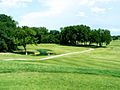
Mesquite Golf Club

See also
 In Spanish: Mesquite (condado de Dallas) para niños
