
Metairie, Louisiana facts for kids
Quick facts for kids
Metairie, Louisiana
|
|
|---|---|

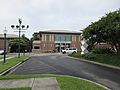
Metairie Central Business District along Causeway Blvd
|
|

Metairie, Louisiana
Location in Louisiana

Metairie, Louisiana
Location in the United States
|
|
| Country | |
| State | |
| Parish | Jefferson |
| Area | |
| • Total | 23.30 sq mi (60.35 km2) |
| • Land | 23.26 sq mi (60.24 km2) |
| • Water | 0.04 sq mi (0.11 km2) |
| Elevation | 3 ft (0.9 m) |
| Population
(2020)
|
|
| • Total | 143,507 |
| • Density | 6,169.96/sq mi (2,382.27/km2) |
| Time zone | UTC−6 (CST) |
| • Summer (DST) | UTC−5 (CDT) |
| ZIP Codes |
70001–70006, 70009–70011, 70003
|
| Area code(s) | 504 |
| GNIS feature ID | 555301 |
Metairie ( MET-ər-ee) is a census-designated place (CDP) in Jefferson Parish, Louisiana, United States, and is part of the New Orleans metropolitan area. With a population of 143,507 in 2020, Metairie is the largest community in Jefferson Parish and was (as of 2010) the fifth-largest CDP in the United States. It is an unincorporated area that (as of 2020) would have been Louisiana's fourth-largest city behind Shreveport (over 180,000 population) had it been incorporated.
Contents
History

In the 1720s French settlers became the first Europeans to settle Metairie in the area known then as Tchoupitoulas and now as Metairie Ridge, a natural levee formed by an ancient branch of the Mississippi River which flowed through modern-day River Ridge, Metairie, Gentilly, and New Orleans East. It emptied into Mississippi Sound. The Acolapissa Native Americans used this ridge as a road, and it is the oldest road in the New Orleans area. Paved in the 1920s, it is called Metairie Road. An electric streetcar was installed running along Metairie Road in the late 1910s, opening the area to greater development. Upscale housing tracts were constructed off the road in the 1920s; this area is now known as "Old Metairie." It is today the most prestigious area of Metairie. The areas to the north and northwest of Metairie Road were not developed until after World War II. The land between Metairie Ridge and Lake Pontchartrain, which was cypress swamps and marshlands, was drained with the Wood Pump. With development of this new land for residences, Metairie's population grew in the 1940s as a result of cheaper land, lower taxes, and larger lots than in Orleans Parish.
In 1990, Metairie made history when one of its districts elected white supremacist David Duke to the Louisiana state legislature for a single term. In 2005, Hurricane Katrina caused a new migration from Orleans Parish, because housing was needed to replace what had been destroyed in the flooding of the city. It has been a racially neutral migration, with equal numbers of black and white residents moving to Jefferson Parish. The 2010 Census showed that Metairie has increasingly become more diverse.
Veterans Boulevard was laid out alongside a drainage canal, and became a commercial center of the region. The Central Business District of Metairie is located on Causeway Blvd near Lake Pontchartrain. Metairie also has one of the handful of major malls located in the New Orleans metro area. Lakeside Shopping Center is the highest-grossing mall in the New Orleans metropolitan area. In the 1970s and early 1980s, an area of bars and nightclubs opened in a section of Metairie known as "Fat City." Fat City is now the most racially diverse area in the New Orleans Metropolitan Area and is home to a vibrant restaurant scene. Several New Orleans radio and television stations have transmitter facilities in Metairie and Jefferson Parish; two of them, WGNO-TV and WNOL, now have studios and main offices in Metairie. Metairie has a large Mardi Gras season that touts itself as more family-friendly than the New Orleans Mardi Gras.
Fort Lauderdale Hurricane
The 1947 Fort Lauderdale Hurricane with winds of 125 mph (201 km/h) directly hit Metairie. Much of the community was under six feet of water.
Hurricane Betsy
Hurricane Betsy, a category three storm, hit the area in 1965, causing extensive wind damage and moderate flooding.
Flood of 1995
The May 8th 1995 Louisiana Flood, which dumped upwards of twenty inches of rain into Metairie in a twelve-hour period, flooded some parts of the region, especially areas south and west of Metairie, including Kenner, Harahan, and River Ridge.
Hurricane Katrina

On August 29, 2005, Metairie was hit hard by the devastating effects of Hurricane Katrina, including widespread wind damage and flooding. There were 29 reported deaths related to Katrina in Metairie. According to satellite images and flood maps, upwards of 75% of Metairie was flooded. Initial insured damages in Metairie are between 3 and 5 billion US dollars. The death toll and damage were less in Metairie than in bordering Orleans Parish, largely because the Metairie side of the 17th Street Canal did not breach, and most residents had already evacuated.
Residents were given a mandatory evacuation on August 28, 2005, the first time one has ever been ordered. Residents were not allowed to return until September 4. then residents were allowed to the area only to visit their homes or business between 7AM and 6PM. Residents were not allowed to return for longer until September 15, 2005. This period of over two weeks in exile angered many residents, especially those whose homes flooded. As the owners were unable to empty the houses of water, the structures suffered more damage.
Metairie was used as a staging area to evacuate people from New Orleans. The most organized effort took place where Causeway intersects I-10. There evacuees gathered or were brought to wait for buses.

The flooding in Metairie had three causes:
- Lake Pontchartrain backflow into canals: Jefferson Parish President Aaron Broussard evacuated all pumping station operators from their posts to Washington Parish (seventy-five miles away) in anticipation of the hurricane. Normally, the machines would be on, not only preventing the Lake from flowing into the drainage canals, but also pumping the rain waters out. Lack of pumping led to severe flooding of Metairie in most areas north of Interstate 10.
- Rain waters: Because almost all of Metairie is between two and seven feet below sea level, all rain water was captured in the Metairie "bowl." Unable to return for nearly two days, the pump operators could not turn the pumps on to pump out any of the rain water or backflow.
- 17th Street Canal breach: There was no breach on the Metairie side of the canal; however, water crept into Metairie through Airline Highway. The narrow high ground of Metairie Road and some elevated railroad tracks partially contained the area of flooding. This water chiefly caused the flooding in the southern part of Old Metairie. There was a breach alongside the Lake Villa canal located in Metairie, where water poured over the top of the levee alongside the pumping station.
Many Metairie residents are joining a class action lawsuit against Aaron Broussard because of his removal of pump operators. Other residents have attempted to recall and remove Broussard as Parish President for what they see as negligence, but they failed to get the support and signatures needed.
Broussard resigned his position on January 8, 2010 in the face of a grand jury investigation of his staff.
Sports

Metairie was home to the New Orleans Baby Cakes Triple-A Minor League Baseball team of the Pacific Coast League from 1993 to 2019. The minor league club played its home games at Privateer Park, home to the University of New Orleans's NCAA baseball team, from 1992 through 1996, and at Shrine on Airline from 1997 to 2019.
The training facilities of NFL franchise New Orleans Saints and the NBA franchise New Orleans Pelicans are located in Metairie. As such, many players reside in the area.
Boxing cards have been held in the Copeland Tower Suites (formerly Landmark Hotel).
Beginning in 2020, the New Orleans Gold of Major League Rugby will play their homes games in Metairie at the Gold Mine on Airline.
Religion
In Metairie, 56.87% of its citizens identify themselves with some religion. There are 41.47% Roman Catholics, 12.77% Protestants, 0.39% Latter Day Saints, 0.97% of another Christian Faith, 0.64% are Muslim, 0.61% are Jewish, 0.02% are of an Eastern faith.
Metairie is home to Congregation Gates of Prayer, a Reform synagogue, and beside it is Congregation Beth Israel, the oldest Orthodox congregation in the New Orleans region. Beth Israel constructed its new building in Metairie in 2012, several years after its building in Lakeview, New Orleans was destroyed by Hurricane Katrina.
Metairie's Catholic churches are part of the Archdiocese of New Orleans. Metairie is home to 13 Catholic parishes and schools.
Geography
Metairie is located in eastern Jefferson Parish and its boundaries include New Orleans to the east, Kenner to the west, Lake Pontchartrain to the north, and Airline Highway to the south. South of Airline Highway from Metairie are River Ridge, Harahan, Elmwood, and Jefferson.
The 17th Street Canal forms the border between Metairie and New Orleans to the east.
Metairie is located at 29°59′52″N 90°10′39″W / 29.99778°N 90.17750°W (29.997797, −90.177473) and has an elevation of 3 feet (0.9 m). According to the United States Census Bureau, the CDP has a total area of 23.2 sq mi (60.2 km2), all but 0.039 sq mi (0.1 km2) (0.22%) of which is land.
Climate
| Climate data for Metairie, Louisiana | |||||||||||||
|---|---|---|---|---|---|---|---|---|---|---|---|---|---|
| Month | Jan | Feb | Mar | Apr | May | Jun | Jul | Aug | Sep | Oct | Nov | Dec | Year |
| Record high °F (°C) | 82 (28) |
85 (29) |
88 (31) |
93 (34) |
96 (36) |
99 (37) |
101 (38) |
103 (39) |
101 (38) |
97 (36) |
87 (31) |
84 (29) |
103 (39) |
| Average high °F (°C) | 63 (17) |
66 (19) |
73 (23) |
79 (26) |
85 (29) |
90 (32) |
92 (33) |
92 (33) |
88 (31) |
81 (27) |
72 (22) |
65 (18) |
79 (26) |
| Average low °F (°C) | 45 (7) |
48 (9) |
55 (13) |
60 (16) |
68 (20) |
73 (23) |
75 (24) |
75 (24) |
72 (22) |
62 (17) |
54 (12) |
48 (9) |
61 (16) |
| Record low °F (°C) | 16 (−9) |
20 (−7) |
28 (−2) |
37 (3) |
51 (11) |
54 (12) |
64 (18) |
64 (18) |
— | — | — | — | 16 (−9) |
Infrastructure
Transportation

The most common method of transportation within Metairie is the automobile. Mass transit is provided by "JeT" (Jefferson Transit), but it does not run on Sundays, holidays, or late at night, unlike many lines of New Orleans' RTA. JeT's coverage is also very limited in terms of usability.
Interstate 10 runs east–west through Metairie.
Major east–west roads (starting from north to south) include West Esplanade Avenue, Veterans Memorial Boulevard, West Napoleon Avenue, West Metairie Avenue, Metairie Road, Airline Drive (which is part of U.S. Route 61) and Jefferson Highway (which is part of U.S. Route 90). The Earhart Expressway, running east–west immediately south of Airline Drive, is the only other freeway entering New Orleans from the west, but it ends as an expressway soon after crossing into Orleans Parish and well before the New Orleans CBD (in Central City.)

For many of the major east–west roadways, the eastbound and westbound lanes are separated by large, open-topped drainage canals. These canals are one of the most distinct characteristics of the Metairie landscape. Similar canals once bisected many streets in neighboring New Orleans, but most were covered over in the mid-20th century.
Multi-line, continuous north–south roads (starting from west to east) include Power Boulevard/David Drive/Hickory Avenue, Transcontinental Drive, Clearview Parkway, Causeway Boulevard, and Bonnabel Boulevard.
The Lake Pontchartrain Causeway's southern terminus lies in Metairie.
Demographics
| Historical population | |||
|---|---|---|---|
| Census | Pop. | %± | |
| 1970 | 136,477 | — | |
| 1980 | 164,160 | 20.3% | |
| 1990 | 149,428 | −9.0% | |
| 2000 | 146,136 | −2.2% | |
| 2010 | 138,481 | −5.2% | |
| 2020 | 143,507 | 3.6% | |
| source:[1] | |||
According to the 2019 American Community Survey, there were 130,427 people living in the census-designated place. At the 2010 United States census, there were 138,481 people living in Metairie. The 2020 census reported 143,507 people living in the CDP. As of 2019, population density was 5,607.7 people per square mile, with a median age of 40.6.
| Race | Number | Percentage |
|---|---|---|
| White (non-Hispanic) | 89,070 | 62.07% |
| Black or African American (non-Hispanic) | 15,827 | 11.03% |
| Native American | 247 | 0.17% |
| Asian | 5,474 | 3.81% |
| Pacific Islander | 24 | 0.02% |
| Other/Mixed | 5,421 | 3.78% |
| Hispanic or Latino | 27,444 | 19.12% |
At the 2019 American Community Survey, the racial and ethnic makeup was 69% non-Hispanic white, 10% Black and African American, 4% Asian, 1% multiracial, and 16% Hispanic and Latino American. According to 2017 census estimates, the racial makeup of Metairie was 67.5% White, 16.2% Hispanic or Latino American of any race, 9.9% Black and African American, 3.9% Asian, 0.7% from other races, 0.9% from two or more races, and 0.1% Native American. By the time of the 2020 census, its racial and ethnic makeup was 62.07% non-Hispanic white, 11.03% Black or African American, 0.17% American Indian and Alaska Native, 3.81% Asian, 0.02% Pacific Islander, 3.78% two or more races, and 19.12% Hispanic or Latino American of any race.
Among the population of Metairie, 52% were female in 2019. There were 56,421 households with an average of 2.63 persons per household. An estimated 52% of households were married couples living together, 23% non-family, 18% female householder with no male present, and 7% male householder with no female present. Approximately 61,354 housing units were in the community, and 92% were occupied; 59% of housing units were owner-occupied, and 64% of housing units were single unit structures. The median value of owner-occupied housing units was $246,600, and the median household income was $60,404. Residents had a per capita income of $35,007 at the 2019 American Community Survey.
Religion
In Metairie, 54.1% of residents identified with some religion as of 2019. Due to Spanish and French colonial influence, Metairie and the surrounding area have an overwhelmingly Catholic populace. Approximately 34.6% identify with the Catholic Church, served by the Roman Catholic Archdiocese of New Orleans; 5.9% were Baptist, 3.1% Pentecostal, 1.4% Methodist, 0.6% Lutheran, 0.6% Latter-Day Saints, 0.5% Anglican, and 0.5% from another Christian group including the Metropolitan Community Church among others.
Approximately 0.7% were Muslims and 0.4% identified with an Eastern religion such as Hinduism, Buddhism, or Sikhism; 0.6% of the community claimed affiliation with Judaism. Metairie is home to Congregation Gates of Prayer, a Reform synagogue, and beside it is Congregation Beth Israel, the oldest Orthodox congregation in the New Orleans metro area. Beth Israel constructed its new building in Metairie in 2012, several years after its building in Lakeview, New Orleans was destroyed by Hurricane Katrina.
Education
Metairie's public schools are operated by the Jefferson Parish Public School System.There are two zoned public high schools in Metairie:
- East Jefferson High School
- Grace King High School
Additionally, some residents are zoned to Alfred Bonnabel High School in Kenner, and some are zoned to Riverdale High School in Jefferson.
Magnet public school
- Haynes Academy for Advanced Studies
Private schools
- Archbishop Chapelle High School
- Archbishop Rummel High School
- Crescent City Christian School
- Ecole Classique
- Lutheran High School
- Metairie Park Country Day School
- Ridgewood Preparatory School
- St. Martin's Episcopal School
Images for kids
-
East Bank Regional Library


See also
 In Spanish: Metairie para niños
