
Milford, Ohio facts for kids
Quick facts for kids
Milford, Ohio
|
|
|---|---|
|
City
Settled 1796 |
|

Main Street in Milford
|
|
| Motto(s):
"On the Little Miami"
|
|

Location of Milford, Ohio
|
|

Location of Milford in Clermont County
|
|
| Country | United States |
| State | Ohio |
| Counties | Clermont, Hamilton |
| Area | |
| • Total | 3.84 sq mi (9.94 km2) |
| • Land | 3.71 sq mi (9.62 km2) |
| • Water | 0.12 sq mi (0.32 km2) |
| Elevation | 548 ft (167 m) |
| Population
(2010)
|
|
| • Total | 6,709 |
| • Estimate
(2019)
|
6,855 |
| • Density | 1,846.71/sq mi (712.94/km2) |
| Time zone | UTC-5 (Eastern (EST)) |
| • Summer (DST) | UTC-4 (EDT) |
| ZIP code |
45150
|
| Area code(s) | 513 |
| FIPS code | 39-50176 |
| GNIS feature ID | 1061523 |
Milford is a city in Clermont and Hamilton counties founded in 1796, in the U.S. state of Ohio, along the Little Miami River and its East Fork in the southwestern part of the state. It is a part of the Greater Cincinnati metropolitan area. The population was 6,710 at the 2010 census.
Contents
History

Milford has been inhabited since prehistoric times. A field along Gatch Avenue on what was once the farm of John Gatch has yielded large numbers of artifacts for several generations; it is now believed to have been the site of a Native American village during the Woodland period. Today, the field is an archaeological site known as the "Gatch Site."
The areas known as Milford, Old Milford, and Miami Township were built on a survey by John Nancarrow, a Revolutionary War veteran from Virginia. Miami Township was named after the Little Miami River and the tribe of Native Americans who once controlled this area. Miami Township was originally named O'Bannon Township in honor of the county's first surveyor. The first United Methodist Church in the Northwest Territory was founded in Milford by Robert J. Gaible in 1798. Because of financial troubles, Nancarrow never visited Milford, and instead sold his share of 230 acres (0.93 km2) of land to Philip Gatch on December 20, 1802, for a total of $920.00. Four years later, Gatch decided to sell 125 acres (0.51 km2) to Ambrose Ranson who, soon after, sold 64 acres (260,000 m2) to John Hageman. Hageman became the first permanent settler and named the area Hageman's Mills. By 1815, Hageman had left for Indiana, and the name "Milford" had come into popular use. In 1818 a wooden bridge across the Little Miami was completed, making the ford obsolete. More than a century later, on January 1, 1920, the mill that was the city's namesake burned down.
At the end of the 1960s Milford was the typical American small town. Small grocery stores, a butcher shop, five & dime, drug store, barber shop and a taxi company that doubled as the fire dispatcher for the volunteer fire department, served as the hub of community activity. Today, Milford seeks to maintain its own urban identity, having developed into a suburb of nearby Cincinnati throughout the 1980s and 1990s, with many of its residents working in Cincinnati. Milford remains Clermont County's only city besides Loveland, which includes parts of Hamilton County.
Present day
Events
- Sunflower revolution
- Milford Frontier Days - Annual festival
Environment
Milford is home to an EPA Superfund site currently on the National Priorities List, the Milford Contaminated Aquifer. The site was added to the NPL in December 2011, after volatile organic compounds such as PCE were found in municipal drinking water supplies.
Business
Area businesses and groups with substantial operations in Milford or adjacent townships include the headquarters of Penn Station sandwiches, Total Quality Logistics, Melink alternative energy corporation, Lykins Oil, Overhoff Technology the North American headquarters of Tata, and the United Church of God.
Geography

Milford is located at 39°10′30″N 84°17′4″W / 39.17500°N 84.28444°W (39.174883, -84.284383). According to the United States Census Bureau, the city has a total area of 3.85 square miles (9.97 km2), of which 3.73 square miles (9.66 km2) is land and 0.12 square miles (0.31 km2) is water.
Demographics
| Historical population | |||
|---|---|---|---|
| Census | Pop. | %± | |
| 1870 | 621 | — | |
| 1880 | 732 | 17.9% | |
| 1890 | 998 | 36.3% | |
| 1900 | 1,150 | 15.2% | |
| 1910 | 1,322 | 15.0% | |
| 1920 | 1,526 | 15.4% | |
| 1930 | 1,916 | 25.6% | |
| 1940 | 2,140 | 11.7% | |
| 1950 | 2,450 | 14.5% | |
| 1960 | 4,130 | 68.6% | |
| 1970 | 4,828 | 16.9% | |
| 1980 | 5,232 | 8.4% | |
| 1990 | 5,690 | 8.8% | |
| 2000 | 6,284 | 10.4% | |
| 2010 | 6,709 | 6.8% | |
| 2019 (est.) | 6,855 | 2.2% | |
| Sources: | |||
2010 census
As of the census of 2010, there were 6,709 people, 3,019 households, and 1,572 families living in the city. The population density was 1,798.7 inhabitants per square mile (694.5/km2). There were 3,291 housing units at an average density of 882.3 per square mile (340.7/km2). The racial makeup of the city was 94.6% White, 2.3% African American, 0.1% Native American, 0.8% Asian, 0.4% from other races, and 1.6% from two or more races. Hispanic or Latino of any race were 1.1% of the population.
There were 3,019 households, of which 25.3% had children under the age of 18 living with them, 36.0% were married couples living together, 11.6% had a female householder with no husband present, 4.5% had a male householder with no wife present, and 47.9% were non-families. 41.7% of all households were made up of individuals, and 19.3% had someone living alone who was 65 years of age or older. The average household size was 2.12 and the average family size was 2.92.
The median age in the city was 43.2 years. 21.4% of residents were under the age of 18; 6.9% were between the ages of 18 and 24; 24.3% were from 25 to 44; 25.5% were from 45 to 64; and 21.9% were 65 years of age or older. The gender makeup of the city was 45.2% male and 54.8% female.
Notable people
- John M. Pattison, 43rd Governor of Ohio
Images for kids
-
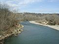
Little Miami River 2007


See also
 In Spanish: Milford (Ohio) para niños
