East Windsor, New Jersey facts for kids
Quick facts for kids
East Windsor, New Jersey
|
|
|---|---|
|
Township
|
|
| Township of East Windsor | |
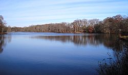
Etra Lake Park in the eastern portion of the township
|
|
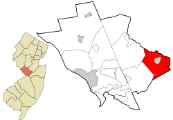
Location in Mercer County and the state of New Jersey.
|
|
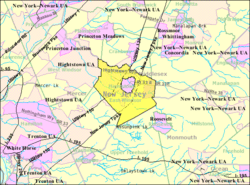
Census Bureau map of East Windsor Township, New Jersey
|
|
| Country | |
| State | |
| County | |
| Formed | February 9, 1797 |
| Incorporated | February 21, 1798 |
| Named for | Windsor, England / Windsor Township |
| Government | |
| • Type | Faulkner Act (council–manager) |
| • Body | Township Council |
| Area | |
| • Total | 15.66 sq mi (40.55 km2) |
| • Land | 15.57 sq mi (40.32 km2) |
| • Water | 0.09 sq mi (0.23 km2) 0.57% |
| Area rank | 172nd of 565 in state 7th of 12 in county |
| Elevation | 102 ft (31 m) |
| Population | |
| • Total | 27,190 |
| • Estimate
(2019)
|
27,288 |
| • Rank | 86th of 565 in state 5th of 13 in county |
| • Density | 1,737.6/sq mi (670.9/km2) |
| • Density rank | 308th of 565 in state 7th of 12 in county |
| Time zone | UTC−05:00 (Eastern (EST)) |
| • Summer (DST) | UTC−04:00 (Eastern (EDT)) |
| ZIP Code |
08512 & 08520
|
| Area code(s) | 609 |
| FIPS code | 3402119780 |
| GNIS feature ID | 0882123 |
| Website | |
East Windsor is a township in Mercer County, New Jersey, United States. Located within the Raritan Valley region, the township is an outer-ring suburb of New York City in the New York Metropolitan area, as defined by the United States Census Bureau, but directly borders the Philadelphia metropolitan area and is part of the Federal Communications Commission's Philadelphia Designated Market Area. As of the 2010 United States Census, the township's population was 27,190, reflecting an increase of 2,271 (+9.1%) from the 24,919 counted in the 2000 Census, which had in turn increased by 2,566 (+11.5%) from the 22,353 counted in the 1990 Census.
Both East Windsor and West Windsor were formed when Windsor Township was split on February 9, 1797, while the area was still part of Middlesex County. It was incorporated by an act of the New Jersey Legislature on February 21, 1798, as one of New Jersey's initial group of 104 townships. Portions of the township were taken to form Hightstown borough (March 5, 1853, within East Windsor; became independent c. 1894) and Washington Township (March 11, 1860, and known as Robbinsville Township since 2007). The township was named for Windsor Township, which was named for Windsor, England.
Contents
Geography
According to the United States Census Bureau, the township had a total area of 15.66 square miles (40.55 km2), including 15.57 square miles (40.32 km2) of land and 0.09 square miles (0.23 km2) of water (0.57%).
Twin Rivers (2010 Census population of 7,443) is an unincorporated community and census-designated place (CDP) located within East Windsor Township. According to "New Jersey: A Guide to the State" by Barbara Westergaard, Twin Rivers was "New Jersey's first planned unit development" and "has attracted the scrutiny of countless researchers, from sociologists and anthropologists to specialists in energy conservation." Other unincorporated communities, localities and place names located completely or partially within East Windsor include Allens Station, Eilers Corner, Etra, Hickory Corner, Locust Corner, Millstone and Washington Oak.
The township borders Robbinsville Township and West Windsor Township in Mercer County; Cranbury Township, Monroe Township and Plainsboro Township in Middlesex County; and both Millstone Township and Upper Freehold Township in Monmouth County. East Windsor completely surrounds the independent borough of Hightstown, making it part one of 21 pairs of "doughnut towns" in the state, where one municipality entirely surrounds another.
The Meadow Lakes continuing care retirement community occupies a 100-acre (40 ha) site that straddles the East Windsor-Hightstown boundary line.
Ecology
According to the A. W. Kuchler U.S. potential natural vegetation types, East Windsor, New Jersey would have an Appalachian Oak (104) vegetation type with an Eastern Hardwood Forest (25) vegetation form.
Climate
According to the Köppen climate classification system, East Windsor, New Jersey has a hot-summer, wet all year, humid continental climate (Dfa). Dfa climates are characterized by at least one month having an average mean temperature ≤ 32.0 °F (≤ 0.0 °C), at least four months with an average mean temperature ≥ 50.0 °F (≥ 10.0 °C), at least one month with an average mean temperature ≥ 71.6 °F (≥ 22.0 °C), and no significant precipitation difference between seasons. During the summer months, episodes of extreme heat and humidity can occur with heat index values ≥ 100 °F (≥ 38 °C). On average, the wettest month of the year is July which corresponds with the annual peak in thunderstorm activity. During the winter months, episodes of extreme cold and wind can occur with wind chill values < 0 °F (< -18 °C). The plant hardiness zone at the East Windsor Municipal Court is 7a with an average annual extreme minimum air temperature of 0.0 °F (-17.8 °C). The average seasonal (November–April) snowfall total is 24 to 30 inches (610 to 760 mm), and the average snowiest month is February which corresponds with the annual peak in nor'easter activity.
| Climate data for East Windsor Township Municipal Court, Mercer County, NJ (1991-2020 Averages) | |||||||||||||
|---|---|---|---|---|---|---|---|---|---|---|---|---|---|
| Month | Jan | Feb | Mar | Apr | May | Jun | Jul | Aug | Sep | Oct | Nov | Dec | Year |
| Average high °F (°C) | 40.3 (4.6) |
43.0 (6.1) |
51.1 (10.6) |
62.7 (17.1) |
72.6 (22.6) |
81.7 (27.6) |
86.1 (30.1) |
84.4 (29.1) |
77.5 (25.3) |
66.3 (19.1) |
55.5 (13.1) |
44.3 (6.8) |
63.8 (17.7) |
| Daily mean °F (°C) | 31.9 (−0.1) |
34.0 (1.1) |
41.3 (5.2) |
51.6 (10.9) |
61.3 (16.3) |
70.7 (21.5) |
75.4 (24.1) |
73.8 (23.2) |
66.6 (19.2) |
55.1 (12.8) |
45.7 (7.6) |
36.0 (2.2) |
53.7 (12.1) |
| Average low °F (°C) | 23.5 (−4.7) |
24.9 (−3.9) |
31.5 (−0.3) |
40.6 (4.8) |
49.9 (9.9) |
59.7 (15.4) |
64.6 (18.1) |
63.3 (17.4) |
55.6 (13.1) |
44.0 (6.7) |
35.9 (2.2) |
27.6 (−2.4) |
43.5 (6.4) |
| Average precipitation inches (mm) | 3.38 (86) |
2.63 (67) |
4.10 (104) |
4.03 (102) |
4.09 (104) |
4.32 (110) |
5.05 (128) |
4.12 (105) |
4.18 (106) |
3.74 (95) |
3.56 (90) |
3.85 (98) |
47.05 (1,195) |
| Average relative humidity (%) | 65.6 | 62.4 | 58.6 | 58.7 | 63.0 | 67.5 | 67.5 | 70.2 | 71.0 | 70.3 | 68.2 | 67.5 | 65.9 |
| Average dew point °F (°C) | 21.1 (−6.1) |
22.5 (−5.3) |
27.9 (−2.3) |
37.6 (3.1) |
48.6 (9.2) |
59.4 (15.2) |
63.9 (17.7) |
63.5 (17.5) |
56.9 (13.8) |
45.6 (7.6) |
35.8 (2.1) |
26.3 (−3.2) |
42.5 (5.8) |
| Source: PRISM Climate Group | |||||||||||||
Demographics
| Historical population | |||
|---|---|---|---|
| Census | Pop. | %± | |
| 1810 | 1,747 | — | |
| 1820 | 1,710 | −2.1% | |
| 1830 | 1,903 | 11.3% | |
| 1840 | 1,989 | 4.5% | |
| 1850 | 2,596 | 30.5% | |
| 1860 | 943 | −63.7% | |
| 1870 | 1,036 | 9.9% | |
| 1880 | 916 | −11.6% | |
| 1890 | 881 | −3.8% | |
| 1900 | 894 | 1.5% | |
| 1910 | 941 | 5.3% | |
| 1920 | 733 | −22.1% | |
| 1930 | 922 | 25.8% | |
| 1940 | 845 | −8.4% | |
| 1950 | 1,284 | 52.0% | |
| 1960 | 2,298 | 79.0% | |
| 1970 | 11,736 | 410.7% | |
| 1980 | 21,041 | 79.3% | |
| 1990 | 22,353 | 6.2% | |
| 2000 | 24,919 | 11.5% | |
| 2010 | 27,190 | 9.1% | |
| 2020 | 30,045 | 10.5% | |
| Population sources: 1810-1920 1840 1850-1870 1850 1870 1880-1890 1890-1910 1910-1930 1930-1990 2000 2010 * = Lost territory in previous decade 2020 |
|||
Census 2010
As of the census of 2010, there were 27,190 people, 10,224 households, and 7,167 families residing in the township. The population density was 1,737.6 per square mile (670.9/km2). There were 10,851 housing units at an average density of 693.4 per square mile (267.7/km2)*. The racial makeup of the township was 62.08% (16,880) White, 8.62% (2,343) Black or African American, 0.53% (145) Native American, 17.66% (4,802) Asian, 0.06% (16) Pacific Islander, 8.31% (2,260) from other races, and 2.74% (744) from two or more races. [[Hispanic (U.S. Census)|Hispanic or Latino of any race were 19.64% (5,340) of the population.
There were 10,224 households out of which 34.7% had children under the age of 18 living with them, 56.3% were married couples living together, 10.1% had a female householder with no husband present, and 29.9% were non-families. 25.0% of all households were made up of individuals, and 9.5% had someone living alone who was 65 years of age or older. The average household size was 2.65 and the average family size was 3.18.
In the township, the population was spread out with 24.2% under the age of 18, 6.7% from 18 to 24, 30.7% from 25 to 44, 26.8% from 45 to 64, and 11.6% who were 65 years of age or older. The median age was 38.2 years. For every 100 females there were 95.2 males. For every 100 females ages 18 and old there were 92.1 males.
The Census Bureau's 2006-2010 American Community Survey showed that (in 2010 inflation-adjusted dollars) median household income was $84,503 (with a margin of error of +/- $4,345) and the median family income was $100,411 (+/- $4,485). Males had a median income of $70,057 (+/- $6,291) versus $44,089 (+/- $2,948) for females. The per capita income for the borough was $37,876 (+/- $1,490). About 3.0% of families and 5.0% of the population were below the poverty line, including 4.2% of those under age 18 and 5.4% of those age 65 or over.
Census 2000
As of the 2000 United States Census there were 24,919 people, 9,448 households, and 6,556 families residing in the township. The population density was 1,592.8 people per square mile (614.8/km2). There were 9,880 housing units at an average density of 631.5 per square mile (243.8/km2). The racial makeup of the township was 74.42% White, 8.90% African American, 0.20% Native American, 9.55% Asian, 0.12% Pacific Islander, 4.61% from other races, and 2.20% from two or more races. Hispanic or Latino of any race were 14.28% of the population.
There were 9,448 households, out of which 34.2% had children under the age of 18 living with them, 55.6% were married couples living together, 9.6% had a female householder with no husband present, and 30.6% were non-families. 24.6% of all households were made up of individuals, and 6.6% had someone living alone who was 65 years of age or older. The average household size was 2.61 and the average family size was 3.12.
The population of the township was spread out, with 24.0% under the age of 18, 7.6% from 18 to 24, 35.2% from 25 to 44, 24.9% from 45 to 64, and 8.3% who were 65 years of age or older. The median age was 36 years. For every 100 females, there were 95.2 males. For every 100 females age 18 and over, there were 91.6 males.
The median income for a household in the township was $63,616, and the median income for a family was $73,461. Males had a median income of $50,875 versus $35,260 for females. The per capita income for the township was $28,695. About 2.8% of families and 5.3% of the population were below the poverty line, including 4.3% of those under age 18 and 8.1% of those age 65 or over.
Economy
Pharmaceutical firms located in East Windsor include Hovione, CoreTech, Aprecia, Sabinsa, Novotec and Windsor Labs.
Working Dog Winery is a vineyard and winery that dates back to a group established in 2001 that began with 3 acres (1.2 ha) of land planted with Cabernet Franc and Chardonnay grapes.
Education
Students in public school for pre-kindergarten through twelfth grade attend the East Windsor Regional School District, which serves students from East Windsor and Hightstown. As of the 2020–21 school year, the district, comprised of six schools, had an enrollment of 5,123 students and 466.0 classroom teachers (on an FTE basis), for a student–teacher ratio of 11.0:1. Public school students in seventh through twelfth grades from Roosevelt Borough (a community in Monmouth County are sent to the district's schools as part of a sending/receiving relationship with the Roosevelt Public School District. The seats on the nine-member board of education are allocated based on the population of the constituent municipalities, with seven seats assigned to East Windsor.
Schools in the district (with 2020–21 enrollment data from the National Center for Education Statistics) are Walter C. Black Elementary School with 491 students in grades K-2, Ethel McKnight Elementary School with 539 students in grades K-2, Perry L. Drew Elementary School with 567 students in grades 3-5, Grace N. Rogers Elementary School with 561 students in grades PreK / 3-5, Melvin H. Kreps Middle School with 1,237 students in grades 6-8 and Hightstown High School with 1,658 students in grades 9-12.
Eighth grade students from all of Mercer County are eligible to apply to attend the high school programs offered by the Mercer County Technical Schools, a county-wide vocational school district that offers full-time career and technical education at its Health Sciences Academy, STEM Academy and Academy of Culinary Arts, with no tuition charged to students for attendance.
Infrastructure
Transportation
Roads and highways
As of May 2010[update], the township had a total of 93.45 miles (150.39 km) of roadways, of which 68.99 miles (111.03 km) were maintained by the municipality, 10.71 miles (17.24 km) by Mercer County, 9.80 miles (15.77 km) by the New Jersey Department of Transportation and 3.95 miles (6.36 km) by the New Jersey Turnpike Authority.
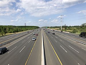
Several major highways serve East Windsor. The most prominent among them is the New Jersey Turnpike (Interstate 95). One exit, Exit 8, is located within East Windsor, connecting the turnpike to Route 33 and Route 133 ("Hightstown Bypass"). Route 33 runs east to west across the southern and eastern portions of the township while Route 133 forms a bypass of Hightstown, connecting Route 33 on the east side of East Windsor to County Route 571 on the west side. U.S. Route 130 crosses the western portions of East Windsor with a north–south orientation parallel to the turnpike, forming a concurrency with Route 33 in the southern portion of the township. The township is also served by County Route 535 and County Route 539.
Public transportation
Suburban Transit offeres commuter service to and from the Port Authority Bus Terminal in Midtown Manhattan on the 300 Route and to and from Wall Street in Downtown Manhattan on the 600 Route.
The nearest NJ Transit rail service is available at the Princeton Junction station. Shuttle bus service to the Princeton Junction station is available during rush hour.
Mercer County offers a shuttle service providing access to major businesses and transportation hubs in the area along Route 130 as well as a local shuttle within the area.
Healthcare
East Windsor is served by CentraState Healthcare System, which is affiliated with Rutgers Robert Wood Johnson Medical School, located in nearby Freehold Township. The regional hospital is a 287-bed medical facility. CentraState Healthcare system also provides healthcare through its various family practices in communities across central New Jersey. One of those six family practices has an office located in East Windsor on U.S. Route 130. The next closest hospitals to the township include the Hamilton Division of Robert Wood Johnson University Hospital in nearby Hamilton and Penn Medicine Princeton Medical Center in nearby Plainsboro.
Notable people
People who were born in, residents of, or otherwise closely associated with East Windsor Township include:
- Clara Barton (1821–1912), founder of the American Red Cross, taught at the Cedarville Road School in East Windsor 1851–2.
- Rich Gunnell (born 1987), college football coach.
- Guy Hutchinson (born 1974), author, broadcaster, theme park historian and comedian.
- Lisa P. Jackson (born 1962), Administrator of the Environmental Protection Agency (EPA).
- Marlon LeBlanc (born 1976), head coach for the West Virginia Mountaineers men's soccer team.
- Loretta Long (born 1940), actress, voice artist, singer, media personality and educator who played the character of Susan Robinson on Sesame Street, from its debut in 1969 until 2015.
- Zubin Mehenti, sportscaster and radio host who joined ESPN in 2011 and has served as the anchor for several variations of the channel's flagship program, SportsCenter.
- Dakota Mills (born 1997), soccer forward who plays for the Saint Kitts and Nevis women's national team.
- Tony Paige (born 1953), radio talk show host on WFAN.
- Randal Pinkett (born 1971), business consultant who was the winner of The Apprentice season 4.
- Al Rosenberg, comedy writer for Imus in the Morning and The Howard Stern Show, who has served as a councilman since 2002.
- Carl Emil Schorske (1915–2015), cultural historian who won the Pulitzer Prize for General Non-Fiction in 1981.
- Anton Strout (born 1970), urban fantasy novelist.
- Jimmy Takter (born 1960), harness racing horse trainer who was inducted into the Harness Racing Hall of Fame in 2012.
- Nick Williams (born 1990), wide receiver who has played in the NFL for the Washington Redskins and Atlanta Falcons.
See also
 In Spanish: Municipio de East Windsor (Nueva Jersey) para niños


