
Misquamicut, Rhode Island facts for kids
Quick facts for kids
Misquamicut, Rhode Island
|
|
|---|---|
.jpg)
Andrea Hotel, c.1930s
|
|

Misquamicut, Rhode Island
Location in Rhode Island

Misquamicut, Rhode Island
Location in the United States
|
|
| Country | United States |
| State | Rhode Island |
| County | Washington |
| Area | |
| • Total | 1.25 sq mi (3.23 km2) |
| • Land | 1.17 sq mi (3.04 km2) |
| • Water | 0.075 sq mi (0.19 km2) |
| Elevation | 3 ft (1 m) |
| Population
(2010)
|
|
| • Total | 390 |
| • Density | 312/sq mi (120.7/km2) |
| Time zone | UTC-5 (Eastern (EST)) |
| • Summer (DST) | UTC-4 (EDT) |
| ZIP code |
02891
|
| Area code(s) | 401 |
| FIPS code | 44-46000 |
| GNIS feature ID | 1217591 |
Misquamicut is a census-designated place and fire district in southern Washington County, Rhode Island. It is part of the town of Westerly and is a census-designated place. The population was listed as 390 in 2010.
History
The district was once known as Pleasant View. The land was purchased from Chief Sosoa of the Montauks in 1661. The name was changed from Pleasant View to Misquamicut in 1928. Misquamicut is an Algonquian word for "red fish." The area suffered a series of devastating hurricanes that wiped out beach homes, hotels, and other structures in 1938, 1944, and 1954. A portion of the oceanfront became Misquamicut State Beach in 1959.
Images for kids
-
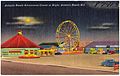
1940s postcard
.jpg)
See also
 In Spanish: Misquamicut (Rhode Island) para niños

All content from Kiddle encyclopedia articles (including the article images and facts) can be freely used under Attribution-ShareAlike license, unless stated otherwise. Cite this article:
Misquamicut, Rhode Island Facts for Kids. Kiddle Encyclopedia.