
Mizoram facts for kids
.svg)

Mizoram is a state in the Republic of India. It is in the eastern region beyond Bangladesh. It covers an area of 8,139 square miles (21,080 km2). It is bigger than the nation of El Salvador but smaller than the State of Israel. In traditional Indian geography it falls under the North-east Indian zone.
The word "Mizoram" means "land of the Mizo people". It is one of the Seven Sister States in North Eastern India, sharing borders with the states of Tripura, Assam, Manipur and with the neighbouring countries of Bangladesh and Myanmar. Mizoram became the 23rd state of India on 20 February 1987. The capital of Mizoram is Aizawl.
Provincial symbols of Mizoram
-
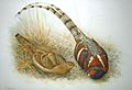
Provincial bird of Mizoram
-
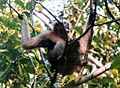
Provincial animal of Mizoram
-
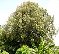
Provincial tree of Mizoram


Images for kids
-
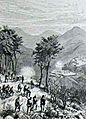
One of the many battles between British troops and British-aligned tribes of Mizoram against a Lusei clan in Mizoram. This sketch is by Lieutenant Cole in 1889 titled "Looshai expedition".
-
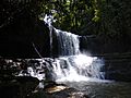
Tuirihiau falls
-
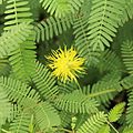
Neptunia oleracea
-
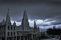
Solomon's Temple, Aizawl
-
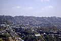
Aizawl The capital city of Mizoram
-
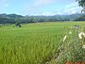
A paddy field in Zawlpui, Serchhip
-
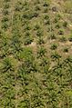
Oil palm in Mamit
-
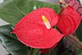
Mizoram produces over 7 million tonnes of Anthurium (shown), supplying the domestic market as well as exporting it to UAE, UK and Japan. The majority of producers and income earners from this business are Mizoram women.
-
A school campus in Mizoram
-
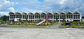
Lengpui Airport Building
-
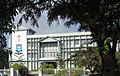
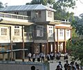
Aizawl Theological College
-
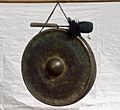
Darkhuang, Zamluang or jamluang – a traditional musical instrument found in Mizoram.Other instruments include khuang (drum), dar (cymbals), as well as bamboo-based phenglawng, tuium and tawtawrawt.
-
Dance of Mizoram
-
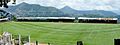
Lammual Stadium
-
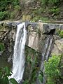
Kawpi Waterfall


See also
 In Spanish: Mizoram para niños
