
Montecito, California facts for kids
Quick facts for kids
Montecito, California
|
|
|---|---|
.jpg) .jpg)  .jpg) _(cropped).jpg) Clockwise: view of Montecito and the Pacific Ocean from the Santa Ynez Mountains; Our Lady of Mount Carmel Church; Lotusland; Butterfly Beach; Casa del Herrero.
|
|

Location in Santa Barbara County and the state of California
|
|

Montecito, California
Location in southern California

Montecito, California
Location in California

Montecito, California
Location in the United States
|
|
| Country | United States |
| State | California |
| County | Santa Barbara |
| Area | |
| • Total | 9.265 sq mi (23.994 km2) |
| • Land | 9.259 sq mi (23.979 km2) |
| • Water | 0.006 sq mi (0.014 km2) 0.06% |
| Elevation | 180 ft (55 m) |
| Population | |
| • Total | 8,638 |
| • Density | 932.33/sq mi (360.007/km2) |
| Time zone | UTC−8 (Pacific) |
| • Summer (DST) | UTC−7 (PDT) |
| ZIP Codes |
93108, 93150
|
| Area code | 805 and 820 |
| FIPS code | 06-48844 |
| GNIS feature IDs | 1661052, 2408861 |
Montecito (Spanish for "Little mountain") is an unincorporated town and census-designated place in Santa Barbara County, California. Located on the Central Coast of California, Montecito sits between the Santa Ynez Mountains and the Pacific Ocean and had a population of 8,638 in 2020. Montecito is best known as a "celebrity enclave", owing to its concentration of prominent residents.
Contents
History
The site of present-day Montecito, along with the entire south coast of Santa Barbara County, was inhabited for over 10,000 years by the Chumash Indians. The Spanish arrived in the 18th century, but left the region largely unsettled while they built the Presidio and Mission Santa Barbara farther west.
In the middle of the 19th century the area was known as a haven for bandits and highway robbers, who hid in the oak groves and canyons, preying on traffic on the coastal route between the towns that developed around the missions. By the end of the 1860s the bandit gangs were gone, and Italian settlers arrived. Finding an area reminiscent of Italy, they built farms and gardens similar to those they had left behind in Italy. Around the end of the 19th century, wealthy tourists from the eastern and midwestern United States began to buy land in the area. It was near enough to Santa Barbara for essential services while still being secluded. Desirable weather and several nearby hot springs offered the promise of comfortable, healthy living, in addition to the availability of affordable land.
The Montecito Hot Springs Hotel was built near the largest of the springs, in a canyon north of the town center and directly south of Montecito Peak, in Hot Springs Canyon. The hotel burned down in 1920; it was replaced a few years later by the smaller Hot Springs Club.
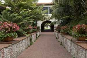
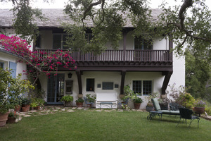
The architect George Washington Smith is noted particularly for his residences around Montecito, and for popularizing the Spanish Colonial Revival style in early 20th century America, as is Lutah Maria Riggs, who started as a draftsman in Smith's firm, rose to partner, and later started her firm.
Geography and climate
According to the United States Census Bureau, the CDP has a total area of 9.3 square miles (24 km2), 99.94% of it land and 0.06% of it water.
Montecito experiences a cool Mediterranean climate (Köppen climate classification Csb) characteristic of coastal Southern California. Because of Montecito's proximity to the ocean, onshore breezes significantly moderate temperatures, resulting in warmer winters and cooler summers compared with places further inland. With its gentle Mediterranean climate, Montecito has long been a desirable location for nursery men and gifted horticulturists. March and April are the months to watch gray whales migrate north from Mexico through Santa Barbara Channel.
| Climate data for Santa Barbara, California (1981–2010 Normals) | |||||||||||||
|---|---|---|---|---|---|---|---|---|---|---|---|---|---|
| Month | Jan | Feb | Mar | Apr | May | Jun | Jul | Aug | Sep | Oct | Nov | Dec | Year |
| Record high °F (°C) | 89 (32) |
89 (32) |
96 (36) |
101 (38) |
101 (38) |
103 (39) |
108 (42) |
99 (37) |
105 (41) |
103 (39) |
97 (36) |
92 (33) |
108 (42) |
| Average high °F (°C) | 64.7 (18.2) |
65.4 (18.6) |
66.1 (18.9) |
69.0 (20.6) |
69.6 (20.9) |
71.2 (21.8) |
74.7 (23.7) |
76.0 (24.4) |
75.1 (23.9) |
72.8 (22.7) |
68.9 (20.5) |
64.7 (18.2) |
69.9 (21.1) |
| Average low °F (°C) | 46.4 (8.0) |
48.1 (8.9) |
49.8 (9.9) |
51.8 (11.0) |
54.6 (12.6) |
57.5 (14.2) |
60.4 (15.8) |
60.4 (15.8) |
59.6 (15.3) |
56.2 (13.4) |
50.3 (10.2) |
46.7 (8.2) |
53.5 (11.9) |
| Record low °F (°C) | 20 (−7) |
27 (−3) |
30 (−1) |
30 (−1) |
36 (2) |
42 (6) |
44 (7) |
46 (8) |
38 (3) |
34 (1) |
28 (−2) |
25 (−4) |
20 (−7) |
| Average rainfall inches (mm) | 4.14 (105) |
4.68 (119) |
3.59 (91) |
0.77 (20) |
0.35 (8.9) |
0.09 (2.3) |
0.01 (0.25) |
0.03 (0.76) |
0.29 (7.4) |
0.52 (13) |
1.48 (38) |
2.63 (67) |
18.58 (472.61) |
| Average rainy days (≥ 0.01 in) | 6.5 | 6.3 | 6.5 | 2.9 | 1.4 | 0.9 | 0.4 | 0.5 | 1.2 | 1.7 | 3.8 | 4.9 | 37 |
| Source: Western Regional Climate Center | |||||||||||||
Demographics
2010

The 2010 United States Census reported that Montecito had a population of 8,965. The population density was 967.7 people per square mile (373.6/km2). The racial makeup of Montecito was 8,267 (92.2%) White, 55 (0.6%) African American, 38 (0.4%) Native American, 218 (2.4%) Asian, 6 (0.1%) Pacific Islander, 156 (1.7%) from other races, and 225 (2.5%) from two or more races. Hispanic or Latino of any race were 605 persons (6.7%).
The Census reported that 8,033 people (89.6% of the population) lived in households, 932 (10.4%) lived in non-institutionalized group quarters, and none were institutionalized.
Of the 3,432 households, 831 (24.2%) had children under the age of 18 living in them; 1,936 (56.4%) were opposite-sex married couples living together, 234 (6.8%) had a female householder with no husband present, 93 (2.7%) had a male householder with no wife present. There were 110 (3.2%) unmarried opposite-sex partnerships, and 36 (1.0%) same-sex married couples or partnerships. 941 households (27.4%) were made up of individuals, and 527 (15.4%) had someone living alone who was 65 years of age or older. The average household size was 2.34. There were 2,263 families (65.9% of all households); the average family size was 2.79.
The age spread of the population accounts 1,515 people (16.9%) under the age of 18, 1,234 people (13.8%) aged 18 to 24, 1,169 people (13.0%) aged 25 to 44, 2,716 people (30.3%) aged 45 to 64, and 2,331 people (26.0%) who were 65 years of age or older. The median age was 50.0 years. For every 100 females, there were 87.3 males. For every 100 females age 18 and over, there were 83.9 males.
4,238 housing units represented an average density of 457.5 per square mile (176.6/km2), of which 2,522 (73.5%) were owner-occupied, and 910 (26.5%) were occupied by renters. The homeowner vacancy rate was 2.4%; the rental vacancy rate was 8.7%. 6,081 people (67.8% of the population) lived in owner-occupied housing units and 1,952 people (21.8%) lived in rental housing units.
2000
_(cropped).jpg)
The census of 2000 counted 10,000 people, 3,686 households, and 2,454 families residing in the census-designated place (CDP). The population density was 1,072.3 people per square mile (413.8/km2). There were 4,193 housing units at an average density of 449.6 per square mile (173.5/km2). The racial makeup of the CDP was 94.0% White, 0.5% African American, 0.3% Native American, 1.3% Asian, 0.2% Pacific Islander, 2.1% from other races, and 1.5% from two or more races. Hispanic or Latino of any race were 5.2% of the population.
Out of the total of 3,686 households, 25.7% had children under the age of 18 living with them, 57.1% were married couples living together, 7.2% had a female householder with no husband present, and 33.4% were non-families. 27.0% of all households were made up of individuals, and 14.0% had someone living alone who was 65 years of age or older. The average household size was 2.41 and the average family size was 2.85.
The CDP population age distribution was 18.4% under the age of 18, 13.5% from 18 to 24, 16.6% from 25 to 44, 30.0% from 45 to 64, and 21.5% who were 65 years of age or older. The median age was 46 years. For every 100 females, there were 84.7 males. For every 100 females age 18 and over, there were 82.1 males.
The median income for a household in the CDP was $110,669, and the median income for a family was $130,123. Males had a median income of $81,719 versus US$42,182 for females. The per capita income for the CDP was $70,077. About 2.3% of families and 3.8% of the population were below the poverty line, including 2.6% of those under age 18 and 2.2% of those age 65 or over.
Notable people
- Douglas Adams
- Troy Aikman
- Dame Judith Anderson
- Ross Bagdasarian, Jr. & Janice Karman
- William Baldwin
- Thomas J. Barrack, Jr.
- Drew Barrymore (2010–2013)
- Jason Bateman
- Orlando Bloom
- T. C. Boyle
- Jeff Bridges
- Mike Bryan
- Carol Burnett
- Elizabeth Eaton Burton
- Frank Caufield
- Julia Child
- John Cleese
- Robert M. Colleary (1929–2012)
- Jimmy Connors
- Fred Couples
- Christopher Cross
- Tom Cruise
- Elizabeth Daily
- Portia de Rossi
- Ellen DeGeneres
- Bradford Dillman
- Michael Douglas
- James Ellison
- Anne Francis
- Tom Freston
- Bob Gale
- Martin Lee Gore
- Tipper Gore
- Sue Grafton
- Andy Granatelli
- Ariana Grande
- Gene Hackman
- Prince Harry, Duke of Sussex and Meghan, Duchess of Sussex
- Pamela Hensley
- Paul Hogan
- Tab Hunter
- Kathy Ireland
- Burl Ives
- Bruce Johnston
- Olivier Leclercq
- Christopher Lloyd
- Kenny Loggins
- Julia Louis-Dreyfus
- Rob Lowe
- David Manners
- Steve Martin
- Dennis Miller
- Jack Mitchell
- Robert Mitchum
- Charlie Munger
- Paul Muni
- Peter Noone
- Brad Paisley
- Jack Palance
- Gwyneth Paltrow
- Suzy Parker
- Zack Pearlman
- Katy Perry
- Chynna Phillips
- Robert Preston
- Adam Pritzker
- Ivan Reitman
- Eva Marie Saint
- John Sanford
- Lori Saunders
- Eric Schmidt
- Ed Snider
- Peter Sperling
- Timothy Stack
- Thomas Steinbeck
- Shaun Tomson
- John Travolta
- E. Duke Vincent
- Joe Walsh
- Ganna Walska
- Ty Warner
- Stuart Whitman
- John Whittemore
- Bruce Willis
- Owen Wilson
- Oprah Winfrey
Education
Children in Montecito are enrolled at Montecito Union Elementary School and Cold Spring Elementary School. Both of these K-6 schools are operated by school districts which only run one school.
Montecito does not have any public schools serving grades 7-12. Students who wish to attend public schools must enroll in the Santa Barbara Unified School District and commute to Santa Barbara Junior High School, followed by Santa Barbara High School.
The four year Westmont College is located in the hills above Montecito.
Images for kids
-
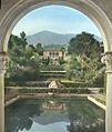
The gardens at Arcady, a Mission Revival estate built in 1905 for industrialist George Owen Knapp.
-
Las Tejas, a Spanish Revival estate built in 1917 by architect Francis W. Wilson for banker Oakleigh Thorne.
-
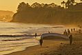
Sunset at Butterfly Beach.
_(3953273520).jpg)
.jpg)
.jpg)
See also
 In Spanish: Montecito para niños
