Moonachie, New Jersey facts for kids
Quick facts for kids
Moonachie, New Jersey
|
|
|---|---|
|
Borough
|
|
| Borough of Moonachie | |

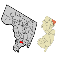
Map highlighting Moonachie's location within Bergen County. Inset: Bergen County's location within New Jersey.
|
|

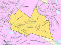
Census Bureau map of Moonachie, New Jersey
|
|
| Country | |
| State | |
| County | |
| Incorporated | May 3, 1910 |
| Government | |
| • Type | Borough |
| • Body | Borough Council |
| Area | |
| • Total | 1.74 sq mi (4.51 km2) |
| • Land | 1.73 sq mi (4.48 km2) |
| • Water | 0.01 sq mi (0.03 km2) 0.69% |
| Area rank | 427th of 565 in state 54th of 70 in county |
| Elevation | 3 ft (0.9 m) |
| Population | |
| • Total | 2,708 |
| • Estimate
(2019)
|
2,702 |
| • Rank | 461st of 566 in state 66th of 70 in county |
| • Density | 1,626.5/sq mi (628.0/km2) |
| • Density rank | 320th of 566 in state 61st of 70 in county |
| Time zone | UTC−05:00 (Eastern (EST)) |
| • Summer (DST) | UTC−04:00 (Eastern (EDT)) |
| ZIP Code |
07074
|
| Area code(s) | 201 |
| FIPS code | 3400347700 |
| GNIS feature ID | 0885307 |
Moonachie ( moo-NAH-kee) is a borough in Bergen County, New Jersey, in the Hackensack River watershed. As of the 2010 United States Census, the borough's population was 2,708, reflecting a decline of 46 (-1.7%) from the 2,754 counted in the 2000 Census, which had in turn declined by 63 (-2.2%) from the 2,817 counted in the 1990 Census.
Tradition is that the borough was named after Monaghie, an Iroquois chief who inhabited the local cedar forests in the 1600s. Moonachie was incorporated as a borough by an act of the New Jersey Legislature on April 11, 1910, from portions of Lodi Township, based on the results of a referendum held on May 3, 1910. On March 26, 1917, portions of Moonachie were taken to form Teterboro.
The name of the borough is pronounced "moo-NAH-kee" or "MOO-nah-kee;" however, in January 1987, then-Mayor of New York City Ed Koch pronounced it "mah-NOO-chee" when he made his now-famous quip that the New York Giants should hold their victory parade in the borough after the team had just won Super Bowl XXI. Koch had refused to grant the Giants permission to hold a parade within the city limits because the team plays its home games in New Jersey, not in New York City.
Contents
Geography
According to the United States Census Bureau, the borough had a total area of 1.678 square miles (4.345 km2), including 1.665 square miles (4.312 km2) of land and 0.013 square miles (0.033 km2) of water (0.76%).
The borough is approximately 9 miles (14 km) northwest of downtown Manhattan in New York City. Nearby is East Rutherford, in which can be found the Meadowlands Sports Complex, home to the National Football League's New York Giants and New York Jets, and a racetrack at which both thoroughbred horse racing and harness racing are conducted.
The borough borders the Bergen County municipalities of Carlstadt, Hasbrouck Heights, Little Ferry, South Hackensack, Teterboro and Wood-Ridge.
Demographics
As of the 2010 United States Census, the borough's population was 2,708, reflecting a decline of 46 (-1.7%) from the 2,754 counted in the 2000 Census, which had in turn declined by 63 (-2.2%) from the 2,817 counted in the 1990 Census.
| Historical population | |||
|---|---|---|---|
| Census | Pop. | %± | |
| 1900 | 212 | — | |
| 1910 | 638 | 200.9% | |
| 1920 | 1,194 | 87.1% | |
| 1930 | 1,465 | 22.7% | |
| 1940 | 1,554 | 6.1% | |
| 1950 | 1,775 | 14.2% | |
| 1960 | 3,052 | 71.9% | |
| 1970 | 2,951 | −3.3% | |
| 1980 | 2,706 | −8.3% | |
| 1990 | 2,817 | 4.1% | |
| 2000 | 2,754 | −2.2% | |
| 2010 | 2,708 | −1.7% | |
| 2019 (est.) | 2,702 | −0.2% | |
| Population sources: 1910-1920 1910 1910-1930 1900-2010 2000 2010 |
|||
2010 Census
As of the census of 2010, there were 2,708 people, 1,005 households, and 702 families residing in the borough. The population density was 1,626.5 per square mile (628.0/km2). There were 1,053 housing units at an average density of 632.5 per square mile (244.2/km2)*. The racial makeup of the borough was 76.59% (2,074) White, 1.40% (38) Black or African American, 0.11% (3) Native American, 10.04% (272) Asian, 0.00% (0) Pacific Islander, 8.57% (232) from other races, and 3.29% (89) from two or more races. [[Hispanic (U.S. Census)|Hispanic or Latino of any race were 24.37% (660) of the population.
There were 1,005 households out of which 26.8% had children under the age of 18 living with them, 49.6% were married couples living together, 14.0% had a female householder with no husband present, and 30.1% were non-families. 24.8% of all households were made up of individuals, and 11.3% had someone living alone who was 65 years of age or older. The average household size was 2.69 and the average family size was 3.24.
In the borough, the population was spread out with 18.5% under the age of 18, 8.9% from 18 to 24, 23.5% from 25 to 44, 32.9% from 45 to 64, and 16.2% who were 65 years of age or older. The median age was 44.4 years. For every 100 females there were 97.2 males. For every 100 females ages 18 and old there were 95.2 males.
The Census Bureau's 2006-2010 American Community Survey showed that (in 2010 inflation-adjusted dollars) median household income was $53,500 (with a margin of error of +/- $6,570) and the median family income was $67,288 (+/- $10,087). Males had a median income of $52,647 (+/- $4,166) versus $42,670 (+/- $7,039) for females. The per capita income for the borough was $27,918 (+/- $2,593). About 4.0% of families and 6.6% of the population were below the poverty line, including 1.4% of those under age 18 and 12.9% of those age 65 or over.
Same-sex couples headed four households in 2010, the same number as was counted in 2000.
Transportation
Roads and highways
As of May 2010[update], the borough had a total of 12.83 miles (20.65 km) of roadways, of which 9.83 miles (15.82 km) were maintained by the municipality and 3.00 miles (4.83 km) by Bergen County.
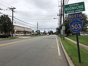
County Route 503 passes through Moonachie as Moonachie Road.
Public transportation
NJ Transit bus routes 161, 163, 164 provide service to the Port Authority Bus Terminal in Midtown Manhattan, service to Newark is offered on the 76 route and local service is available on the 703 (rush hour) and 772 bus routes.
Education
Public school students in pre-kindergarten through eighth grade are served by the Moonachie School District at the Robert L. Craig School. As of the 2018–19 school year, the district, comprised of one school, had an enrollment of 317 students and 30.7 classroom teachers (on an FTE basis), for a student–teacher ratio of 10.3:1.
For ninth through twelfth grades, approximately 100 public school students attend Wood-Ridge High School in Wood-Ridge, as part of a sending/receiving relationship with the Wood-Ridge School District. As of the 2018–19 school year, the high school had an enrollment of 583 students and 46.9 classroom teachers (on an FTE basis), for a student–teacher ratio of 12.4:1.
Public school students from the borough, and all of Bergen County, are eligible to attend the secondary education programs offered by the Bergen County Technical Schools, which include the Bergen County Academies in Hackensack, and the Bergen Tech campus in Teterboro or Paramus. The district offers programs on a shared-time or full-time basis, with admission based on a selective application process and tuition covered by the student's home school district.
Notable people
People who were born in, residents of, or otherwise closely associated with Moonachie include:
- Jennifer Velez (born 1965 or 1966), former Commissioner of the New Jersey Department of Human Services.
- Nikita Whitlock (born 1991), fullback for the New York Giants.
See also
 In Spanish: Moonachie para niños


