
Moora, Western Australia facts for kids
Quick facts for kids MooraWestern Australia |
|||||||||
|---|---|---|---|---|---|---|---|---|---|
.JPG)
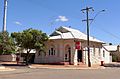
Moora, Western Australia.
|
|||||||||
| Population | 1,773 (2016 census) | ||||||||
| Postcode(s) | 6510 | ||||||||
| Elevation | 203 m (666 ft) | ||||||||
| Location |
|
||||||||
| LGA(s) | Shire of Moora | ||||||||
| State electorate(s) | Moore | ||||||||
| Federal Division(s) | Durack | ||||||||
|
|||||||||
Moora is a townsite located 177 km north of Perth in the Wheatbelt region of Western Australia. Moora was one of the original stations on the Midland railway line to Walkaway, and the townsite was gazetted in 1895. At the 2016 census, Moora had a population of 1,773.
Natural disasters
The town was left underwater in 1932 when heavy rainfall inundated the town causing severe flooding. The town was left isolated as both rail lines and roads had portions washed away. Over half the town was submerged to a depth of 3 feet (90 cm) and once the waters receded was left under a thick coating of mud. Crops and stock in the surrounding area were also lost.
In March 1999, the town suffered a major flood when ex-Tropical Cyclone Elaine caused the Moore River to break its banks with the evacuation of 1000 people. Just as the community was recovering, another major rainfall event on the already saturated land in May the same year caused yet another flood in the town.
Recreation
The Moora Agricultural Show is held every year in September and includes a full Equestrian Program, Fire Works, Fashion Parade, entertainment and some exciting exhibits. The Moora Cup Race Day is one of the biggest events on Moora's social calendar and is held every year in October.
Many tourist attractions can be found around the Moora District, ranging from the Western Wildflower Farm to the abundance of hand-painted murals and the Moora Town Clock. As such, Moora is often a popular stopover for tourist’s en route to holiday destinations and those following the wildflower trail.
Nature
Moora lies within the Moora Important Bird Area, so identified by BirdLife International because it supports up to 60 breeding pairs of the endangered Short-billed Black Cockatoo. Surrounding the town are several rural activities (such as the growing of wheat, barley, canola, oaten hay and lupins, as well as the raising of sheep, cattle and pigs) and a silica mine located 15 km north of the townsite.
Climate
| Climate data for Moora | |||||||||||||
|---|---|---|---|---|---|---|---|---|---|---|---|---|---|
| Month | Jan | Feb | Mar | Apr | May | Jun | Jul | Aug | Sep | Oct | Nov | Dec | Year |
| Record high °C (°F) | 45.0 (113.0) |
45.5 (113.9) |
42.3 (108.1) |
39.6 (103.3) |
34.5 (94.1) |
26.4 (79.5) |
24.7 (76.5) |
27.7 (81.9) |
32.8 (91.0) |
37.5 (99.5) |
42.3 (108.1) |
44.0 (111.2) |
45.5 (113.9) |
| Average high °C (°F) | 34.4 (93.9) |
34.1 (93.4) |
31.0 (87.8) |
26.4 (79.5) |
21.9 (71.4) |
18.7 (65.7) |
17.3 (63.1) |
17.9 (64.2) |
20.6 (69.1) |
24.5 (76.1) |
28.5 (83.3) |
32.0 (89.6) |
25.6 (78.1) |
| Average low °C (°F) | 17.7 (63.9) |
18.1 (64.6) |
16.3 (61.3) |
13.6 (56.5) |
9.9 (49.8) |
8.1 (46.6) |
6.8 (44.2) |
6.7 (44.1) |
7.6 (45.7) |
9.5 (49.1) |
13.0 (55.4) |
15.5 (59.9) |
11.9 (53.4) |
| Record low °C (°F) | 8.6 (47.5) |
9.1 (48.4) |
5.0 (41.0) |
3.2 (37.8) |
0.6 (33.1) |
−1.4 (29.5) |
−1.0 (30.2) |
−1.1 (30.0) |
0.0 (32.0) |
0.0 (32.0) |
3.9 (39.0) |
7.4 (45.3) |
−1.4 (29.5) |
| Average precipitation mm (inches) | 11.0 (0.43) |
14.3 (0.56) |
19.8 (0.78) |
25.4 (1.00) |
60.9 (2.40) |
90.0 (3.54) |
88.6 (3.49) |
63.8 (2.51) |
38.6 (1.52) |
24.9 (0.98) |
12.8 (0.50) |
9.6 (0.38) |
459.1 (18.07) |
| Average precipitation days | 2.2 | 2.4 | 3.2 | 5.8 | 10.3 | 14.3 | 15.6 | 13.5 | 10.3 | 7.4 | 4.1 | 2.4 | 91.5 |
| Average relative humidity (%) | 28 | 30 | 34 | 42 | 53 | 63 | 65 | 60 | 53 | 41 | 35 | 30 | 44 |
Education
Moora is home to the Central Midlands Senior High School, Moora Primary School and St Joseph's School (SJSM) - a Catholic private co-educational primary school.
Notable residents
Musician Paul Harding from electronic music group Pendulum attended Moora Primary School.
Images for kids
-
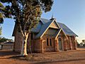
St James Anglican church
-
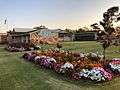
Shire council offices and garden
-
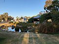
Visitors centre garden
-
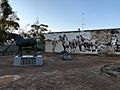
Australian Draughthorse Memorial
-
Moora post office


