
Morayfield, Queensland facts for kids
Quick facts for kids MorayfieldMoreton Bay, Queensland |
|||||||||||||||
|---|---|---|---|---|---|---|---|---|---|---|---|---|---|---|---|

Raff's Sugar Plantation, 1874
|
|||||||||||||||

Morayfield
Location in Queensland
|
|||||||||||||||
| Population | 21,394 (2016 census suburb) | ||||||||||||||
| • Density | 480.8/km2 (1,245/sq mi) | ||||||||||||||
| Postcode(s) | 4506 | ||||||||||||||
| Area | 44.5 km2 (17.2 sq mi) | ||||||||||||||
| Time zone | AEST (UTC+10:00) | ||||||||||||||
| Location |
|
||||||||||||||
| LGA(s) | Moreton Bay Region | ||||||||||||||
| State electorate(s) |
|
||||||||||||||
| Federal Division(s) | Longman | ||||||||||||||
|
|||||||||||||||
Morayfield is a town and suburb in the Moreton Bay Region, Queensland, Australia. In the 2016 census, the suburb of Morayfield had a population of 21,394 people.
Morayfield is 44.5 kilometres (27.7 mi) by road north of Brisbane CBD, the state capital.
Geography
Morayfield is a mostly residential area, consisting mainly of low-set brick homes and some semi-rural acreage. The main commercial area is concentrated along Morayfield Road and includes the Morayfield Shopping Centre, which opened in 1997. The suburb is situated in the Burpengary Creek catchment area.
History
In 1868 Brisbane man George Raff bought some of the land held by the failed Caboolture Cotton Company, calling it "Moray Field", derived from Raff's native Morayshire in Scotland. It was often written as "Morayfields" and, from 1881, became "Morayfield".
Until the mid-1980s, Morayfield remained a rural area consisting of a small dairy holding and small crop farming enterprises. However, with the population pressure caused by the rapid growth of the greater Brisbane area, it has since suffered to some degree from random or unplanned residential development and rapid population growth. It is a thriving retail and service industry commercial center.
Greg Norman is currently involved in a large-scale plan to radically alter the eastern fringes of Morayfield, with land to the east of the Bruce Highway and south of the Caboolture River is to be turned into medium density residential lots.
In January 2011 parts of Morayfield were flooded during the 2010-2011 Queensland floods.
Demographics
In the 2016 census, Morayfield recorded a population of 21,394 people, 51.5% female and 48.5% male. The median age of the Morayfield population was 32 years, 6 years below the national median of 38. 77.2% of people living in Morayfield were born in Australia. The other top responses for country of birth were New Zealand 5.5%, England 3.3%, Philippines 0.7%, South Africa 0.6%, Papua New Guinea 0.5%. 88.2% of people spoke only English at home; the next most common languages were Samoan 0.8%, Mandarin 0.5%, Korean 0.4%, Tagalog 0.3% and German 0.2%.
| Year | Population | Notes |
|---|---|---|
| 1911 | 96 | |
| 1954 | 221 | |
| 1986 | 2,305 | |
| 1996 | 15,496 | |
| 2001 | 16,781 | |
| 2006 | 18,020 | |
| 2011 | 19,346 | |
| 2016 | 21,394 |
Heritage listings
Morayfield has a number of heritage-listed sites, including:
- 34 Nolan Drive: Morayfield Plantation
- 68 Captain Whish Avenue: Oaklands Sugar Mill
Transport
Morayfield railway station provides access to regular Queensland Rail City network services to Brisbane and Ipswich, as well as Caboolture and the Sunshine Coast. Morayfield Road is a major road that passes through both Morayfield and Caboolture, most of the regions shops are situated on this major road, including the Morayfield Shopping Centre.
Education
Morayfield State School is a government primary (Prep-6) school for boys and girls at 196-230 Morayfield Road (27°06′23″S 152°56′50″E / 27.1065°S 152.9472°E). In 2017, the school had an enrolment of 554 students with 46 teachers (44 full-time equivalent) and 33 non-teaching staff (23 full-time equivalent). It includes a special education program.
Minimbah State School is a government primary (Prep-6) school for boys and girls at the corner Walkers Road and Minimbah Drive (27°06′39″S 152°55′27″E / 27.1107°S 152.9243°E). In 2017, the school had an enrolment of 802 students with 57 teachers (51 full-time equivalent) and 29 non-teaching staff (18 full-time equivalent). It includes a special education program.
Morayfield East State School is a government primary (Prep-6) school for boys and girls at 107 Graham Road (27°07′00″S 152°58′01″E / 27.1168°S 152.9669°E). In 2017, the school had an enrolment of 918 students with 64 teachers (58 full-time equivalent) and 47 non-teaching staff (31 full-time equivalent). It includes a special education program.
Morayfield State High School is a government secondary (7-12) school for boys and girls at Visentin Road (27°06′32″S 152°57′12″E / 27.1090°S 152.9533°E). In 2017, the school had an enrolment of 1,425 students with 115 teachers (112 full-time equivalent) and 48 non-teaching staff (36 full-time equivalent). It includes a special education program.
Carmichael College is a private primary and secondary (Prep-12) school for boys and girls at 793-833 Oakey Flat Road (27°10′22″S 152°55′07″E / 27.1729°S 152.9185°E). In 2017, the school had an enrolment of 158 students with 16 teachers (14 full-time equivalent) and 6 non-teaching staff (3 full-time equivalent). The school is named after Irish missionary Amy Carmichael. The Creekside Community Church (one of the Christian Community Churches of Australia) is on the school campus and supports the school.
Images for kids
-
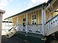
Original building, Morayfield State School, 2014
,_front_view.jpg)
