
Mudgeeraba, Queensland facts for kids
Quick facts for kids MudgeerabaQueensland |
|||||||||||||||
|---|---|---|---|---|---|---|---|---|---|---|---|---|---|---|---|

Old Post Office, 2015
|
|||||||||||||||

Mudgeeraba
Location in Queensland
|
|||||||||||||||
| Population | 13,624 (2016 census suburb) | ||||||||||||||
| • Density | 528.1/km2 (1,368/sq mi) | ||||||||||||||
| Postcode(s) | 4213 | ||||||||||||||
| Area | 25.8 km2 (10.0 sq mi) | ||||||||||||||
| Time zone | AEST (UTC+10:00) | ||||||||||||||
| LGA(s) | City of Gold Coast | ||||||||||||||
| State electorate(s) | Mudgeeraba | ||||||||||||||
| Federal Division(s) | |||||||||||||||
|
|||||||||||||||
Mudgeeraba ( MUH-jə-RƏ-bah) is a town and suburb in the City of Gold Coast, Queensland, Australia. In the 2016 census, the suburb of Mudgeeraba had a population of 13,624 people.
Mudgeeraba's essential character remains one of a nineteenth-century village, and contains important evidence of its earlier form and building. Most older houses are situated on large blocks of 0.5 acres (2,000 m2) to 2 acres (8,100 m2), alongside much larger farming properties situated in the area.
Contents
History
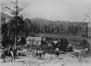

Mudgeeraba is remnant of the type of township that characterises the rural hinterland of the Gold Coast. Subdivision of land was conventional and buildings were traditionally rural or rural commercial. The Schmidt Farmhouse is typical of farms of that period in the district (the farmhouse is now in the adjacent suburb of Worongary).

Mudgeeraba, like other areas in the region, was an early centre for farming, timber getting and cattle grazing by the mid-1870s. It rose to some prominence with the coming of the railway from Brisbane to Tweed Heads in 1903. The station of the South Coast railway line was located near the present-day motorway entrance. In 1890, the Queensland State Government indicated that the railway station would be positioned as close to the township, located on Coach Road, as possible. Following the decision was made to position the railway station at some distance to the town, early residents acquired land nearby. Once the railway line was in operation the centre of the town was relocated to its present position. The railway was closed in 1961. The modern day Pacific Motorway largely follows the route of the former railway. The new Gold Coast railway opened on a different alignment from Brisbane to neighbouring Robina in 1998. Robina station is about 1.8 km further than the old Mudgeeraba railway station.
In the early 1930s during the Great Depression, the Upper Mudgeeraba Creek banks were the location of unemployment relief camps set up under the Income (Unemployment Relief) Tax Acts, 1930. The creek water helped sustain vegetable gardens for the residents, housed in timber and corrugated iron huts. One aspect of the relief scheme put in place by the Queensland Government was to establish small banana plantations. In Upper Mudgeeraba, 300 acres divided into 50 blocks were made available to successful applicants to farm.
Geography
Mudgeeraba Creek is the major creek of a catchment area in the southern region of the Gold Coast. It is part of the larger catchment area of Nerang River. Bonogin and Wyangan Creeks are tributaries of Mudgeeraba Creek.
Since 2005, under the Beaches to Bushland restoration program, Gold Coast City, with the help of Austinville Landcare Group, have worked on restoration of areas of upper Mudgeeraba Creek.
Heritage Listings
Mudgeeraba has a number of local heritage-listed sites, including:
- Mudgeeraba Old Post Office (formerly Nerang Shire Council Chambers)
- Wallaby Hotel (formerly Exchange Hotel)
- Mudgeeraba State School
- Hardy's House
- Hardy's Bridge
Demographics
In the 2011 census, Mudgeeraba recorded a population of 13,204 people, 51.3% female and 48.7% male. The median age of the Mudgeeraba population was 36 years, 1 year below the national median of 37. 69% of people living in Mudgeeraba were born in Australia. The other top responses for country of birth were New Zealand 8.5%, England 6.1%, South Africa 1.7%, Scotland 0.7%, Germany 0.7%. 88.7% of people spoke only English at home; the next most common languages were 0.7% Japanese, 0.6% German, 0.6% Mandarin, 0.4% Cantonese, 0.4% Spanish.
Sport and recreation
A number of sporting teams represent the area, including the Mudgeeraba Redbacks, the local rugby league club who play home games at Firth Park, the Hinterland District Netball Association who run a large competition on Saturday mornings for players 5yrs to 17yrs and Monday nights for 13yrs to opens at Firth Park, Somerset Drive, Mudgeeraba, the Mudgeeraba Lawn Bowls Club situated just behind the Rugby Club, and the Mudgeeraba Soccer Club. Mudgeeraba Spartans Junior AFL Club plays their home games at Somerset College. The starting point for the annual 96 km cross-country Kokoda Challenge is in Mudgeeraba.
Education
Mudgeeraba State School is a government primary (Prep-6) school for boys and girls at Old Coach Road (28°04′26″S 153°21′10″E / 28.0740°S 153.3527°E). In 2017, the school had an enrolment of 843 students with 64 teachers (51 full-time equivalent) and 33 non-teaching staff (21 full-time equivalent). It includes a special education program.
Clover Hill State School is a government primary (Prep-6) school for boys and girls at Clover Hill Drive (28°05′30″S 153°22′34″E / 28.0917°S 153.3760°E). In 2017, the school had an enrolment of 947 students with 72 teachers (60 full-time equivalent) and 26 non-teaching staff (17 full-time equivalent). It includes a special education program.
Mudgeeraba Creek State School is a government primary (Prep-6) school for boys and girls at Gold Coast-Springbrook Road (28°05′12″S 153°20′49″E / 28.0867°S 153.3470°E). In 2017, the school had an enrolment of 705 students with 61 teachers (52 full-time equivalent) and 37 non-teaching staff (24 full-time equivalent). It includes a special education program.
Mudgeeraba Special School is a special primary and secondary (Prep-12) school for boys and girls at 4-6 School Street (28°04′40″S 153°21′50″E / 28.0778°S 153.3640°E). In 2017, the school had an enrolment of 160 students with 42 teachers (39 full-time equivalent) and 65 non-teaching staff (40 full-time equivalent).
Somerset College is a private primary and secondary (Prep-12) school for boys and girls at Somerset Drive (28°05′26″S 153°22′30″E / 28.0906°S 153.3750°E). In 2017, the school had an enrolment of 1,438 students with 102 teachers (99 full-time equivalent) and 98 non-teaching staff (88 full-time equivalent).
There is no government secondary school in Mudgeeraba; the nearest is neighbouring Robina.
Notable people
- Darius Boyd, rugby league player
- Denan Kemp, former rugby league player and owner of "Bloke in a Bar"
- Richard Clapton, musician
- d'Arcy Doyle, artist
- Matthew Saunoa, 2006 New Zealand Idol champion
