Murchison (Western Australia) facts for kids
Quick facts for kids Murchison |
|
|---|---|

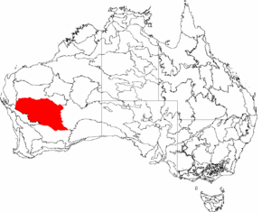
The IBRA regions, with Murchison in red
|
|
| Location | Western Australia, Australia |
| Area | 281,205.54 km2 (108,574.07 sq mi) |
The Murchison is an interim Australian bioregion located within the Mid West of Western Australia. The bioregion is loosely related to the catchment area of the Murchison River and comprises 281,200 square kilometres (108,600 sq mi). Traditionally the region is known as The Murchison.
Contents
Geology
Fauna
Flora
Development
The Murchison is one of the main pastoral areas in WA, dominated by large pastoral leases on Crown land operated as sheep and cattle stations. Mining (gold, iron and nickel) is the major contributor to the region’s economy. There are extensive mining areas, with a large number of abandoned historical mining towns and settlements.
The Australian Square Kilometre Array Pathfinder radio telescope is located nearby, and was officially opened in October 2012.
Political boundaries
Local government areas within the bioregion include the Shire of Yalgoo, the Shire of Mount Magnet, the Shire of Murchison, the Shire of Cue, the Shire of Sandstone, the Shire of Meekatharra, the Shire of Wiluna and the Shire of Leonora.
Population is scattered. The largest population centres are Meekatharra, Mount Magnet and Leonora, with smaller mining and pastoral towns at Yalgoo, Sandstone, Cue, Wiluna and Leinster.

