Murrumbateman facts for kids
Quick facts for kids MurrumbatemanNew South Wales |
|||||||||||||||
|---|---|---|---|---|---|---|---|---|---|---|---|---|---|---|---|

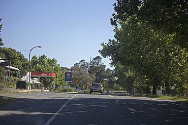
Barton Highway in Murrumbateman
|
|||||||||||||||
| Population | 3,219 (2016 census) | ||||||||||||||
| Postcode(s) | 2582 | ||||||||||||||
| Elevation | 572.21 m (1,877 ft) | ||||||||||||||
| Location | |||||||||||||||
| LGA(s) | Yass Valley Council | ||||||||||||||
| County | Murray | ||||||||||||||
| Parish | Namima, Murrumbateman | ||||||||||||||
| State electorate(s) | Goulburn | ||||||||||||||
| Federal Division(s) | Eden-Monaro | ||||||||||||||
|
|||||||||||||||
Murrumbateman is a town in the Southern Tablelands of New South Wales, Australia. It is on the Barton Highway, approximately 30 kilometres north-west of Canberra, and is part of the Yass Valley Shire. At the 2016 census, Murrumbateman had a population of 3,219 people.
Annual events
- The Murrumbateman Field Day is held in October each year and draws large crowds from Canberra and Yass
- The Australian Cool Climate Wine Show is held annually in September
Facilities and services
Murrumbateman has the following:
- Village Market - Saturday morning on 2nd and 4th Saturday each month
- Park
- Public toilets
- Motel
- Takeaway store
- Petrol station/supermarket
- Garage
- Accountant
- Butcher
- Rural supplies store
- Pub
- Guesthouses
- Restaurants
- Wineries
- Australia Post agency
- Hair & beauty salon
- Dentist
- Doctor
- Pharmacy
- Veterinary clinic
- Dance school
- Pre-school
- Family day care
- Library
- Catholic Church
- Uniting Church
- I.T. specialist
- Landcare group
New development
The Fairley Estate, a new 100 home subdivision at Murrumbateman, will add 60 per cent more housing to the village and trigger other infrastructure and commercial developments. Consisting of 19 hectares adjoining the village, the new subdivision is named Fairley after a Murrumbateman teacher of the 1800s. It will include a commercial and tourist precinct with an international hotel chain as a tenant, boutique brewery, bakery, childcare, visitors' centre and cafe and children's park, medical services and post office.
History and economy
With the arrival of European settlers in the 19th century sheep farming, wheat growing and goldmining became major economic activities. The first government school opened in 1869.
Winemaking began in Murrumbateman in the 1970s with some of the surrounding rural properties being developed as grape growing areas or as boutique wineries.
In recent years much of the land has been subdivided into small hobby farm blocks ranging from 2 to 40 acres (0.81 to 16.19 ha). Similar subdivisions have occurred in other regions around Canberra including Bungendore, Sutton, Gundaroo and Burra. Residents tend to commute to Canberra for work rather than make a living off the small parcels of land. Other nearby towns are Yass, Gunning and Dalton.
Murrumbateman has a pub and a handful of retail outlets.
The Murrumbateman Market is held fortnightly at the Recreation Ground. The market focus is on local produce and local arts and crafts but there is always a range of products from the wider Yass Valley and beyond including fruit and vegetables, breads, cakes, jams, olives, chillies, sauces, biodynamic beef and a range of wines from the local area plus woollen and alpaca products and handmade goods of all types.
Notable people
- Sir Walter Merriman – sheep breeder, knighted in 1954 for his contributions to the fine wool industry, and founder of the Merryville stud, Murrumbateman
- David Pereira - Australian cellist


