
Muskingum County, Ohio facts for kids
Quick facts for kids
Muskingum County
|
||
|---|---|---|

Muskingum County Courthouse
|
||
|
||

Location within the U.S. state of Ohio
|
||
 Ohio's location within the U.S. |
||
| Country | ||
| State | ||
| Founded | March 1, 1804 | |
| Named for | A Native American word meaning "swampy ground" | |
| Seat | Zanesville | |
| Largest city | Zanesville | |
| Area | ||
| • Total | 673 sq mi (1,740 km2) | |
| • Land | 665 sq mi (1,720 km2) | |
| • Water | 8.0 sq mi (21 km2) 1.2%% | |
| Population
(2020)
|
||
| • Total | 86,410 | |
| • Density | 128.40/sq mi (49.57/km2) | |
| Time zone | UTC−5 (Eastern) | |
| • Summer (DST) | UTC−4 (EDT) | |
| Congressional districts | 6th, 12th | |

Muskingum County is a county located in the U.S. state of Ohio. As of the 2020 census, the population was 86,410. Its county seat is Zanesville. Nearly bisected by the Muskingum River, the county name is based on a Delaware American Indian word translated as "town by the river" or "elk's eye".
Muskingum County comprises the Zanesville, OH Micropolitan Statistical Area, which is also included in the Columbus-Marion-Zanesville, OH Combined Statistical Area. The Zanesville Micropolitan Statistical Area is the second-largest statistical area within the Combined Statistical Area, after the Columbus Metropolitan Statistical Area.
Contents
Geography
According to the U.S. Census Bureau, the county has a total area of 673 square miles (1,740 km2), of which 665 square miles (1,720 km2) is land and 8.0 square miles (21 km2) (1.2%) is water. It is the fourth-largest county in Ohio by land area.
Adjacent counties
- Coshocton County (north)
- Guernsey County (east)
- Noble County (southeast)
- Morgan County (south)
- Perry County (southwest)
- Licking County (west)
Demographics
| Historical population | |||
|---|---|---|---|
| Census | Pop. | %± | |
| 1810 | 10,036 | — | |
| 1820 | 17,824 | 77.6% | |
| 1830 | 29,334 | 64.6% | |
| 1840 | 38,749 | 32.1% | |
| 1850 | 45,049 | 16.3% | |
| 1860 | 44,416 | −1.4% | |
| 1870 | 44,886 | 1.1% | |
| 1880 | 49,774 | 10.9% | |
| 1890 | 51,210 | 2.9% | |
| 1900 | 53,185 | 3.9% | |
| 1910 | 57,488 | 8.1% | |
| 1920 | 57,980 | 0.9% | |
| 1930 | 67,398 | 16.2% | |
| 1940 | 69,795 | 3.6% | |
| 1950 | 74,535 | 6.8% | |
| 1960 | 79,159 | 6.2% | |
| 1970 | 77,826 | −1.7% | |
| 1980 | 83,340 | 7.1% | |
| 1990 | 82,068 | −1.5% | |
| 2000 | 84,585 | 3.1% | |
| 2010 | 86,074 | 1.8% | |
| 2020 | 86,410 | 0.4% | |
| U.S. Decennial Census 1790-1960 1900-1990 1990-2000 2020 |
|||
2010 census
As of the 2010 United States Census, there were 86,074 people, 34,271 households, and 23,125 families living in the county. The population density was 129.5 inhabitants per square mile (50.0/km2). There were 38,074 housing units at an average density of 57.3 per square mile (22.1/km2). The racial makeup of the county was 93.0% white, 3.8% black or African American, 0.3% Asian, 0.2% American Indian, 0.2% from other races, and 2.5% from two or more races. Those of Hispanic or Latino origin made up 0.8% of the population. In terms of ancestry, 25.2% were German, 15.5% were Irish, 11.1% were American, and 10.9% were English.
Of the 34,271 households, 32.3% had children under the age of 18 living with them, 49.1% were married couples living together, 13.2% had a female householder with no husband present, 32.5% were non-families, and 26.9% of all households were made up of individuals. The average household size was 2.46 and the average family size was 2.95. The median age was 39.5 years.
The median income for a household in the county was $39,538 and the median income for a family was $48,425. Males had a median income of $40,183 versus $28,668 for females. The per capita income for the county was $20,561. About 13.0% of families and 16.6% of the population were below the poverty line, including 24.6% of those under age 18 and 9.3% of those age 65 or over.
Culture
The Muskingum County Library System serves the communities of Muskingum County from its administrative offices in Zanesville, Ohio. This includes service to Dresden, Duncan Falls, New Concord, and Roseville. In 2005, the library loaned more than 918,000 items to its 73,000 cardholders. Total holding are over 328,000 volumes with over 190 periodical subscriptions.
The Wilds is a 9,154 acres (37.04 km2) wildlife preserve open to visitation for a fee.
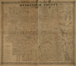
Historical Maps
Communities
City
- Zanesville (county seat)
Villages
Townships
- Adams
- Blue Rock
- Brush Creek
- Cass
- Clay
- Falls
- Harrison
- Highland
- Hopewell
- Jackson
- Jefferson
- Licking
- Madison
- Meigs
- Monroe
- Muskingum
- Newton
- Perry
- Rich Hill
- Salem
- Salt Creek
- Springfield
- Union
- Washington
- Wayne

Census-designated places
Other unincorporated communities
Historical places
- Irville - Former populated place in Licking Township, removed for the creation of Dillon Lake.
- Mattingly Settlement - Named for the many members of the Mattingly family who settled in Muskingum Township.
Education
The county is served by 7 high schools: John Glenn High School in New Concord (East Muskingum Local School District), Philo High School confusingly not located in Philo but instead across the river in Duncan Falls (Franklin Local School District), Maysville High School located in South Zanesville (Maysville Local Schools), Bishop Rosecrans (Catholic high school in downtown Zanesville), Tri-Valley High School located in Dresden (Tri-Valley Local School District), West Muskingum High School located in Zanesville (West Muskingum Local School District), and Zanesville High School which, as the name implies, is in Zanesville (Zanesville City School District).
Each high school is the only high school in school districts of the same name, the exception being Roscrans as the district is referred to as Bishop Fenwick.
The county is also served by three colleges, Muskingum University, Zane State College, and a branch campus of Ohio University known as Ohio University Zanesville.
Images for kids
-
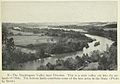
The Muskingum Valley near Dresden, seen in 1923 from the "Geography of Ohio"
_(cropped).jpg)
See also
 In Spanish: Condado de Muskingum para niños
