
Naremburn, New South Wales facts for kids
Quick facts for kids NaremburnSydney, New South Wales |
|||||||||||||||
|---|---|---|---|---|---|---|---|---|---|---|---|---|---|---|---|

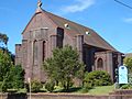
St Leonards Catholic Church, Naremburn
|
|||||||||||||||

Naremburn
Location in New South Wales
|
|||||||||||||||
| Population | 5,884 (2016 census) | ||||||||||||||
| • Density | 3,441/km2 (8,910/sq mi) | ||||||||||||||
| Established | 1853 | ||||||||||||||
| Postcode(s) | 2065 | ||||||||||||||
| Area | 1.71 km2 (0.7 sq mi) | ||||||||||||||
| Location | 6 km (4 mi) north of Sydney CBD | ||||||||||||||
| LGA(s) | City of Willoughby | ||||||||||||||
| State electorate(s) | Willoughby | ||||||||||||||
| Federal Division(s) | North Sydney | ||||||||||||||
|
|||||||||||||||

Naremburn is a suburb on the lower North Shore of Sydney, New South Wales, Australia. Naremburn is located 6 kilometres north of the Sydney central business district, in the local government area of the City of Willoughby.
History
The suburb name dates to the 1800s but its origin cannot be verified. Naremburn was originally known as Central Township. The earliest land grants in the area were granted to Humphrey Evans and Peter Dargan in 1794.
Naremburn Post Office opened on 20 March 1882 and closed in 1986.
Transport
Bus routes 114 from Balmoral and 115 from Sydney CBD travel through Naremburn to Chatswood, with stops located along Willoughby Road.
The closest railway station is St Leonards railway station on the Northern and North Shore & Western Lines of the Sydney Trains network.
The Warringah Freeway to the city runs through the suburb.
Gallery
-
St Cuthberts Anglican Church
-
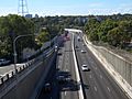
Warringah Freeway
-
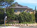
Willoughby Road


