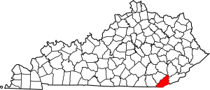
National Register of Historic Places listings in Bell County, Kentucky facts for kids
This is a list of the National Register of Historic Places listings in Bell County, Kentucky.
It is intended to be a complete list of the properties on the National Register of Historic Places in Bell County, Kentucky, United States. The locations of National Register properties for which the latitude and longitude coordinates are included below, may be seen in a map.
There are 9 properties listed on the National Register in the county.
Current listings
| Name on the Register | Image | Date listed | Location | City or town | Description | |
|---|---|---|---|---|---|---|
| 1 | American Association, Limited, Office Building |
(#78001299) |
2215 Cumberland Ave. 36°36′24″N 83°43′05″W / 36.606667°N 83.717917°W |
Middlesboro | ||
| 2 | Brooks House |
(#09001137) |
210 Arthur Heights 36°36′35″N 83°43′01″W / 36.609722°N 83.717083°W |
Middlesboro | ||
| 3 | Cumberland Gap Historic District |
(#80000366) |
East of Middlesboro 36°36′14″N 83°40′28″W / 36.603889°N 83.674444°W |
Middlesboro | Extends into Claiborne County, Tennessee and Lee County, Virginia | |
| 4 | Cumberland Gap National Historical Park |
(#66000353) |
East of Middlesboro along Kentucky-Virginia state line 36°36′14″N 83°40′28″W / 36.603889°N 83.674444°W |
Middlesboro | Extends into Harlan County, Claiborne County, Tennessee and Lee County, Virginia | |
| 5 | Hensley Settlement |
(#80000367) |
Cumberland Gap National Historical Park 36°40′10″N 83°31′42″W / 36.669444°N 83.528333°W |
Cubage | ||
| 6 | Middlesboro Downtown Commercial District |
(#83002554) |
Roughly bounded by Cumberland Ave., 19th, 20th Sts., and Edgewood Rd. 36°36′30″N 83°42′50″W / 36.608333°N 83.713889°W |
Middlesboro | ||
| 7 | Mt. Moriah Baptist Church |
(#85001747) |
314 N. Main St. 36°36′38″N 83°42′46″W / 36.610694°N 83.712778°W |
Middlesboro | ||
| 8 | Pineville Courthouse Square Historic District |
(#90001019) |
Along Kentucky, Pine, Virginia, and Walnut Sts. 36°45′41″N 83°41′44″W / 36.761389°N 83.695556°W |
Pineville | Includes the Bell County Courthouse and several commercial buildings | |
| 9 | St. Mary's Episcopal Church |
(#84000341) |
131 Edgewood Rd. 36°36′32″N 83°43′00″W / 36.608889°N 83.716667°W |
Middlesboro |

All content from Kiddle encyclopedia articles (including the article images and facts) can be freely used under Attribution-ShareAlike license, unless stated otherwise. Cite this article:
National Register of Historic Places listings in Bell County, Kentucky Facts for Kids. Kiddle Encyclopedia.


