
National Register of Historic Places listings in Brookhaven (town), New York facts for kids
This is a list of all National Register of Historic Places listings in the Town of Brookhaven, New York. The locations of National Register properties for which the latitude and longitude coordinates are included below, may be seen in an online map.
Listings
| Name on the Register | Image | Date listed | Location | City or town | Description | |
|---|---|---|---|---|---|---|
| 1 | Bald Hill Schoolhouse |
 |
(#88001018) |
Horseblock Road 40°50′06″N 73°02′34″W / 40.835°N 73.042778°W |
Farmingville | |
| 2 | Bayles Shipyard |
 |
(#00000580) |
101 East Broadway 40°56′54″N 73°04′05″W / 40.948333°N 73.068056°W |
Port Jefferson | |
| 3 | Bellport Academy |
(#02001452) |
24 Academy Lane 40°45′14″N 72°56′16″W / 40.754008°N 72.937831°W |
Bellport | ||
| 4 | Bellport Village Historic District |
 |
(#02001451) |
Roughly bounded by South Country Road, Bellport Lane, Brown's Lane, Brewster Lane, and Bell Street 40°45′30″N 72°56′12″W / 40.758297°N 72.936794°W |
Bellport | |
| 5 | Benner–Foos–Ceparano Estate |
(#16000557) |
99 Van Brunt Manor & 6 Osprey Lane Coordinates missing |
Poquott | Shingle Style 1890s estate is only Lamb & Rich design with bowed plan. Transitioned from vacation home to full-time residence over the 20th century; one of the few North Shore estates in its original form. | |
| 6 | Mary Louise Booth Girlhood House |
 |
(#14001219) |
E. Main St. 40°50′12″N 72°54′57″W / 40.8367°N 72.9157°W |
Yaphank | Childhood home of Mary Louise Booth, 19th-century newspaper editor and French translator. See these links, and this one too. |
| 7 | Brewster House |
 |
(#08000109) |
Junction of NY 25A & Runs Road 40°56′43″N 73°06′11″W / 40.945278°N 73.103056°W |
East Setauket | |
| 8 | Caroline Church and Cemetery |
 |
(#91001148) |
Junction of Dyke and Bates Roads 40°56′49″N 73°06′46″W / 40.946944°N 73.112778°W |
Setauket | |
| 9 | Carrington House |
 |
(#13001057) |
Lewis Walk (at eastern terminus of Ocean Walk) 40°39′43″N 73°04′39″W / 40.661898°N 73.077606°W |
Cherry Grove | Early 20th-century beach bungalow was home to theater director Frank Carrington and an early center of gay life on Fire Island; Truman Capote wrote Breakfast at Tiffany's during a stay there. |
| 10 | Cherry Grove Community House and Theatre |
 |
(#13000373) |
180 Bayview Walk 40°39′36″N 73°05′26″W / 40.660072°N 73.090566°W |
Cherry Grove | |
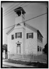
| 11 | Congregational Church of Patchogue |
.jpg) |
(#93000279) |
95 East Main Street 40°45′57″N 73°00′47″W / 40.765833°N 73.013056°W |
Patchogue | |
| 12 | Davis Town Meeting House |
 |
(#01000850) |
Junction of Middle Country Road and Coram-Mt. Sinai Road 40°52′54″N 72°59′01″W / 40.881667°N 72.983611°W |
Coram | |
| 13 | ELVIRA (sloop) |
(#12000288) |
Newey Lane 40°46′17″N 72°53′54″W / 40.771292°N 72.898284°W |
Brookhaven | ||
| 14 | First Congregational Church of New Village |
 |
(#02000361) |
North side of Middle Country Road, West of Elliot Avenue 40°51′35″N 73°06′37″W / 40.859722°N 73.110278°W |
Lake Grove | |
| 15 | First National Bank of Port Jefferson |
 |
(#05001134) |
Main and East Main Streets 40°56′43″N 73°04′06″W / 40.945278°N 73.068333°W |
Port Jefferson | |
| 16 | William Floyd House |
 |
(#71000066) |
20 Washington Avenue 40°46′09″N 72°49′21″W / 40.7692°N 72.8225°W |
Mastic Beach | |
| 17 | Gamecock Cottage |
 |
(#07000886) |
Shipman's Point, South end of West Meadow Beach 40°55′40″N 73°08′50″W / 40.927778°N 73.147222°W |
Stony Brook | |
| 18 | Noah Hallock House |
 |
(#13000913) |
172 Hallock Landing Rd. 40°57′43″N 72°56′19″W / 40.961954°N 72.938476°W |
Rocky Point | Seaside frame cottage of early settler |
| 19 | Hawkins Homestead |
 |
(#88000727) |
165 Christian Avenue 40°55′45″N 73°08′19″W / 40.929167°N 73.138611°W |
Stony Brook | |
| 20 | Robert Hawkins Homestead |
 |
(#86000702) |
Yaphank Avenue 40°49′04″N 72°55′04″W / 40.817778°N 72.917778°W |
Yaphank | |
| 21 | Homan-Gerard House and Mills |
 |
(#88002761) |
Junction Main Street and Yaphank Road 40°50′09″N 72°54′57″W / 40.835833°N 72.915833°W |
Yaphank | |
| 22 | Samuel Hopkins House |
(#09000057) |
415 Pipe Stave Hollow Rd. 40°57′30″N 73°01′16″W / 40.958272°N 73.021003°W |
Miller Place | ||
| 23 | Nathaniel Longbotham House |
(#89002022) |
1541 Stony Brook Road 40°54′27″N 73°08′05″W / 40.9075°N 73.134722°W |
Stony Brook | ||
| 24 | Masury Estate Ballroom |
 |
(#86002513) |
Old Neck Road South 40°46′54″N 72°48′26″W / 40.781667°N 72.807222°W |
Center Moriches | |
| 25 | Frank Melville Memorial Park |
 |
(#10000486) |
Old Field Rd between Lake St. and Main St. 40°56′42″N 73°06′57″W / 40.945°N 73.115833°W |
Setauket | |
| 26 | Middle Island Presbyterian Church |
 |
(#05001388) |
271 Middle Country Road 40°52′49″N 72°57′48″W / 40.880278°N 72.963333°W |
Middle Island | |
| 27 | Miller Place Historic District |
 |
(#76001281) |
North Country Road 40°57′30″N 72°59′56″W / 40.958333°N 72.998889°W |
Miller Place | |
| 28 | William Sidney Mount House |
 |
(#66000575) |
Stony Brook Road and NY 25A 40°54′27″N 73°08′18″W / 40.9075°N 73.138333°W |
Stony Brook | |
| 29 | Old Field Club and Farm |
(#15001027) |
86 W. Meadow Rd. Coordinates missing |
East Setauket | Early social center of Setauket when built for a residential community in 1930 | |
| 30 | Port Jefferson Village Historic District |
 |
(#05000265) |
Roughly along East Main Street, East Broadway, Grant Street, High Street and South Street 40°56′49″N 73°03′58″W / 40.946944°N 73.066111°W |
Port Jefferson | |
| 31 | Setauket Presbyterian Church and Burial Ground |
 |
(#96001023) |
5 Caroline Avenue 40°56′45″N 73°06′41″W / 40.945833°N 73.111389°W |
Setauket | |
| 32 | Sherwood-Jayne House |
 |
(#09000969) |
55 Old Post Rd. 40°56′21″N 73°05′20″W / 40.939267°N 73.088786°W |
East Setauket | |
| 33 | Smith Estate |
 |
(#81000414) |
Longwood and Smith Roads 40°52′05″N 72°54′24″W / 40.868056°N 72.906667°W |
Ridge | Also known as Longwood Estate - Smith House |
| 34 | Smith-Rourke House |
 |
(#89002021) |
350 South Country Road 40°45′43″N 72°58′44″W / 40.761944°N 72.978889°W |
East Patchogue | |
| 35 | St. Andrew's Episcopal Church |
 |
(#88001442) |
Main Street 40°50′12″N 72°54′55″W / 40.836667°N 72.915278°W |
Yaphank | |
| 36 | St. James Chapel |
 |
(#00000583) |
East side of Main Street, 250 ft. North of Stony Brook Lane 40°54′56″N 73°08′50″W / 40.915556°N 73.147222°W |
Stony Brook | |
| 37 | St. Paul's Episcopal Church Complex |
 |
(#95000722) |
31 Rider Avenue 40°45′52″N 73°00′33″W / 40.764444°N 73.009167°W |
Patchogue | |
| 38 | Stony Brook Grist Mill |
 |
(#90001140) |
Harbor Road, West of Main Street 40°54′49″N 73°08′47″W / 40.913611°N 73.146389°W |
Stony Brook | |
| 39 | Suffolk County Almshouse Barn |
 |
(#86002512) |
West of Yaphank Avenue 40°49′41″N 72°55′18″W / 40.828056°N 72.921667°W |
Yaphank | |
| 40 | Terry-Ketcham Inn |
 |
(#92000555) |
81 Main Street 40°48′08″N 72°46′52″W / 40.802222°N 72.781111°W |
Center Moriches | |
| 41 | Thompson House |
 |
(#87002283) |
North Country Road 40°56′01″N 73°07′04″W / 40.933501°N 73.117779°W |
Setauket | |
| 42 | United Methodist Church |
 |
(#84003006) |
South Ocean Avenue and Church Street 40°45′52″N 73°00′53″W / 40.764439°N 73.014619°W |
Patchogue | |
| 43 | Union Savings Bank |
 |
(#10000337) |
62 South Ocean Avenue 40°45′52″N 73°00′54″W / 40.764497°N 73.014972°W |
Patchogue | On the opposite corner from United Methodist Church (Patchogue, New York) |
| 44 | US Post Office-Patchogue |
 |
(#88002397) |
170 East Main Street 40°45′55″N 73°00′42″W / 40.765278°N 73.011667°W |
Patchogue | |
| 45 | USS SAN DIEGO (Armored Cruiser) Shipwreck Site |
 |
(#98000071) |
Address Restricted |
Fire Island | |
| 46 | West Meadow Beach Historic District |
 |
(#04001195) |
Trustees Road 40°55′59″N 73°08′48″W / 40.933056°N 73.146667°W |
Stony Brook | |
| 47 | Josiah Woodhull House |
 |
(#11000602) |
170 North Country Rd. 40°57′30″N 72°52′12″W / 40.958333°N 72.87°W |
Shoreham |
Former listings
| Name on the Register | Image | Date listed | Date removed | Location | City or town | Summary | |
|---|---|---|---|---|---|---|---|
| 1 | Radio Central Complex |
(#80002777) |
|
S of Rocky Point on Rocky Point-Yaphank Rd. |
Rocky Point vicinity | Currently owned by the New York State Department of Environmental Conservation. See this link also. |

All content from Kiddle encyclopedia articles (including the article images and facts) can be freely used under Attribution-ShareAlike license, unless stated otherwise. Cite this article:
National Register of Historic Places listings in Brookhaven (town), New York Facts for Kids. Kiddle Encyclopedia.