National Register of Historic Places listings in Brule County, South Dakota facts for kids
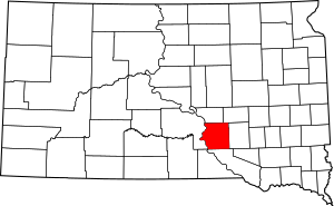
This is a list of the National Register of Historic Places listings in Brule County, South Dakota.
This is intended to be a complete list of the properties on the National Register of Historic Places in Brule County, South Dakota, United States. The locations of National Register properties for which the latitude and longitude coordinates are included below, may be seen in a map.
There are 7 properties listed on the National Register in the county. Two other site that were once listed have been removed.
Current listings
| Name on the Register | Image | Date listed | Location | City or town | Description | |
|---|---|---|---|---|---|---|
| 1 | Ashley Shanty and Privy |
(#99001580) |
RR1, Box 100 43°45′36″N 99°05′03″W / 43.76°N 99.084167°W |
Pukwana | part of the Federal Relief Construction in South Dakota Multiple Property Submission (MPS) | |
| 2 | Chamberlain Bridge |
(#01000999) |
Interstate 90 loop over the Missouri River 43°48′41″N 99°20′14″W / 43.811389°N 99.337222°W |
Chamberlain | part of the Historic Bridges in South Dakota MPS | |
| 3 | Chamberlain Rest Stop Tipi |
(#14001177) |
I-90 between exits 263 & 265 43°47′12″N 99°20′24″W / 43.786645°N 99.340064°W |
Chamberlain vicinity | ||
| 4 | Robert A. Crawford House |
(#94001392) |
204 16th Ave., W. 43°48′02″N 99°20′21″W / 43.800422°N 99.339199°W |
Chamberlain | ||
| 5 | Dunlap Methodist Episcopal Church |
(#01000666) |
Junction of 369th Ave. and 264th St. 43°33′27″N 98°49′59″W / 43.5575°N 98.833056°W |
Platte | ||
| 6 | Holy Trinity Church |
(#83004205) |
Off Interstate 90 43°44′18″N 98°57′28″W / 43.738333°N 98.957778°W |
Kimball | ||
| 7 | Edward Morrison House |
(#05000945) |
624 Main St. 43°46′37″N 99°10′52″W / 43.776944°N 99.181111°W |
Pukwana |
Former listings
| Name on the Register | Image | Date listed | Date removed | Location | City or town | Summary | |
|---|---|---|---|---|---|---|---|
| 1 | O.G. Bradshaw Elevator |
(#12000034) |
|
220 W. Railroad St. 43°44′56″N 98°57′26″W / 43.748855°N 98.957292°W |
Kimball | ||
| 2 | Taft Hotel |
(#86000243) |
|
200 S. Main |
Chamberlain |

All content from Kiddle encyclopedia articles (including the article images and facts) can be freely used under Attribution-ShareAlike license, unless stated otherwise. Cite this article:
National Register of Historic Places listings in Brule County, South Dakota Facts for Kids. Kiddle Encyclopedia.


