National Register of Historic Places listings in Brunswick County, North Carolina facts for kids
This list includes properties and districts listed on the National Register of Historic Places in Brunswick County, North Carolina. Click the "Map of all coordinates" link to the right to view an online map of all properties and districts with latitude and longitude coordinates in the table below.
Current listings
| Name on the Register | Image | Date listed | Location | City or town | Description | |
|---|---|---|---|---|---|---|
| 1 | Bald Head Creek Boathouse |
(#97001496) |
Smith's Island, mouth of Cape Fear R 33°51′41″N 77°59′11″W / 33.861389°N 77.986389°W |
Smith's Island | ||
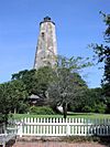
| 2 | Bald Head Island Lighthouse |
(#75001242) |
S of Southport on Smith's Island at Bald Head 33°52′24″N 78°00′03″W / 33.873333°N 78.000833°W |
Southport | Known as "Old Baldy"; oldest lighthouse in North Carolina | |
| 3 | Brunswick County Courthouse |
(#79001663) |
Davis and Moore Sts. 33°55′08″N 78°01′05″W / 33.918889°N 78.018056°W |
Southport | ||
| 4 | Brunswick Town Historic District |
(#78001932) |
N of Southport off SR 133 34°02′27″N 77°56′41″W / 34.040833°N 77.944722°W |
Southport | ||
| 5 | Cape Fear Civil War Shipwreck Discontiguous District |
(#85003195) |
Address Restricted |
Holden Beach | ||
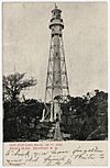
| 6 | Cape Fear Lighthouse Complex |
(#78001931) |
S of Kure Beach 33°50′41″N 77°58′02″W / 33.844722°N 77.967222°W |
Kure Beach | ||
| 7 | Fort Caswell Historic District |
(#13001025) |
100 Caswell Beach Rd. 33°53′28″N 78°01′41″W / 33.8911753°N 78.0280691°W |
Caswell Beach vicinity | ||
| 8 | Fort Johnston |
(#74001327) |
Moore St. 33°55′05″N 78°01′03″W / 33.918169°N 78.017511°W |
Southport | ||
| 9 | Oak Island Life Saving Station |
(#00001553) |
217 Caswell Beach Rd. 33°53′29″N 78°02′01″W / 33.891389°N 78.033611°W |
Caswell Beach | ||
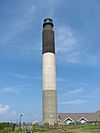
| 10 | Oak Island Lighthouse |
(#07000293) |
300A Caswell Beach Rd., N of NC 133 33°53′33″N 78°02′07″W / 33.8925°N 78.035278°W |
Caswell Beach | ||
| 11 | New Hope Presbyterian Church |
(#11000888) |
800 Cherrytree Rd., NE 34°08′09″N 78°07′09″W / 34.135833°N 78.119133°W |
Winnabow vicinity | ||
| 12 | Orton Plantation |
(#73001294) |
On Cape Fear River at jct. of NC 1530 and 1529; also 9149 Orton Road 34°03′31″N 77°56′44″W / 34.058611°N 77.945556°W |
Smithville Township | Second set of boundaries represents a boundary increase of September 20, 2013 | |
| 13 | Southport Historic District |
(#80002801) |
Roughly bounded by Cape Fear River, Rhett, Bay, Short and Brown Sts. 33°55′09″N 78°01′13″W / 33.919242°N 78.020325°W |
Southport | ||
| 14 | St. Philip's Church Ruins |
(#70000442) |
S of Orton off NC 1533 34°02′32″N 77°56′55″W / 34.042222°N 77.948611°W |
Orton | ||
| 15 | T. B. McCLINTIC |
(#94000532) |
Tripp's Marina 33°54′53″N 78°22′33″W / 33.914722°N 78.375833°W |
Shallotte Point |

All content from Kiddle encyclopedia articles (including the article images and facts) can be freely used under Attribution-ShareAlike license, unless stated otherwise. Cite this article:
National Register of Historic Places listings in Brunswick County, North Carolina Facts for Kids. Kiddle Encyclopedia.


