National Register of Historic Places listings in Brunswick County, Virginia facts for kids
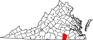
This is a list of the National Register of Historic Places listings in Brunswick County, Virginia.
This is intended to be a complete list of the properties and districts on the National Register of Historic Places in Brunswick County, Virginia, United States. The locations of National Register properties and districts for which the latitude and longitude coordinates are included below, may be seen in an online map.
There are 12 properties and districts listed on the National Register in the county. Another property was once listed but has been removed.
Current listings
| Name on the Register | Image | Date listed | Location | City or town | Description | |
|---|---|---|---|---|---|---|
| 1 | Brick House |
(#82004544) |
VA 659 36°38′58″N 77°59′14″W / 36.649444°N 77.987222°W |
White Plains | ||
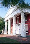
| 2 | Brunswick County Courthouse Square |
(#74002110) |
202, 216, 228, and 234 N. Main St. 36°45′31″N 77°50′48″W / 36.758611°N 77.846667°W |
Lawrenceville | ||
| 3 | Church Home for Aged, Infirm and Disabled Colored People |
(#04000910) |
236 Pleasant Grove Rd. 36°44′47″N 77°52′52″W / 36.746389°N 77.881111°W |
Brodnax | ||
| 4 | Fort Christanna |
(#80004175) |
Fort Hill Rd. southwest of Lawrenceville 36°42′48″N 77°52′15″W / 36.713333°N 77.870833°W |
Lawrenceville | ||
| 5 | Gholson Bridge |
(#78003010) |
S of Lawrenceville on VA 715 at Meherrin River 36°43′01″N 77°49′52″W / 36.716944°N 77.831222°W |
Lawrenceville | ||
| 6 | Hobson's Choice |
(#80004174) |
E of Alberta on VA 606 36°52′19″N 77°48′58″W / 36.872083°N 77.816111°W |
Alberta | ||
| 7 | Lawrenceville Historic District |
(#00000313) |
Roughly bounded by W. Sixth Ave., Maria St., Lawrenceville townline, Rose Creek, and Thomas St. 36°45′29″N 77°50′50″W / 36.758056°N 77.847222°W |
Lawrenceville | ||
| 8 | Mason-Tillett House |
(#03001443) |
1050 Christanna Highway 36°33′33″N 77°48′13″W / 36.559028°N 77.803611°W |
Valentines | ||
| 9 | Rocky Run Methodist Church |
(#95000828) |
VA 616, 1.8 mi. E of jct. with VA 46 36°55′55″N 77°56′21″W / 36.931944°N 77.939167°W |
Alberta | ||
| 10 | St. Paul's College |
(#79003032) |
St. Paul's College campus 36°45′40″N 77°50′59″W / 36.761111°N 77.849722°W |
Lawrenceville | ||
| 11 | St. Paul's School |
(#04000037) |
Brunswick Dr. at Interstate 85 36°49′31″N 77°57′30″W / 36.825278°N 77.958472°W |
Meredithville |
Former listing
| Name on the Register | Image | Date listed | Date removed | Location | City or town | Summary | |
|---|---|---|---|---|---|---|---|
| 1 | Bentfield |
(#74002109) |
|
SW of Lawrenceville off U.S. 58 and VA 656 |
Lawrenceville | Destroyed by fire in 1974 |

All content from Kiddle encyclopedia articles (including the article images and facts) can be freely used under Attribution-ShareAlike license, unless stated otherwise. Cite this article:
National Register of Historic Places listings in Brunswick County, Virginia Facts for Kids. Kiddle Encyclopedia.


