National Register of Historic Places listings in Claiborne Parish, Louisiana facts for kids
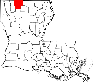
This is a list of the National Register of Historic Places listings in Claiborne Parish, Louisiana.
This is intended to be a complete list of the properties on the National Register of Historic Places in Claiborne Parish, Louisiana, United States. The locations of National Register properties for which the latitude and longitude coordinates are included below, may be seen in a map.
There are 11 properties listed on the National Register in the parish.
Current listings
| Name on the Register | Image | Date listed | Location | City or town | Description | |
|---|---|---|---|---|---|---|
| 1 | Arizona Methodist Church |
(#83003608) |
Louisiana Highway 806 32°47′17″N 92°57′26″W / 32.788056°N 92.957222°W |
Arizona | ||
| 2 | J.W. Burnham House |
(#86003671) |
Off U.S. Route 79 32°56′57″N 93°04′47″W / 32.949167°N 93.079722°W |
Haynesville | ||
| 3 | Capers-McKenzie House |
(#83000496) |
N. 5th St. 32°47′46″N 93°03′28″W / 32.796111°N 93.057778°W |
Homer | ||
| 4 | Claiborne Parish Courthouse |
(#81000291) |
Courthouse Sq. 32°47′28″N 93°03′18″W / 32.791111°N 93.055°W |
Homer | ||
| 5 | Friendship CME Church |
(#16000297) |
1055 Friendship Rd. Coordinates missing |
Lisbon | ||
| 6 | Homer Historic District |
(#86001994) |
Roughly bounded by N. 2nd, E. Main, S. 3rd, and W. Main Sts. 32°47′28″N 93°03′18″W / 32.791111°N 93.055°W |
Homer | ||
| 7 | Killgore House |
(#87000731) |
Junction of Louisiana Highways 2 and 518 32°47′44″N 92°52′19″W / 32.795556°N 92.871944°W |
Lisbon | ||
| 8 | Monk House |
(#91001081) |
Louisiana Highway 9 and Claiborne Parish Route 39 32°53′21″N 92°57′55″W / 32.889167°N 92.965278°W |
Homer | ||
| 9 | Dr. John W. Todd House |
(#86003683) |
306 Pine St. 32°47′24″N 93°02′49″W / 32.79°N 93.046944°W |
Homer | ||
| 10 | Tulip Methodist Church |
(#87001367) |
Off Louisiana Highway 518 32°40′55″N 92°59′00″W / 32.681944°N 92.983333°W |
Marsalis | ||
| 11 | Alberry Wasson Homeplace |
(#82002766) |
1½ miles south of Summerfield 32°53′40″N 92°50′28″W / 32.894444°N 92.841111°W |
Summerfield |

All content from Kiddle encyclopedia articles (including the article images and facts) can be freely used under Attribution-ShareAlike license, unless stated otherwise. Cite this article:
National Register of Historic Places listings in Claiborne Parish, Louisiana Facts for Kids. Kiddle Encyclopedia.


