National Register of Historic Places listings in Conejos County, Colorado facts for kids
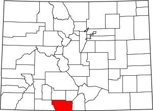
This is a list of the National Register of Historic Places listings in Conejos County, Colorado.
This is intended to be a complete list of the properties and districts on the National Register of Historic Places in Conejos County, Colorado, United States. The locations of National Register properties and districts for which the latitude and longitude coordinates are included below, may be seen in a map.
There are 13 properties and districts listed on the National Register in the county, including 2 National Historic Landmark.
| Adams - Alamosa - Arapahoe - Archuleta - Baca - Bent - Boulder - Broomfield - Chaffee - Cheyenne - Clear Creek - Conejos - Costilla - Crowley - Custer - Delta - Denver - Dolores - Douglas - Eagle - El Paso - Elbert - Fremont - Garfield - Gilpin - Grand - Gunnison - Hinsdale - Huerfano - Jackson - Jefferson - Kiowa - Kit Carson - La Plata - Lake - Larimer - Las Animas - Lincoln - Logan - Mesa - Mineral - Moffat - Montezuma - Montrose - Morgan - Otero - Ouray - Park - Phillips - Pitkin - Prowers - Pueblo - Rio Blanco - Rio Grande - Routt - Saguache - San Juan - San Miguel - Sedgwick - Summit - Teller - Washington - Weld - Yuma |
Current listings
| Name on the Register | Image | Date listed | Location | City or town | Description | |
|---|---|---|---|---|---|---|
| 1 | Costilla Crossing Bridge |
(#85000194) |
County Road over the Rio Grande 37°04′43″N 105°45′22″W / 37.078611°N 105.756111°W |
Antonito | Built 1892, rehabilitated 2006 [1] | |
| 2 | Denver & Rio Grande Railroad San Juan Extension |
(#73000462) |
Between Antonito and Chama, New Mexico via Cumbres Pass 36°51′56″N 106°23′56″W / 36.865556°N 106.398889°W |
Antonito | Now a scenic railway, the Cumbres and Toltec Scenic Railroad; extends into Archuleta County | |
| 3 | Engine No. 463 |
(#75000502) |
Off U.S. Route 285 37°04′12″N 106°00′38″W / 37.07°N 106.010556°W |
Antonito | ||
| 4 | La Jara Depot |
(#75000503) |
Broadway and Main Sts. 37°16′31″N 105°57′35″W / 37.275278°N 105.959722°W |
La Jara | ||
| 5 | McIntire Ranch |
(#08000204) |
Approximately 1.5 miles north of County Road V 37°16′50″N 105°49′05″W / 37.280556°N 105.818056°W |
Sanford | ||
| 6 | Palace Hotel |
(#94001013) |
429 Main St. 37°04′35″N 106°00′30″W / 37.076389°N 106.008333°W |
Antonito | ||
| 7 | Pike's Stockade |
(#66000244) |
4 miles east of Sanford on State Highway 136 37°17′37″N 105°48′36″W / 37.293611°N 105.81°W |
Sanford | ||
| 8 | Rio Grande Engine No. 168 |
(#79000601) |
5234B U.S. 285 37°04′07″N 106°00′50″W / 37.068611°N 106.013750°W |
Antonito | ||
| 9 | S.P.M.D.T.U. Concilio Superior |
(#01000322) |
603 Main St. 37°04′35″N 106°00′30″W / 37.076389°N 106.008333°W |
Antonito | ||
| 10 | Warshauer Mansion |
(#74000564) |
515 River St. 37°04′34″N 106°00′36″W / 37.076111°N 106.01°W |
Antonito |

All content from Kiddle encyclopedia articles (including the article images and facts) can be freely used under Attribution-ShareAlike license, unless stated otherwise. Cite this article:
National Register of Historic Places listings in Conejos County, Colorado Facts for Kids. Kiddle Encyclopedia.


