National Register of Historic Places listings in Cullman County, Alabama facts for kids
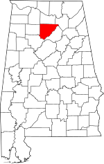
This is a list of the National Register of Historic Places listings in Cullman County, Alabama.
This is intended to be a complete list of the properties and districts on the National Register of Historic Places in Cullman County, Alabama, United States. Latitude and longitude coordinates are provided for many National Register properties and districts; these locations may be seen together in a Google map.
There are 9 properties and districts listed on the National Register in the county.
| Name on the Register | Image | Date listed | Location | City or town | Description | |
|---|---|---|---|---|---|---|
| 1 | Ave Maria Grotto |
(#84000610) |
St. Bernard Abbey 34°10′28″N 86°48′58″W / 34.174444°N 86.816111°W |
Cullman | ||
| 2 | Clarkson Bridge |
(#74000408) |
West of Cullman 34°12′27″N 86°59′28″W / 34.2075°N 86.991111°W |
Cullman | ||
| 3 | Crane Hill Masonic Lodge |
(#01001294) |
14538 County Road 222 34°05′49″N 87°03′16″W / 34.097083°N 87.0545°W |
Crane Hill | ||
| 4 | Cullman Downtown Commercial Historic District |
(#85000738) |
Roughly bounded by 4th and 1st Aves. and 2nd and 5th Sts., SE. 34°10′33″N 86°50′24″W / 34.175826°N 86.840036°W |
Cullman | ||
| 5 | Cullman Historic District |
(#84000615) |
Roughly bounded by 1st and 8th Aves. and 3rd and 9th Sts. 34°10′26″N 86°49′58″W / 34.173855°N 86.832762°W |
Cullman | ||
| 6 | Ernest Edward Greene House |
(#92001828) |
105 6th Ave., SE. 34°10′45″N 86°50′16″W / 34.179167°N 86.837778°W |
Cullman | ||
| 7 | Louisville and Nashville Railroad Depot |
(#76000320) |
309 1st Ave., NE. 34°10′48″N 86°50′39″W / 34.18°N 86.844167°W |
Cullman | ||
| 8 | Shady Grove Methodist Church and Cemetery |
(#02001067) |
Ruby Community 3.7 miles west of Logan 34°08′29″N 87°02′08″W / 34.141389°N 87.035556°W |
Logan | ||
| 9 | Stiefelmeyer's |
(#83003444) |
202 1st Ave., SE. 34°10′35″N 86°50′32″W / 34.176389°N 86.842222°W |
Cullman |

All content from Kiddle encyclopedia articles (including the article images and facts) can be freely used under Attribution-ShareAlike license, unless stated otherwise. Cite this article:
National Register of Historic Places listings in Cullman County, Alabama Facts for Kids. Kiddle Encyclopedia.


