National Register of Historic Places listings in Custer County, Nebraska facts for kids
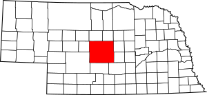
This is a list of the National Register of Historic Places listings in Custer County, Nebraska. It is intended to be a complete list of the properties and districts on the National Register of Historic Places in Custer County, Nebraska, United States. The locations of National Register properties and districts for which the latitude and longitude coordinates are included below, may be seen in a map.
There are 14 properties and districts listed on the National Register in the county. Another three sites were once listed but have since been removed.
Listings county-wide
| Name on the Register | Image | Date listed | Location | City or town | Description | |
|---|---|---|---|---|---|---|
| 1 | Arrow Hotel |
(#85002145) |
509 S. 9th Ave. 41°24′06″N 99°38′26″W / 41.401667°N 99.640556°W |
Broken Bow | ||
| 2 | Brenizer Library |
(#07000654) |
430 W. Center Ave. 41°29′04″N 99°45′41″W / 41.484444°N 99.761389°W |
Merna | ||
| 3 | Broken Bow Carnegie Library |
(#98000193) |
255 S. 10th St. 41°24′12″N 99°38′30″W / 41.403333°N 99.641667°W |
Broken Bow | ||
| 4 | Broken Bow Commercial Square Historic District |
(#06001058) |
Five blocks in downtown Broken Bow centered around the public square 41°24′08″N 99°38′25″W / 41.402222°N 99.640278°W |
Broken Bow | ||
| 5 | Custer County Courthouse and Jail |
(#79001435) |
Courthouse Square, Main St. 41°24′09″N 99°38′32″W / 41.4025°N 99.642222°W |
Broken Bow | ||
| 6 | William R. Dowse House |
(#86003365) |
80560 Oak Grove Road 41°30′40″N 99°15′40″W / 41.511111°N 99.261111°W |
Comstock | ||
| 7 | Finch Memorial Library |
(#15000392) |
205 N. Walnut St. 41°25′26″N 100°11′40″W / 41.4240°N 100.1944°W |
Arnold | ||
| 8 | First Custer County Courthouse |
(#89002213) |
Pacific St. and Cameron Ave. 41°17′33″N 99°55′22″W / 41.2925°N 99.922778°W |
Callaway | ||
| 9 | First National Bank-Steinmeier Building |
(#11000527) |
624 Main St. 41°17′17″N 99°22′53″W / 41.288111°N 99.3815°W |
Ansley | ||
| 10 | Stillman P. Groat House |
(#15000105) |
432 N. 10th Ave. 41°24′32″N 99°38′29″W / 41.408753°N 99.641335°W |
Broken Bow | ||
| 11 | Benjamin and Mary Kellenbarger House |
(#07000659) |
451 W. Center Ave. 41°29′02″N 99°45′51″W / 41.483889°N 99.764167°W |
Merna | ||
| 12 | Mason City School |
(#06000103) |
750 Main St. 41°13′14″N 99°18′02″W / 41.220556°N 99.300556°W |
Mason City | ||
| 13 | St. Anselm's Catholic Church, Rectory and Parish Hall |
(#08000170) |
Nebraska Highway 2 41°36′58″N 99°51′59″W / 41.616111°N 99.866389°W |
Anselmo | ||
| 14 | Sargent Bridge |
(#92000740) |
Dawson St. over the Middle Loup River, 1 mile south of Sargent 41°37′38″N 99°22′18″W / 41.627222°N 99.371667°W |
Sargent | ||
| 15 | Security State Bank Building |
(#87002072) |
403 S. 9th St. 41°24′09″N 99°38′26″W / 41.4025°N 99.640556°W |
Broken Bow |
Former listings
| Name on the Register | Image | Date listed | Date removed | Location | City or town | Summary | |
|---|---|---|---|---|---|---|---|
| 1 | Haumont House |
(#69000368) |
|
NE of Broken Bow |
Broken Bow vicinity | ||
| 2 | Wescott, Gibbons & Bragg Store |
(#78001694) |
|
Off Nebraska Highway 106 |
Comstock |

All content from Kiddle encyclopedia articles (including the article images and facts) can be freely used under Attribution-ShareAlike license, unless stated otherwise. Cite this article:
National Register of Historic Places listings in Custer County, Nebraska Facts for Kids. Kiddle Encyclopedia.


