National Register of Historic Places listings in Ellis County, Kansas facts for kids
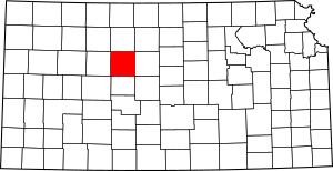
This is a list of the National Register of Historic Places listings in Ellis County, Kansas.
This is intended to be a complete list of the properties and districts on the National Register of Historic Places in Ellis County, Kansas, United States. The locations of National Register properties and districts for which the latitude and longitude coordinates are included below, may be seen in a map.
There are 20 properties and districts listed on the National Register in the county. Another 2 properties were once listed have been removed.
Current listings
| Name on the Register | Image | Date listed | Location | City or town | Description | |
|---|---|---|---|---|---|---|
| 1 | Justus Bissing, Jr. Historic District |
(#03001495) |
502-504 W. 12th St. 38°52′31″N 99°20′13″W / 38.875348°N 99.336899°W |
Hays | ||
| 2 | Brungardt-Dreiling Farmstead |
(#16000704) |
2567 Golf Course Rd. 38°51′24″N 99°08′20″W / 38.856766°N 99.138838°W |
Victoria | ||
| 3 | Chestnut Street Historic District |
(#06000621) |
Main, W. 9th, W. 10th, W. 11th, E. 11th, and E. 12th Sts. Boundary increase (listed May 24, 2011): 1302 Main St. 38°56′12″N 99°33′37″W / 38.936667°N 99.560278°W |
Hays | ||
| 4 | Walter P. Chrysler House |
(#72000495) |
104 W. 10th St. 38°56′11″N 99°33′39″W / 38.936517°N 99.560937°W |
Ellis | ||
| 5 | Drees House |
(#01000183) |
100 E. 19th St. 38°52′42″N 99°19′34″W / 38.878214°N 99.32603°W |
Hays | ||
| 6 | Ellis Congregational Church |
(#00000156) |
Eighth and Washington Sts. 38°56′26″N 99°33′38″W / 38.940496°N 99.560574°W |
Ellis | ||
| 7 | First Presbyterian Church |
(#73000753) |
100 W. 7th St. 38°52′15″N 99°19′50″W / 38.870833°N 99.330556°W |
Hays | ||
| 8 | Fort Fletcher Stone Arch Bridge |
(#01000385) |
4.8 miles (7.7 km) south of Walker, Walker Ave. 38°47′53″N 99°04′39″W / 38.798056°N 99.0775°W |
Walker | ||
| 9 | Fort Hays |
(#71000314) |
Frontier Historical Park 38°51′46″N 99°20′06″W / 38.862778°N 99.335°W |
Hays | ||
| 10 | Gallagher House |
(#01000184) |
310 E. 20th St. 38°52′39″N 99°19′18″W / 38.877401°N 99.321535°W |
Hays | ||
| 11 | George Grant Villa |
(#72000496) |
2680 Grants Villa Road 38°46′05″N 99°07′10″W / 38.76808°N 99.119575°W |
Victoria | ||
| 12 | Memorial City Hall |
(#07000142) |
911 Washington St. 38°56′18″N 99°33′36″W / 38.938434°N 99.559938°W |
Ellis | ||
| 13 | Merchants Bank of Ellis |
(#02000428) |
822 Washington St. 38°56′20″N 99°33′38″W / 38.939016°N 99.560504°W |
Ellis | ||
| 14 | J.A. Mermis House |
(#09000190) |
1401 Ash Street 38°52′33″N 99°19′56″W / 38.875971°N 99.332165°W |
Hays | ||
| 15 | Papes Barn |
(#15000689) |
890 Ellis Ave. 38°48′39″N 99°33′25″W / 38.810778°N 99.556970°W |
Ellis vicinity | ||
| 16 | Phillip Hardware Store |
(#82002658) |
719 Main St. 38°52′14″N 99°19′54″W / 38.870533°N 99.331687°W |
Hays | ||
| 17 | St. Fidelis Catholic Church |
(#71000315) |
Southeastern corner of St. Anthony and Delaware Sts. 38°51′24″N 99°09′01″W / 38.856667°N 99.150278°W |
Victoria | ||
| 18 | St. Joseph's Church and Parochial School |
(#08001066) |
210 and 217 W. 13th St. 38°51′24″N 99°09′01″W / 38.856667°N 99.150278°W |
Hays |
Former listings
| Name on the Register | Image | Date listed | Date removed | Location | City or town | Summary | |
|---|---|---|---|---|---|---|---|
| 1 | Krueger Building |
(#06000111) |
|
811 Fort St. 38°52′13″N 99°20′01″W / 38.870278°N 99.333611°W |
Hays | Demolished in 2012 | |
| 2 | Madden Elevator |
(#82002657) |
|
117 E. 9th St. |
Hays |

All content from Kiddle encyclopedia articles (including the article images and facts) can be freely used under Attribution-ShareAlike license, unless stated otherwise. Cite this article:
National Register of Historic Places listings in Ellis County, Kansas Facts for Kids. Kiddle Encyclopedia.


