
National Register of Historic Places listings in Fairbanks North Star Borough, Alaska facts for kids

This is a list of the National Register of Historic Places listings in Fairbanks North Star Borough, Alaska.
This is intended to be a complete list of the properties and districts on the National Register of Historic Places in Fairbanks North Star Borough, Alaska, United States. The locations of National Register properties and districts for which the latitude and longitude coordinates are included below, may be seen in an online map.
There are 32 properties and districts listed on the National Register in the borough, including 3 National Historic Landmarks.
Current listings
| Name on the Register | Image | Date listed | Location | City or town | Description | |
|---|---|---|---|---|---|---|
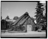
| 1 | Chatanika Gold Camp |
 |
(#79003753) |
Mile 27¾ on the Steese Highway 65°06′40″N 147°28′41″W / 65.111°N 147.478°W |
Chatanika | |
| 2 | Chena Pump House |
 |
(#82004900) |
796 Chena Pump Road 64°49′53″N 147°53′05″W / 64.831389°N 147.884722°W |
Fairbanks | |
| 3 | Chugwater Site |
(#79003754) |
On Moose Creek Bluff, 35 kilometres (22 mi) southeast of Fairbanks 64°41′30″N 147°13′05″W / 64.6917°N 147.2181°W |
North Pole | ||
| 4 | Old City Hall |
 |
(#02000561) |
410 Cushman Street 64°50′31″N 147°43′15″W / 64.841833°N 147.72075°W |
Fairbanks | |
| 5 | Clay Street Cemetery (AHRS Site No. FAI-164) |
 |
(#82001619) |
Seventh Avenue and Clay Street 64°50′29″N 147°42′25″W / 64.841389°N 147.706944°W |
Fairbanks | |
| 6 | Constitution Hall |
 |
(#05001196) |
University of Alaska Fairbanks campus 64°51′26″N 147°49′19″W / 64.857306°N 147.821833°W |
Fairbanks | |
| 7 | Mary Lee Davis House |
 |
(#82004901) |
410 Cowles Street 64°50′36″N 147°43′51″W / 64.84325°N 147.730806°W |
Fairbanks | |
| 8 | Discovery Claim on Pedro Creek |
.JPG) |
(#92000498) |
Mile 16.5 on the Steese Highway 65°00′31″N 147°29′59″W / 65.008611°N 147.499722°W |
Fairbanks | |
| 9 | Ester Camp Historic District |
 |
(#87000703) |
Off Alaska Route 3 64°50′47″N 148°01′09″W / 64.846389°N 148.019167°W |
Ester | |
| 10 | F.E. Company Housing |
 |
(#97000400) |
505, 507, 521, and 523 Illinois Street 64°51′02″N 147°43′04″W / 64.850556°N 147.717778°W |
Fairbanks | |
| 11 | F.E. Company Machine Shop |
 |
(#95001164) |
behind 612 Illinois Street 64°51′07″N 147°43′20″W / 64.851944°N 147.722298°W |
Fairbanks | |
| 12 | F.E. Company Manager's House |
 |
(#96000095) |
757 Illinois Street 64°51′11″N 147°42′58″W / 64.852944°N 147.716083°W |
Fairbanks | |
| 13 | F.E. Company Dredge No. 2 |
(#99000763) |
Fairbanks Creek 65°02′33″N 147°05′33″W / 65.0425°N 147.0925°W |
Fairbanks | ||
| 14 | F.E. Company Gold Dredge No. 5 |
(#04000186) |
Upper Dome Creek 65°01′51″N 147°34′23″W / 65.030833°N 147.573056°W |
Fairbanks | Scrapped c. 2012. | |
| 15 | Federal Building |
 |
(#78003422) |
250 Cushman Street 64°50′35″N 147°43′17″W / 64.843056°N 147.721389°W |
Fairbanks | |
| 16 | Goldstream Dredge No. 8 |
.jpg) |
(#84000637) |
1755 Old Steese Highway North (mile 9 on the Steese Highway in Goldstream Valley) 64°56′14″N 147°39′26″W / 64.937222°N 147.657222°W |
Fairbanks | |
| 17 | Harding Railroad Car |
 |
(#78003423) |
Pioneer Park, 2300 Airport Way 64°50′17″N 147°46′20″W / 64.838056°N 147.772222°W |
Fairbanks | Pullman passenger-observation car Denali (Alaska Railroad No. X-336) |
| 18 | Hinckley–Creamer Dairy |
 |
(#77001572) |
College Road 64°51′53″N 147°44′11″W / 64.864722°N 147.736389°W |
Fairbanks | |
| 19 | Illinois Street Historic District |
 |
(#01000966) |
300-700 Illinois Street 64°51′07″N 147°43′03″W / 64.851944°N 147.7175°W |
Fairbanks | |
| 20 | Immaculate Conception Church |
.jpg) |
(#76002278) |
115 North Cushman Street 64°50′43″N 147°43′18″W / 64.845278°N 147.721667°W |
Fairbanks | |
| 21 | Falcon Joslin House |
 |
(#80004567) |
413 Cowles Street 64°50′35″N 147°43′49″W / 64.843°N 147.730361°W |
Fairbanks | |
| 22 | Lacey Street Theatre |
.JPG) |
(#90000878) |
504 Second Avenue 64°50′38″N 147°43′04″W / 64.843889°N 147.717778°W |
Fairbanks | |
| 23 | Ladd Field |
 |
(#85002730) |
Fort Wainwright 64°50′18″N 147°36′48″W / 64.838333°N 147.613333°W |
Fairbanks | |
| 24 | Main School |
 |
(#90001472) |
800 Cushman Street 64°50′23″N 147°43′15″W / 64.839722°N 147.720833°W |
Fairbanks | Now City Hall. |
| 25 | Masonic Temple |
.jpg) |
(#80004568) |
809 First Avenue 64°50′39″N 147°43′36″W / 64.844167°N 147.726667°W |
Fairbanks | |
| 26 | NENANA (steamer) |
_Fairbanks,_Alaska.jpg) |
(#72001581) |
Pioneer Park, 2300 Airport Way 64°50′19″N 147°46′20″W / 64.838611°N 147.772222°W |
Fairbanks | |
| 27 | Oddfellows House |
 |
(#80004569) |
825 First Avenue 64°50′40″N 147°43′39″W / 64.844472°N 147.727444°W |
Fairbanks | |
| 28 | Rainey's Cabin |
 |
(#75002158) |
University of Alaska campus 64°51′32″N 147°49′55″W / 64.858944°N 147.831833°W |
College | |
| 29 | Rose Building |
 |
(#92000444) |
520 Church Street 64°50′47″N 147°43′09″W / 64.846389°N 147.719167°W |
Fairbanks | Reported to have been demolished; address has disappeared. |
| 30 | St. Matthew's Episcopal Church |
 |
(#16000001) |
1029 1st Ave. 64°50′45″N 147°43′50″W / 64.845833°N 147.730613°W |
Fairbanks | |
| 31 | George C. Thomas Memorial Library |
 |
(#72001542) |
901 First Avenue 64°50′41″N 147°43′41″W / 64.844722°N 147.728056°W |
Fairbanks | |
| 32 | Wickersham House |
.jpg) |
(#79003757) |
Pioneer Park, 2300 Airport Way 64°50′19″N 147°46′16″W / 64.838556°N 147.771139°W |
Fairbanks |

All content from Kiddle encyclopedia articles (including the article images and facts) can be freely used under Attribution-ShareAlike license, unless stated otherwise. Cite this article:
National Register of Historic Places listings in Fairbanks North Star Borough, Alaska Facts for Kids. Kiddle Encyclopedia.