National Register of Historic Places listings in Grant County, Arkansas facts for kids
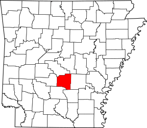
This is a list of the National Register of Historic Places listings in Grant County, Arkansas.
This is intended to be a complete list of the properties on the National Register of Historic Places in Grant County, Arkansas, United States. The locations of National Register properties for which the latitude and longitude coordinates are included below, may be seen in a map.
There are 10 properties listed on the National Register in the county, including 1 National Historic Landmark.
Current listings
| Name on the Register | Image | Date listed | Location | City or town | Description | |
|---|---|---|---|---|---|---|
| 1 | Dr. John L. Butler House |
(#86002848) |
313 Oak St. 34°18′35″N 92°24′06″W / 34.309722°N 92.401667°W |
Sheridan | ||
| 2 | Samuel D. Byrd, Sr., Homestead |
(#04001494) |
15966 US 270, W. 34°20′30″N 92°39′43″W / 34.341667°N 92.661944°W |
Poyen | ||
| 3 | Glaser-Kelly House |
(#91000583) |
310 N. Oak St. 34°18′35″N 92°24′03″W / 34.309722°N 92.400833°W |
Sheridan | ||
| 4 | Jenkins' Ferry Battleground |
(#70000120) |
Northeast of Leola on Highway 46 34°11′53″N 92°34′00″W / 34.198056°N 92.566667°W |
Leola | One of the Camden Expedition Sites, a National Historic Landmark consisting of sites in several counties | |
| 5 | Koon House #1 |
(#99001249) |
Junction of US 167 and County Road 523 34°16′29″N 92°23′57″W / 34.274722°N 92.399167°W |
Sheridan | ||
| 6 | Koon House #2 |
(#99001248) |
2959 US 167 34°16′04″N 92°23′58″W / 34.267778°N 92.399444°W |
Sheridan | ||
| 7 | Koon House #3 |
(#99001247) |
2988 US 167 34°16′04″N 92°23′57″W / 34.267778°N 92.399167°W |
Sheridan | Demolished | |
| 8 | Koon House #4 |
(#99001246) |
3004 US 167 34°16′03″N 92°23′57″W / 34.2675°N 92.399167°W |
Sheridan | Demolished | |
| 9 | Koon House #6 |
(#99001245) |
3253 US 167 34°15′49″N 92°23′58″W / 34.263611°N 92.399444°W |
Sheridan | ||
| 10 | Oak Grove School |
(#91000693) |
U.S. Route 270, 6 miles east of Sheridan 34°18′57″N 92°16′51″W / 34.315833°N 92.280833°W |
Oak Grove |

All content from Kiddle encyclopedia articles (including the article images and facts) can be freely used under Attribution-ShareAlike license, unless stated otherwise. Cite this article:
National Register of Historic Places listings in Grant County, Arkansas Facts for Kids. Kiddle Encyclopedia.


