National Register of Historic Places listings in Greensville County, Virginia facts for kids
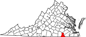
This is a list of the National Register of Historic Places listings in Greensville County, Virginia.
This is intended to be a complete list of the properties and districts on the National Register of Historic Places in Greensville County, Virginia, United States. The locations of National Register properties and districts for which the latitude and longitude coordinates are included below, may be seen in a Google map.
There are 3 properties and districts listed on the National Register in the county. Another property was once listed but has been removed.
Current listings
| Name on the Register | Image | Date listed | Location | City or town | Description | |
|---|---|---|---|---|---|---|
| 1 | Alexander Watson Batte House |
(#91000831) |
Southern side of Scotland Dr., 1500 feet west of its junction with Orion Rd. 36°48′03″N 77°33′18″W / 36.800972°N 77.555000°W |
Jarratt | ||
| 2 | John Green Archaeological Sites |
(#85000985) |
Address Restricted |
Emporia | ||
| 3 | Weaver House |
(#82004561) |
Otterdam Rd. 36°45′35″N 77°30′48″W / 36.759722°N 77.513333°W |
Cowie Corner |
Former listing
| Name on the Register | Image | Date listed | Date removed | Location | City or town | Summary | |
|---|---|---|---|---|---|---|---|
| 1 | Spring Hill |
(#85003094) |
|
State Route 730 |
Emporia | Demolished in 1999 |

All content from Kiddle encyclopedia articles (including the article images and facts) can be freely used under Attribution-ShareAlike license, unless stated otherwise. Cite this article:
National Register of Historic Places listings in Greensville County, Virginia Facts for Kids. Kiddle Encyclopedia.


