National Register of Historic Places listings in Hanover County, Virginia facts for kids
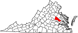
This is a list of the National Register of Historic Places listings in Hanover County, Virginia.
This is intended to be a complete list of the properties and districts on the National Register of Historic Places in Hanover County, Virginia, United States. The locations of National Register properties and districts for which the latitude and longitude coordinates are included below, may be seen in an online map.
There are 44 properties and districts listed on the National Register in the county, including 3 National Historic Landmarks.
Current listings
| Name on the Register | Image | Date listed | Location | City or town | Description | |
|---|---|---|---|---|---|---|
| 1 | Ashland Historic District |
(#83003284) |
Center, Racecourse, James, Howard, Clay Sts., Hanover and Railroad Aves. 37°45′30″N 77°28′50″W / 37.758333°N 77.480556°W |
Ashland | ||
| 2 | Ashland UDC Jefferson Davis Highway Marker |
(#13000642) |
Junction of Cedar Lane and the Washington Highway 37°41′22″N 77°27′46″W / 37.689444°N 77.462889°W |
Glen Allen | ||
| 3 | Beaverdam Depot |
(#88002060) |
On C & O RR tracks at jct. of VA 715 and 739 37°56′28″N 77°39′12″W / 37.941111°N 77.653333°W |
Beaverdam | ||
| 4 | Church Quarter |
(#00001436) |
12432 Old Ridge Rd. 37°50′54″N 77°31′31″W / 37.848472°N 77.525139°W |
Doswell | ||
| 5 | Clover Lea |
(#79003045) |
E of Mechanicsville off VA 629 37°38′36″N 77°11′05″W / 37.643472°N 77.184861°W |
Mechanicsville | ||
| 6 | Cold Harbor National Cemetery |
(#95000922) |
Jct. VA 156 and 619, .5 mi. E 37°35′22″N 77°16′48″W / 37.589444°N 77.280000°W |
Mechanicsville | ||
| 7 | Cool Well |
(#07000931) |
8198 Shady Grove Rd. 37°37′35″N 77°22′32″W / 37.626389°N 77.375556°W |
Mechanicsville | ||
| 8 | Dewberry |
(#96000576) |
Approximately 1 mi. NE of jct. of VA 738 and VA 601 37°53′41″N 77°35′22″W / 37.894722°N 77.589444°W |
Beaverdam | ||
| 9 | Fork Church |
(#70000801) |
At jct. of Rtes. 738 and 685 37°51′13″N 77°31′52″W / 37.853611°N 77.531111°W |
Ashland | ||
| 10 | Hanover County Courthouse |
(#69000247) |
Jct. of Rte. 1006 and U.S. 301 37°45′47″N 77°22′01″W / 37.763056°N 77.366944°W |
Hanover Court House | ||
| 11 | Hanover County Courthouse Historic District |
(#71000980) |
US 301 37°45′46″N 77°22′00″W / 37.762778°N 77.366667°W |
Hanover | ||
| 12 | Hanover Meeting House |
(#91001089) |
6411 Heatherwood Dr. 37°38′42″N 77°19′50″W / 37.645000°N 77.330556°W |
Mechanicsville | Site of the first non-Anglican church in Virginia | |
| 13 | Hanover Town |
(#74002122) |
River Rd. on the western side of the Pamunkey River 37°41′52″N 77°14′46″W / 37.697778°N 77.246111°W |
Mechanicsville | ||
| 14 | Hanover Wayside |
(#02001365) |
8225 Hanover Wayside Rd. 37°42′08″N 77°22′56″W / 37.702222°N 77.382222°W |
Hanover | ||
| 15 | Hickory Hill |
(#74002121) |
E of Ashland off VA 646 37°46′27″N 77°24′50″W / 37.774167°N 77.413889°W |
Ashland | ||
| 16 | Immanuel Episcopal Church |
(#96000577) |
SR 606, 1.7 mi. E of jct. with US 360 37°38′35″N 77°12′59″W / 37.643056°N 77.216389°W |
Mechanicsville | ||
| 17 | Laurel Meadow |
(#95000827) |
VA 643 E side, 0.2 mi. S of jct. with VA 627 37°38′00″N 77°20′12″W / 37.633333°N 77.336528°W |
Mechanicsville | ||
| 18 | Montpelier Historic District |
(#02000517) |
Roughly along Mountain Rd. 37°49′08″N 77°40′59″W / 37.818889°N 77.683056°W |
Montpelier | ||
| 19 | Oak Forest |
(#99000964) |
7400 Rural Point Rd. 37°40′35″N 77°21′07″W / 37.676389°N 77.351944°W |
Mechanicsville | ||
| 20 | Oakland |
(#74002123) |
N of Montpelier 37°52′20″N 77°39′42″W / 37.872222°N 77.661667°W |
Montpelier | ||
| 21 | Oakley Hill |
(#94000459) |
VA 156 S side, 2500 ft. W of jct. with VA 643 37°35′45″N 77°20′23″W / 37.595972°N 77.339722°W |
Mechanicsville | ||
| 22 | Patrick Henry's Birthplace Archeological Site |
(#82001819) |
9620 Studley Farm Dr. 37°40′09″N 77°17′27″W / 37.669167°N 77.290833°W |
Studley | ||
| 23 | Pine Slash |
(#87001946) |
VA 643 37°39′21″N 77°19′31″W / 37.655972°N 77.325278°W |
Studley | ||
| 24 | Randolph-Macon College Buildings |
(#79003044) |
Randolph-Macon College campus 37°45′38″N 77°28′47″W / 37.760556°N 77.479722°W |
Ashland | ||
| 25 | Richmond National Battlefield Park |
(#66000836) |
E of Richmond 37°35′24″N 77°17′06″W / 37.590000°N 77.285000°W |
Richmond | ||
| 26 | Edmund Ruffin Plantation |
(#66000837) |
11 mi. NE of Richmond on U.S. 360 37°39′15″N 77°13′21″W / 37.654167°N 77.222500°W |
Richmond | Also known as Marlbourne | |
| 27 | Rural Plains |
(#75002021) |
6 mi. N of Mechanicsville off VA 606 37°39′39″N 77°20′49″W / 37.660833°N 77.346944°W |
Mechanicsville | ||
| 28 | St. Paul's Episcopal Church |
(#94000460) |
Jct. of US 301 and VA 54, SW corner 37°45′56″N 77°22′15″W / 37.765694°N 77.370833°W |
Hanover | ||
| 29 | Scotchtown |
(#66000835) |
10 mi. NW of Ashland on VA 685 37°50′40″N 77°35′10″W / 37.844444°N 77.586111°W |
Ashland | Also known as the Patrick Henry House | |
| 30 | Selwyn |
(#03000445) |
6279 Powhite Farm Dr. 37°34′57″N 77°19′12″W / 37.582500°N 77.320000°W |
Mechanicsville | ||
| 31 | Sharp's Oakland |
(#01001514) |
12308 Verdon Rd. 37°53′57″N 77°30′47″W / 37.899167°N 77.513194°W |
Doswell | ||
| 32 | Slash Church |
(#72001399) |
VA 656, N of jct. with VA 657 37°43′10″N 77°24′52″W / 37.719306°N 77.414444°W |
Ashland | ||
| 33 | Spring Green |
(#02000316) |
2160 Old Church Rd. 37°37′50″N 77°10′21″W / 37.630556°N 77.172500°W |
Mechanicsville | ||
| 34 | Springfield |
(#94000990) |
VA 631 S side, 0.4 mi. SW of jct. with VA 671 37°51′57″N 77°36′47″W / 37.865833°N 77.613056°W |
Coatesville | ||
| 35 | Sycamore Tavern |
(#74002124) |
W of U.S. 33 37°49′23″N 77°41′14″W / 37.822917°N 77.687361°W |
Montpelier | ||
| 36 | The Tavern at Old Church |
(#16000260) |
3350-3360 Old Church Rd. 37°38′41″N 77°13′17″W / 37.644722°N 77.221389°W |
Mechanicsville | ||
| 37 | Totomoi |
(#76002108) |
W of Studley on VA 643 37°40′08″N 77°22′19″W / 37.668889°N 77.371944°W |
Studley | ||
| 38 | Trinity Church |
(#90001923) |
Jct. of VA 738 and VA 658 37°54′04″N 77°37′56″W / 37.901111°N 77.632222°W |
Beaverdam | ||
| 39 | Virginia Industrial Home School for Colored Girls |
(#15000926) |
11391 Barrett Center Rd. 37°42′39″N 77°21′42″W / 37.710947°N 77.361564°W |
Mechanicsville | ||
| 40 | Williamsville |
(#85002915) |
Off VA 615 37°41′50″N 77°18′23″W / 37.697222°N 77.306389°W |
Studley |

All content from Kiddle encyclopedia articles (including the article images and facts) can be freely used under Attribution-ShareAlike license, unless stated otherwise. Cite this article:
National Register of Historic Places listings in Hanover County, Virginia Facts for Kids. Kiddle Encyclopedia.


