National Register of Historic Places listings in James City County, Virginia facts for kids
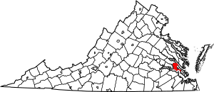
This is a list of the National Register of Historic Places listings in James City County, Virginia.
This is intended to be a complete list of the properties and districts on the National Register of Historic Places in James City County, Virginia, United States. The locations of National Register properties and districts for which the latitude and longitude coordinates are included below, may be seen in an online map.
There are 19 properties and districts listed on the National Register in the county, including one National Historic Landmark.
Current listings
| Name on the Register | Image | Date listed | Location | City or town | Description | |
|---|---|---|---|---|---|---|
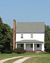
| 1 | Amblers |
(#15000016) |
2205 Jamestown Rd. 37°13′36″N 76°47′14″W / 37.226667°N 76.787222°W |
Jamestown | ||
| 2 | Archeological Site No. 44JC308 |
(#93000507) |
Address Restricted |
Williamsburg | Paspahegh settlement site | |
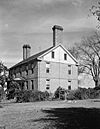
| 3 | Carter's Grove |
(#69000249) |
SE of jct. of Rte. 667 and U.S. 60 37°12′25″N 76°37′29″W / 37.206944°N 76.624722°W |
Williamsburg | Georgian country house and plantation near Williamsburg, recently closed and sold to a private owner | |
| 4 | Chickahominy Shipyard Archeological Site |
(#79003048) |
Address Restricted |
Toano | ||
| 5 | Colonial National Historical Park |
(#66000839) |
VA 359 37°12′55″N 76°31′45″W / 37.215278°N 76.529167°W |
Jamestown | ||
| 6 | Croaker Landing Archaeological Site (44JC70) |
(#87000753) |
Address Restricted |
Croaker | ||
| 7 | Governor's Land Archeological District |
(#73002025) |
Address Restricted |
Jamestown | ||
| 8 | Green Spring |
(#78000261) |
Address Restricted |
Williamsburg | ||
| 9 | Hickory Neck Church |
(#73002023) |
N of Toano on U.S. 60 37°23′35″N 76°48′11″W / 37.393056°N 76.803056°W |
Toano | ||
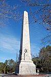
| 10 | Jamestown National Historic Site |
(#66000840) |
Jamestown Island 37°12′31″N 76°46′42″W / 37.208611°N 76.778333°W |
Jamestown | ||
| 11 | Kingsmill Plantation |
(#72001401) |
5 mi. S of Williamsburg 37°13′43″N 76°40′35″W / 37.228611°N 76.676389°W |
Williamsburg | ||
| 12 | Norge Train Depot |
(#08000256) |
7770 Croaker Rd. 37°22′36″N 76°46′17″W / 37.376667°N 76.771389°W |
Williamsburg | ||
| 13 | Pinewoods |
(#71000983) |
1.4 mi. SW of jct. of VA 613 and 614 37°16′21″N 76°49′32″W / 37.272500°N 76.825694°W |
Lightfoot | ||
| 14 | Powhatan |
(#70000803) |
N of jct. of Rtes. 615 and 5 37°15′47″N 76°46′09″W / 37.263056°N 76.769167°W |
Five Forks | ||
| 15 | Riverview |
(#96001446) |
124 Riverview Plantation Dr. 37°23′08″N 76°41′12″W / 37.385556°N 76.686528°W |
Williamsburg | ||
| 16 | Stone House Site |
(#73002024) |
Address Restricted |
Toano | ||
| 17 | White Hall |
(#07000234) |
3200 Rochambeau Rd. 37°24′07″N 76°48′17″W / 37.401944°N 76.804722°W |
Toano | ||
| 18 | Windsor Castle |
(#87002149) |
1812 Forge Rd. 37°22′33″N 76°51′15″W / 37.375833°N 76.854167°W |
Toano |

All content from Kiddle encyclopedia articles (including the article images and facts) can be freely used under Attribution-ShareAlike license, unless stated otherwise. Cite this article:
National Register of Historic Places listings in James City County, Virginia Facts for Kids. Kiddle Encyclopedia.


