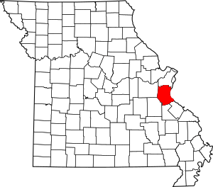
National Register of Historic Places listings in Jefferson County, Missouri facts for kids
This is a list of the National Register of Historic Places listings in Jefferson County, Missouri.
This is intended to be a complete list of the properties and districts on the National Register of Historic Places in Jefferson County, Missouri, United States. Latitude and longitude coordinates are provided for many National Register properties and districts; these locations may be seen together in a map.
There are 15 properties and districts listed on the National Register in the county.
Current listings
| Name on the Register | Image | Date listed | Location | City or town | Description | |
|---|---|---|---|---|---|---|
| 1 | Beaumont-Tyson Quarry District |
(#74001079) |
Address Restricted |
Times Beach | ||
| 2 | Boemler Archeological District |
(#74001075) |
Address Restricted |
Byrnes Mill | ||
| 3 | Boland Archeological District |
(#74001080) |
Address Restricted |
Times Beach | ||
| 4 | Central School Campus |
(#09000813) |
221 S. 3rd St. 38°08′18″N 90°33′23″W / 38.138292°N 90.556497°W |
De Soto | ||
| 5 | Thomas C. Fletcher House |
(#74001076) |
Elm between 1st and 2nd Sts. 38°13′55″N 90°34′02″W / 38.231944°N 90.567222°W |
Hillsboro | ||
| 6 | Gustave Greystone-Meissner House |
(#74001078) |
Northeast of Pevely off U.S. Route 61 38°18′13″N 90°22′48″W / 38.303611°N 90.38°W |
Pevely | ||
| 7 | Kimmswick Bone Bed |
(#80002371) |
Junction of Rock and Little Rock Creeks 38°22′45″N 90°23′01″W / 38.379167°N 90.383611°W |
Imperial | Also known as "Mastodon State Historic Site". | |
| 8 | Kimmswick Historic District |
(#07000752) |
Roughly bounded by Front St., 4th St., Mill St., Elm St., and Oak St. 38°22′00″N 90°21′51″W / 38.366606°N 90.364153°W |
Kimmswick | ||
| 9 | Valentine Leight General Store |
(#92001014) |
4566 Main St. 38°24′37″N 90°34′09″W / 38.410278°N 90.569167°W |
House Springs | ||
| 10 | Moder Archeological District |
(#74001077) |
Address Restricted |
House Springs | ||
| 11 | Louis J. and Harriet Rozier House |
(#06000221) |
322 W. Clement 38°08′16″N 90°33′27″W / 38.137778°N 90.5575°W |
DeSoto | ||
| 12 | Sandy Creek Covered Bridge |
(#70000337) |
5 miles north of Hillsboro off U.S. Route 21 38°17′38″N 90°31′05″W / 38.293889°N 90.518056°W |
Hillsboro | ||
| 13 | Stonebrook |
(#10001130) |
3511 Stonebrook Forest Dr. 38°21′38″N 90°27′44″W / 38.360556°N 90.462222°W |
Antonia | ||
| 14 | Windsor Harbor Road Bridge |
(#83001024) |
Windsor Harbor Rd. at Rock Creek 38°21′50″N 90°21′44″W / 38.363889°N 90.362222°W |
Kimmswick |

All content from Kiddle encyclopedia articles (including the article images and facts) can be freely used under Attribution-ShareAlike license, unless stated otherwise. Cite this article:
National Register of Historic Places listings in Jefferson County, Missouri Facts for Kids. Kiddle Encyclopedia.


