National Register of Historic Places listings in King George County, Virginia facts for kids
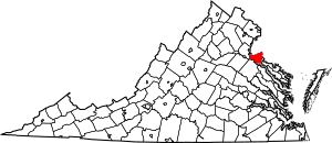
This is a list of the National Register of Historic Places listings in King George County, Virginia.
This is intended to be a complete list of the properties and districts on the National Register of Historic Places in King George County, Virginia, United States. The locations of National Register properties and districts for which the latitude and longitude coordinates are included below, may be seen in a Google map.
There are 15 properties and districts listed on the National Register in the county. Another property was once listed but has been removed.
Current listings
| Name on the Register | Image | Date listed | Location | City or town | Description | |
|---|---|---|---|---|---|---|
| 1 | Belle Grove |
(#73002029) |
On U.S. 301 38°10′45″N 77°11′18″W / 38.179167°N 77.188333°W |
Port Conway | Birthplace of President James Madison | |
| 2 | Ralph Bunche High School |
(#06000353) |
10139 James Madison Hwy. 38°16′18″N 77°08′14″W / 38.271667°N 77.137222°W |
King George | ||
| 3 | Cleydael |
(#86003495) |
Off VA 206 38°18′47″N 77°08′01″W / 38.313194°N 77.133611°W |
Weedonville | ||
| 4 | Eagle's Nest |
(#90002160) |
VA 642 E of jct. of VA 218 and VA 682 38°19′38″N 77°12′04″W / 38.327222°N 77.201111°W |
Ambar | ||
| 5 | Emmanuel Church |
(#86003593) |
US 301 38°10′46″N 77°11′09″W / 38.179583°N 77.185833°W |
Port Conway | Built 1860 as the church for Belle Grove | |
| 6 | Lamb's Creek Church |
(#72001403) |
VA 607 38°15′51″N 77°16′08″W / 38.264167°N 77.268889°W |
Sealston | ||
| 7 | Marmion |
(#70000804) |
NE of jct. of SR 649 and 609 38°18′32″N 77°12′44″W / 38.308889°N 77.212222°W |
Comorn | ||
| 8 | Millbank |
(#04000845) |
Millbank Rd., northwest of Port Conway 38°11′25″N 77°12′00″W / 38.190278°N 77.200000°W |
Port Conway | ||
| 9 | Nanzatico |
(#69000250) |
S of jct. of SR 650 and 625 38°10′18″N 77°07′30″W / 38.171667°N 77.125000°W |
King George Court House | ||
| 10 | Office Hall |
(#90002164) |
Jct. of VA 3 and US 301 38°14′21″N 77°08′58″W / 38.239167°N 77.149444°W |
King George Court House | ||
| 11 | Powhatan Rural Historic District |
(#92000020) |
Jct. of VA 607 and VA 610 38°15′03″N 77°12′37″W / 38.250833°N 77.210278°W |
King George | ||
| 12 | Rokeby |
(#04001544) |
5447 Kings Hwy 38°16′25″N 77°14′51″W / 38.273611°N 77.247500°W |
King George | ||
| 13 | St. Paul's Church |
(#73002028) |
W of Owens off VA 206 38°19′57″N 77°07′29″W / 38.332500°N 77.124722°W |
Owens | ||
| 14 | Woodlawn Historic and Archeological District |
(#90002012) |
Between VA 625 and the Rappahannock R., E of US 301 38°10′42″N 77°09′51″W / 38.178333°N 77.164167°W |
Port Conway |
Former listing
| Name on the Register | Image | Date listed | Date removed | Location | City or town | Summary | |
|---|---|---|---|---|---|---|---|
| 1 | Nanzattico Archeological Site |
(#03001091) |
|
Address Restricted |
Index |

All content from Kiddle encyclopedia articles (including the article images and facts) can be freely used under Attribution-ShareAlike license, unless stated otherwise. Cite this article:
National Register of Historic Places listings in King George County, Virginia Facts for Kids. Kiddle Encyclopedia.


