National Register of Historic Places listings in King William County, Virginia facts for kids
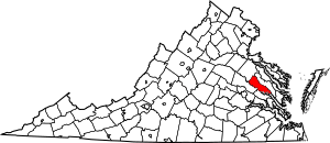
This is a list of the National Register of Historic Places listings in King William County, Virginia.
This is intended to be a complete list of the properties and districts on the National Register of Historic Places in King William County, Virginia, United States. The locations of National Register properties and districts for which the latitude and longitude coordinates are included below, may be seen in an online map.
There are 20 properties and districts listed on the National Register in the county, including 1 National Historic Landmark.
Current listings
| Name on the Register | Image | Date listed | Location | City or town | Description | |
|---|---|---|---|---|---|---|
| 1 | Burlington |
(#78003023) |
River Rd. southeast of Beulahville 37°50′40″N 77°08′38″W / 37.844444°N 77.143889°W |
Aylett | ||
| 2 | Chelsea |
(#69000253) |
N of jct. of Chelsea Rd. and Rte. 30 37°35′55″N 76°49′38″W / 37.598611°N 76.827222°W |
West Point | ||
| 3 | Chericoke |
(#80004195) |
W of Falls on VA 666 37°38′09″N 77°06′45″W / 37.635833°N 77.112500°W |
Falls | ||
| 4 | Elsing Green |
(#69000252) |
SW of jct. of SR 632 and 623 37°36′08″N 77°03′04″W / 37.602222°N 77.051111°W |
Tunstall | ||
| 5 | Horn Quarter |
(#80004196) |
NW of Manquin on VA 614 37°46′34″N 77°18′42″W / 37.776111°N 77.311667°W |
Manquin | ||
| 6 | King William County Courthouse |
(#69000251) |
Rte. 619, off VA 30 37°41′16″N 77°00′48″W / 37.687778°N 77.013333°W |
King William | ||
| 7 | King William Training School |
(#06000872) |
18627 King William Rd. 37°41′44″N 77°01′58″W / 37.695556°N 77.032778°W |
King William | ||
| 8 | Mangohick Church |
(#72001402) |
VA 638, S of VA 30 37°48′28″N 77°16′18″W / 37.807778°N 77.271667°W |
Mangohick | ||
| 9 | Mount Columbia |
(#88003208) |
Off VA 649, 2.7 mi. W of VA 605 37°42′49″N 77°11′11″W / 37.713611°N 77.186389°W |
Manquin | ||
| 10 | Pamunkey Indian Reservation Archaeological District |
(#82004567) |
Entirety of the Pamunkey Indian Reservation 37°34′32″N 77°00′14″W / 37.575556°N 77.003889°W |
Lanesville | ||
| 11 | Roseville Plantation |
(#07000800) |
3736 Herring Creek Rd 37°51′09″N 77°15′30″W / 37.852500°N 77.258333°W |
Aylett | ||
| 12 | St. John's Church |
(#73002214) |
N of Sweet Hall on VA 30 37°36′59″N 76°55′16″W / 37.616389°N 76.921111°W |
Sweet Hall | ||
| 13 | Seven Springs |
(#80004194) |
W of Enfield 37°44′47″N 77°13′54″W / 37.746389°N 77.231667°W |
Enfield | ||
| 14 | Sharon Indian School |
(#07000764) |
13383 King William Rd. 37°44′04″N 77°06′50″W / 37.734444°N 77.113889°W |
King William | ||
| 15 | Sweet Hall |
(#77001490) |
S of King William 37°34′11″N 76°54′16″W / 37.569811°N 76.904444°W |
King William | ||
| 16 | West Point Historic District |
(#96001051) |
Kirby, Main, and Lee Sts. from 1st through 13th Sts. 37°32′00″N 76°47′51″W / 37.533333°N 76.797500°W |
West Point | ||
| 17 | Windsor Shades |
(#78003025) |
SW of Sweet Hall off VA 30 37°34′15″N 76°54′38″W / 37.570833°N 76.910556°W |
Sweet Hall | ||
| 18 | Wyoming |
(#80004197) |
N of Studley on VA 615 37°43′24″N 77°17′10″W / 37.723333°N 77.286111°W |
Studley | ||
| 19 | Zoar |
(#06000065) |
VA 608, Upshaw Rd. 37°47′19″N 77°06′38″W / 37.788611°N 77.110556°W |
Aylett |

All content from Kiddle encyclopedia articles (including the article images and facts) can be freely used under Attribution-ShareAlike license, unless stated otherwise. Cite this article:
National Register of Historic Places listings in King William County, Virginia Facts for Kids. Kiddle Encyclopedia.


