National Register of Historic Places listings in King and Queen County, Virginia facts for kids
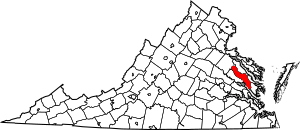
This is a list of the National Register of Historic Places listings in King and Queen County, Virginia.
This is intended to be a complete list of the properties and districts on the National Register of Historic Places in King and Queen County, Virginia, United States. The locations of National Register properties and districts for which the latitude and longitude coordinates are included below, may be seen in an online map.
There are 17 properties and districts listed on the National Register in the county.
Current listings
| Name on the Register | Image | Date listed | Location | City or town | Description | |
|---|---|---|---|---|---|---|
| 1 | Bewdley |
(#78003024) |
S of St. Stephens Church on Mattaponi River 37°45′06″N 77°03′53″W / 37.751528°N 77.064722°W |
St. Stephens Church | ||
| 2 | Dixon |
(#04001539) |
402 Limehouse Rd. 37°35′01″N 76°47′29″W / 37.583611°N 76.791389°W |
Shacklefords | ||
| 3 | Farmington |
(#95000243) |
1.5 mi. SE of jct. of VA 14 and US 360, S side 37°46′44″N 77°02′13″W / 37.778889°N 77.036944°W |
St. Stephens Church | ||
| 4 | Fort Mattapony |
(#94000547) |
By the cemetery at Locust Grove Plantation 37°43′45″N 77°00′42″W / 37.729167°N 77.011667°W |
Walkerton | ||
| 5 | Hillsborough |
(#71000984) |
2 mi. SE of Walkerton off SR 633 37°42′36″N 76°59′00″W / 37.710000°N 76.983333°W |
Walkerton | ||
| 6 | Holly Hill |
(#73002026) |
NE of Aylett off U.S. 360 37°47′41″N 77°05′04″W / 37.794722°N 77.084444°W |
Aylett | ||
| 7 | King and Queen Courthouse Green Historic District |
(#98001162) |
Junction of Allen Circle and Courthouse Landing Rd., northwest of Shacklefords; also 106 Allen Circle 37°40′10″N 76°52′41″W / 37.669444°N 76.878056°W |
Shacklefords | 106 Allen Circle represents a boundary increase of February 5, 2014 | |
| 8 | Marriott School |
(#07000052) |
450 Newtown Rd. 37°48′28″N 77°03′15″W / 37.807778°N 77.054167°W |
St. Stephens Church | Houses the King and Queen County branch of the Pamunkey Regional Library | |
| 9 | Mattaponi Church |
(#73002027) |
½ mile south of Cumnor off State Route 14 37°43′08″N 76°53′13″W / 37.718889°N 76.886944°W |
Cumnor | ||
| 10 | Newington Archaeological Site |
(#10000146) |
697 Frazier Ferry Rd. 37°40′20″N 76°54′12″W / 37.672222°N 76.903333°W |
King and Queen Courthouse | ||
| 11 | Newtown Historic District |
(#82001821) |
VA 721 and 625 37°54′48″N 77°07′41″W / 37.913333°N 77.128056°W |
Newtown | ||
| 12 | Northbank |
(#06000121) |
453 N. Bank Rd. 37°45′56″N 77°04′28″W / 37.765556°N 77.074444°W |
Walkerton | ||
| 13 | Providence Plantation and Farm |
(#09000689) |
1302 Roundabout Route Rd. 37°54′56″N 77°10′35″W / 37.915556°N 77.176389°W |
Newtown | ||
| 14 | Upper Church, Stratton Major Parish |
(#73002030) |
SE of Shanghai on VA 14 37°36′10″N 76°46′15″W / 37.602778°N 76.770833°W |
Shanghai |

All content from Kiddle encyclopedia articles (including the article images and facts) can be freely used under Attribution-ShareAlike license, unless stated otherwise. Cite this article:
National Register of Historic Places listings in King and Queen County, Virginia Facts for Kids. Kiddle Encyclopedia.


