National Register of Historic Places listings in Lee County, Virginia facts for kids
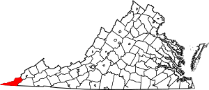
This is a list of the National Register of Historic Places listings in Lee County, Virginia.
This is intended to be a complete list of the properties and districts on the National Register of Historic Places in Lee County, Virginia, United States. The locations of National Register properties and districts for which the latitude and longitude coordinates are included below, may be seen in a Google map.
There are 8 properties and districts listed on the National Register in the county, including 1 National Historic Landmark.
Current listings
| Name on the Register | Image | Date listed | Location | City or town | Description | |
|---|---|---|---|---|---|---|
| 1 | Cumberland Gap Historic District |
(#80000366) |
East of Middlesboro 36°36′09″N 83°40′13″W / 36.602500°N 83.670278°W |
Gibson Station | Extends into Bell County, Kentucky and Claiborne County, Tennessee | |
| 2 | Cumberland Gap National Historical Park |
(#66000353) |
East of Middlesboro along the Kentucky-Virginia state line 36°36′36″N 83°39′00″W / 36.610000°N 83.650000°W |
Cumberland Gap | Extends into Bell County, Kentucky, Harlan County, Kentucky, and Claiborne County, Tennessee | |
| 3 | Dickinson-Milbourn House |
(#93000825) |
U.S. Route 58 36°41′08″N 83°07′24″W / 36.685556°N 83.123472°W |
Jonesville | ||
| 4 | Ely Mound |
(#83003287) |
2 miles (3.2 km) west of Rose Hill off U.S. Route 58 36°39′22″N 83°24′08″W / 36.656111°N 83.402222°W |
Rose Hill | ||
| 5 | Jonesville Methodist Campground |
(#74002133) |
West of Jonesville at the junction of U.S. Route 58 and State Route 652 36°40′57″N 83°08′38″W / 36.682500°N 83.143889°W |
Jonesville | ||
| 6 | Keokee Store No. 1 |
(#07000397) |
State Route 606 36°51′55″N 82°54′00″W / 36.865278°N 82.900000°W |
Keokee | ||
| 7 | William Sayers Homestead |
(#15000017) |
110 Mabel Parkey Dr. 36°36′45″N 83°34′14″W / 36.612500°N 83.570556°W |
Ewing |

All content from Kiddle encyclopedia articles (including the article images and facts) can be freely used under Attribution-ShareAlike license, unless stated otherwise. Cite this article:
National Register of Historic Places listings in Lee County, Virginia Facts for Kids. Kiddle Encyclopedia.


