National Register of Historic Places listings in Louisa County, Virginia facts for kids
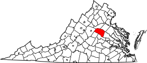
This is a list of the National Register of Historic Places listings in Louisa County, Virginia.
This is intended to be a complete list of the properties and districts on the National Register of Historic Places in Louisa County, Virginia, United States. The locations of National Register properties and districts for which the latitude and longitude coordinates are included below, may be seen in a Google map.
There are 21 properties and districts listed on the National Register in the county, including 1 National Historic Landmark.
Current listings
| Name on the Register | Image | Date listed | Location | City or town | Description | |
|---|---|---|---|---|---|---|
| 1 | Anderson-Foster House |
(#78003028) |
N of Holly Grove 37°48′04″N 77°49′05″W / 37.801111°N 77.818056°W |
Holly Grove | ||
| 2 | Baker-Strickler House |
(#09000046) |
10074 W. Gordon Rd. 38°07′41″N 78°12′14″W / 38.128194°N 78.203889°W |
Gordonsville | ||
| 3 | Bloomington |
(#04000850) |
Bloomington Ln. 37°58′32″N 77°59′32″W / 37.975556°N 77.992361°W |
Louisa | ||
| 4 | Boswell's Tavern |
(#69000257) |
Jct. of VA 22 and U.S. 15 38°04′12″N 78°11′02″W / 38.070000°N 78.183889°W |
Gordonsville | ||
| 5 | Boxley Place |
(#07000273) |
103 Ellisville Dr. 38°01′40″N 78°00′19″W / 38.027778°N 78.005278°W |
Louisa | ||
| 6 | Cobham Park |
(#74002101) |
S of VA 22 38°03′08″N 78°15′35″W / 38.052222°N 78.259722°W |
Waldrop | Extends into Albemarle County | |
| 7 | Cuckoo |
(#94000550) |
Jct. of US 33 and VA 522 S 37°57′12″N 77°53′59″W / 37.953333°N 77.899722°W |
Mineral | Federal-style home with a Colonial-style portico built for physician Henry Pendleton about 1819. | |
| 8 | Duke House |
(#07000830) |
2729 Diggstown Rd. 37°56′44″N 77°46′23″W / 37.945556°N 77.772917°W |
Bumpass | ||
| 9 | Grassdale |
(#73002035) |
W of Trevilians off U.S. 15 38°02′36″N 78°11′50″W / 38.043333°N 78.197222°W |
Trevilians | ||
| 10 | Green Springs |
(#72001406) |
0.2 mi. S of VA 617 and 1.5 mi. SW of jct. with VA 640 38°00′18″N 78°10′50″W / 38.005000°N 78.180556°W |
Trevilians | ||
| 11 | Green Springs Historic District |
(#73002036) |
NE of Zion Crossroads on U.S. 15 38°01′02″N 78°09′30″W / 38.017222°N 78.158333°W |
Zion Crossroads | ||
| 12 | Harris-Poindexter House and Store |
(#02000534) |
81 Tavern Rd. 37°59′07″N 77°49′16″W / 37.985278°N 77.821111°W |
Mineral | ||
| 13 | Hawkwood |
(#70000809) |
S of Gordonsville off U.S. 15 38°00′57″N 78°11′41″W / 38.015833°N 78.194722°W |
Gordonsville | ||
| 14 | Ionia |
(#72001405) |
0.1 mi. E of VA 640 and 0.8 mi. N of jct. with VA 613 38°00′42″N 78°08′46″W / 38.011528°N 78.146111°W |
Trevilians | ||
| 15 | Jerdone Castle |
(#84000042) |
N of Bumpas 38°00′25″N 77°45′05″W / 38.006944°N 77.751250°W |
Bumpass | ||
| 16 | Longwood |
(#02000998) |
924 Longwood Dr. 38°03′43″N 78°13′16″W / 38.062083°N 78.221111°W |
Gordonsville | ||
| 17 | Louisa County Courthouse |
(#90001998) |
Jct. of Main St. and VA 208 38°01′28″N 78°00′13″W / 38.024444°N 78.003611°W |
Louisa | ||
| 18 | Louisa High School |
(#11000605) |
212 Fredericksburg Avenue 38°01′31″N 77°59′52″W / 38.025278°N 77.997778°W |
Louisa | ||
| 19 | Mineral Historic District |
(#05000271) |
Roughly along Mineral, Louisa, Lee, Richmond, Albemarle, Pendleton, Piedmon, Old Tolersville, S. Cecilia, et al. 38°00′29″N 77°54′30″W / 38.008056°N 77.908333°W |
Mineral | ||
| 20 | Providence Presbyterian Church |
(#73002034) |
NW of Gum Spring off U.S. 250 37°47′08″N 77°54′17″W / 37.785556°N 77.904722°W |
Gum Spring | ||
| 21 | Shady Grove School |
(#09000416) |
2925 Three Chopt Road 37°45′43″N 77°52′29″W / 37.762083°N 77.874861°W |
Gum Spring | ||
| 22 | Westend |
(#70000810) |
S of jct. of Rtes. 22 and 638 38°02′45″N 78°10′15″W / 38.045833°N 78.170833°W |
Trevilians |

All content from Kiddle encyclopedia articles (including the article images and facts) can be freely used under Attribution-ShareAlike license, unless stated otherwise. Cite this article:
National Register of Historic Places listings in Louisa County, Virginia Facts for Kids. Kiddle Encyclopedia.


